photo sharing and upload picture albums photo forums search pictures popular photos photography help login
Deems Burton | all galleries >> The Salmon Trinity Alps Wilderness >> The Trinity Alps High Route > Alps High Route. This map shows most of the xc routes I've hiked. Hike at your own risk!!
previous | next

Alps High Route. This map shows most of the xc routes I've hiked. Hike at your own risk!!

Trinity Alps Wilderness

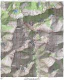
From 1987 to 1992, I designed a xc loop route around the granite glaciated heart of the Trinity Alps at the 8000ft level. I took many hikes to high points, studied maps, and was able to solve 75 percent of the High Route. In 1993 I hiked the loop in nine days, with layovers at Boulder and Mirror Lakes. There are many dangerous ledges and cliffs to cross. It is a very difficult xc route for only the experienced adventurer, with many challenges to solve every day. Hike it, but at your own risk. The redlines show most of my xc adventures from 1987 to 2003, but not all. The labels on the passes are my own names for them, and won't show up on usgs maps.


other sizes: small medium large original auto
previous | next
share
jason 09-Jan-2020 06:15
notice any spots big/flat enough for a one man tent, or a bivi, along any of those high slabs south of Wedding Cake to that next major ridge ?
sergio 16-Apr-2015 02:42
This is on my bucket list, thanks for posting
Alden Moffatt 11-Oct-2007 23:22
I never thought of going to Papoose from Canyon Ck or from Grizley from Mirror. These are butt kickin great hikes! And you survived! I enjoyed your photos.
Type your message and click Add Comment
It is best to login or register first but you may post as a guest.
Enter an optional name and contact email address. Name
Name Email
help private comment