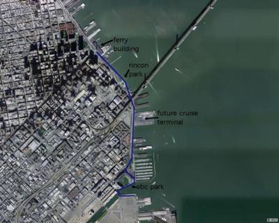
again, this aerial photo is from the microsoft terraserver website... click here for an interactive map beginning with this view... the blue line shows the area covered in the photo tour, from china basin north to the ferry building