


|
|
|
|
|
|
| |
| 07-Sep-2024 | |
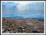
Skyline Trail loop is one of the most popular hiking trail in Mount Rainier National Park. It is 5.5 miles (8.9 km) long with an elevation gain of 1700 ft (518 m). At a distance, it is the Tatoosh Range to the south.
All photos are copyrighted and may not be reproduced or distributed without the expressed, written consent of the photographer.
| comment | |