


|
|
|
|
|
|
| |
| 26-Jan-2022 | |
Actually it's called a "Mesolow" : A small, highly localized area of low pressure that often
brings enhanced precipitation. From a local meteorologist: "How does this happen?
On a cold day like today, air rises over the relatively warm and moist lake water.
When the wind flow is light, there is nothing to steer/push this rising air in a
given direction. Instead, it is able to take on the shape of the shoreline. In this case,
the bowl-like shape helps feed colder air originating over the land into the rising
lake air, generating a persistent twisting vortex."
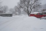
It's been snowing these big light flakes all day.
All photographs copyright © P Kocinski. All rights reserved. Unauthorized use prohibited
Please login or register.