photo sharing and upload picture albums photo forums search pictures popular photos photography help login
ecoRidge | all galleries >> Artful Maps >> Maps Organized By Geographical Region >> Southeast US Maps > Dolphin Swim
previous | next

Dolphin Swim

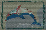
Shaded relief data, topologic maps, and land cover classification of the Gulf Coast and immediate area.


Sizes


hide exif
Full EXIF Info
Date/Time06-Dec-2016 15:27:49
Make
Model
Flash UsedNo
Focal Length
Exposure Time
Aperture
ISO Equivalent
Exposure Bias
White Balance
Metering Mode
JPEG Quality
Exposure Program
Focus Distance

other sizes: small medium large original auto
previous | next
share
Type your message and click Add Comment
It is best to login or register first but you may post as a guest.
Enter an optional name and contact email address. Name
Name Email
help private comment