


|
|
|
|
|
|
| |
| 25-MAR-2014 | |
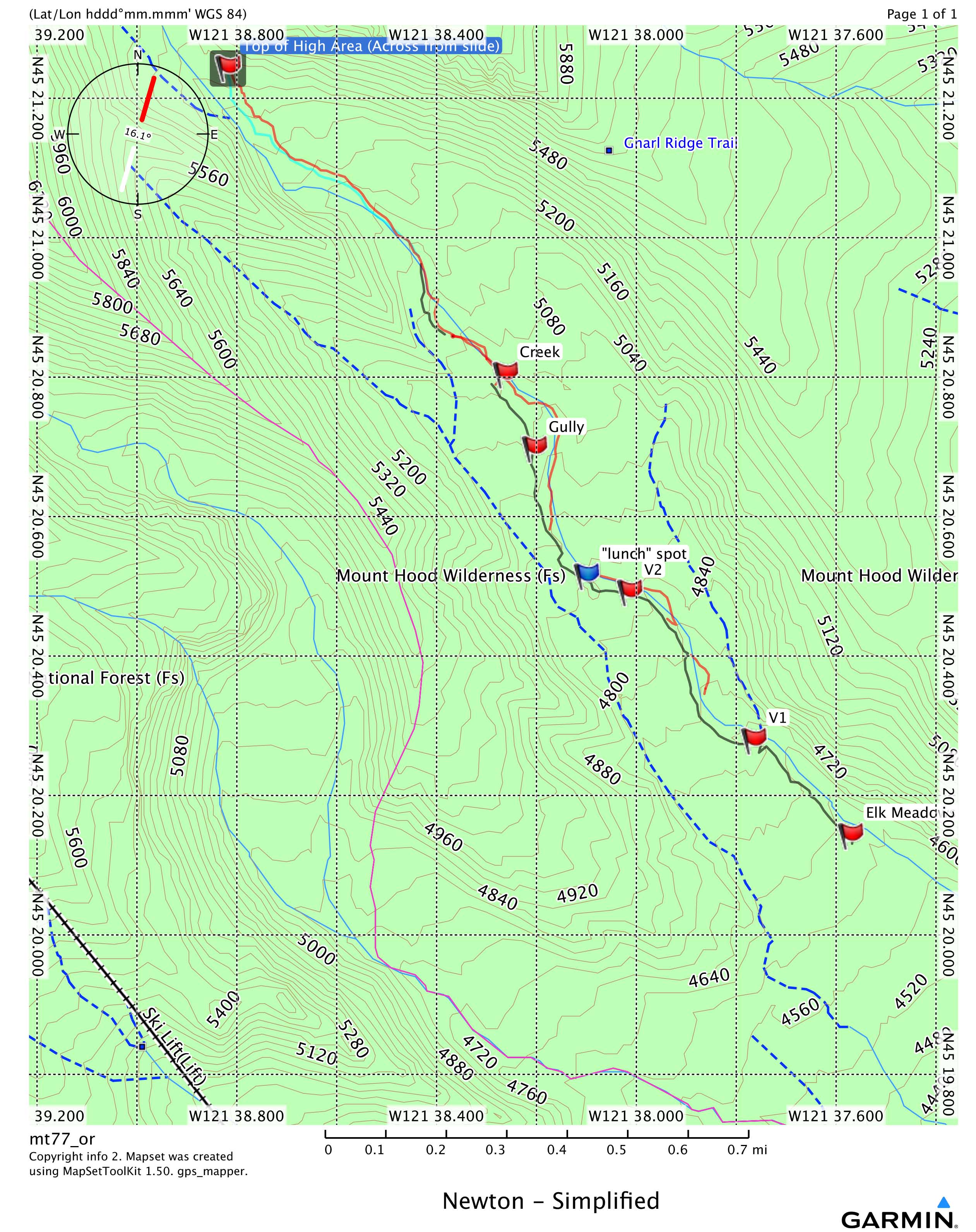
This shows some nice places for pictures:
1) At the start if you can cross the creek
2) V1 view one
3) V2 view two
4) Creek and above
I usually ski up on the bank, if I don't know if the snow bridges are in, to either the gully or after going around the gully, taking an easy drop to where creek is shown.
I follow near the creek but look for easier places not far from it, one can follow the hiking trail, but it fades after awhile, and you need to leave it before you end up on the wrong side of the smaller ridge, just above the gully, or creek flag.
It can be harder away from the creek depending on your luck, with either hills, or tight places with lots of small trees or even a small creek. It can be just as windy or long as you twist around trying to avoid these items. Still I usually go a bit away from the bank if it looks easier.
But on the way down this might be the place to find un-tracked snow.
On the way back if time isn't a problem I ski down as far as I can in the creek bed, so far taking a snow bridge hasn't left me on the wrong side of the creek, which could result in a long backtrack.
This trip there was only one snow bridges below the gully which I did not take (probably because I knew the snow bridges near the lunch spot were not in when I did this trip a week or so ago) , or I would have been on the wrong side.
The black line shows my route up as close to the bank as I could get with trees etc. The red lines show where I skied in the creek bed on the way back, the gaps are where I could not continue because the creek was up against the bank, so I climbed back up before and down somewhere after. I did not go down above V1 but it would have been possible to hug the bank and make it back to the start (usually you need 2 snow bridges because you can not hug the steep bank, covered with dirt and rock).
OH! Not shown, is where I had to make a quick and easy up and down between creek and gully - fairly rare that you have to do that!
Maybe someday, I can do the same for the other bank. I think showing where there are snow bridges would be too complicated?
All images are copyrighted, please request before using