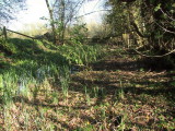
Imagination is required here.As well as an inquisitive mind.Firstly,so close to it's source,why would such a small stream require such a wide flowing zone? Yet,one so clearly defined by comparatively high banking?From just upstream of the castle moat,the stream widens to as much as 50 ft. between high banks.It then flows for about 100 - 150 yards in an L shape,running along two well defined edges to a bailey??perhaps.Throughout this section,the stream is but a trickle,now,but having completed it's L-shaped course it then returns to a fairly narrow waterway.This begs the question,why was the watercourse widened as it passed the Norman Castle and bailey?This part of the stream's course is now heavily silted up,but in Norman times could have been of a reasonable depth,being easily dammed at the lower end,where the wide course now ceases,as at Lindsey Castle,Suffolk.There,the stream runs alongside the motte and bailey,into a large dammed man made lake.Also worthy of note,the motte at Lindsey is of the same style as here at Stowting,ie about 10 ft above surrounding land and wide and flat topped.