


|
|
|
|
|
|
| |
| 18-JUL-2009 | |
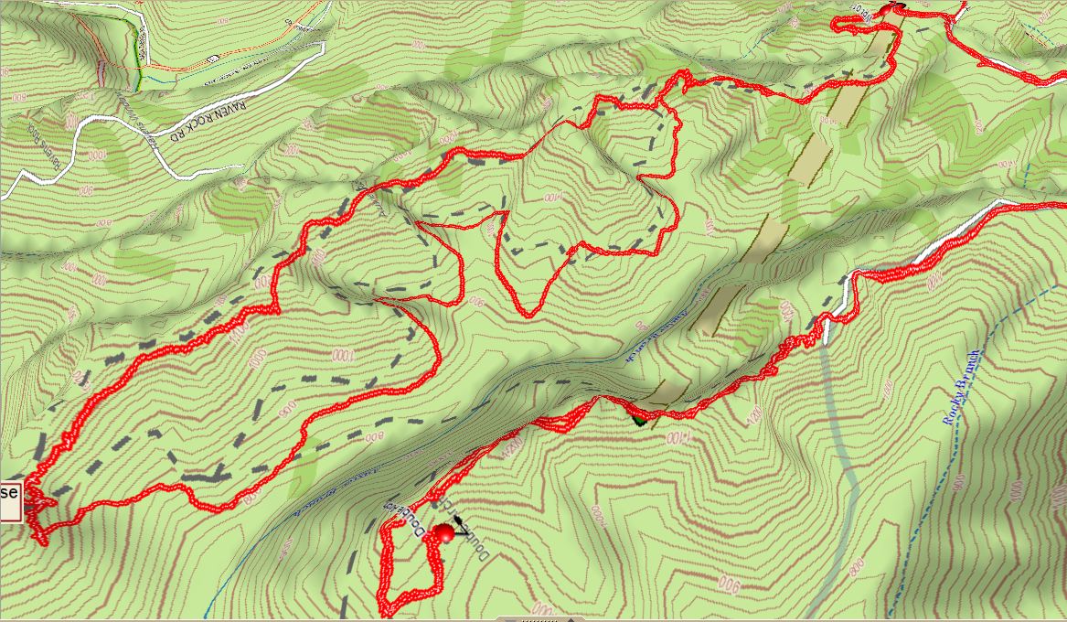
The Auxier Ridge Loop can be seen to the left with the Double Arch Trail to the right in the foreground.
Auxier Ridge is the thicker appearing line to the back with the thinner loops in the foreground being the approach down in the bowels
of the gorge. This lengthy winding section with numerous elevation changes accounts for the three hours it took to reach the
base of Auxier Ridge and Haystack Rock. The 5 mile loop loop took 4.5 hours to complete, including rest stops and photo ops.
The Double Arch is located at the end of the backward 'J' and following from this point over to Auxier Ridge one can approximate
the locations of which the images of this double arch were taken as seen, for example, here http://www.pbase.com/jtsmall/image/115100115
© 2005-2022 by John Small