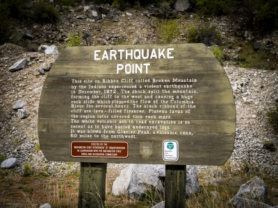
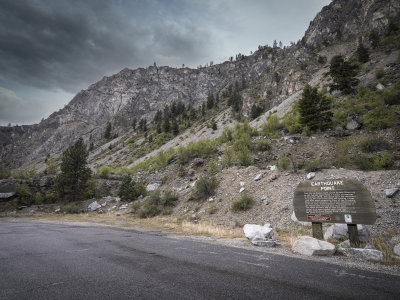
Earthquake Point and Ribbon Cliffs are natural formations left by a huge earthquake. The debris from the resulting rockslide actually stopped the flow of the Columbia River in December of 1872. The Indians in the area were told six months before the earthquake to move to a reservation upriver. This earthquake was taken as a sign, since the riverbed dried up as a result of the temporary dam built by the slide of debris.
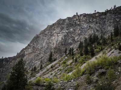
There are also black "ribbons" visible in the cliffs that were long-buried lava, now exposed. That's how they got the name, "Ribbon Cliffs."