


|
|
|
|
|
|
| Gervan | profile | all galleries >> Somewhere in the Netherlands >> Utrecht (prov) >> Haarzuilens | tree view | thumbnails | slideshow |
Haarzuilens is a small village in the Dutch province of Utrecht. It is a part of the municipality of Utrecht, and lies about 8 km west of Utrecht.
It was a separate municipality until 1954, when it was joined to the municipality of Vleuten.
In 2001, the village of Haarzuilens
had 224 inhabitants. The built-up area of the village contained 95 residences. The administrative area "Haarzuilens",
which can also include the peripheral parts of the village as well as the surrounding countryside, has a population of around 580.
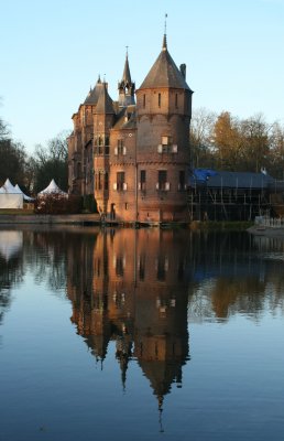
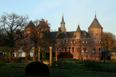
Pronounced Harzollens by the local Dutch inhabitants, the village was built around the turn of the 19th century after its predecessor
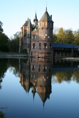
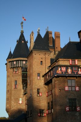
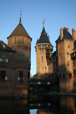
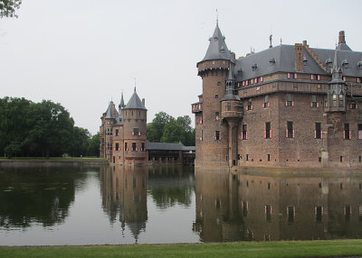
and the local castle De Haar had been destroyed in a devastating fire. The trees surrounding the castle are said to have originated
in a forest on the other side of Utrecht. Local lore has it that several houses in Utrecht were demolished in order to move the
trees to their new location and to give the castle's landlord his forest without the decades of delay usually required to
grow new trees. Nevertheless, the landlord allegedly went on a five-year honeymoon trip before the trees had been replanted.
(Source : Wikipedia)
*****
Haarzuilens is een klein dorp in de gemeente Utrecht, in de Nederlandse provincie Utrecht. Tot 2001 was het een zelfstandig
dorp behorende bij de voormalige gemeente Vleuten-De Meern. Sindsdien is het een onderdeel van de gemeente Utrecht en is het ingedeeld
bij de wijk Vleuten-De Meern. Het dorp heeft echter niet zijn volledige zelfstandigheid verloren, zoals plaatsnaamborden en postadressen.
In 1999 had het dorp 210 inwoners.
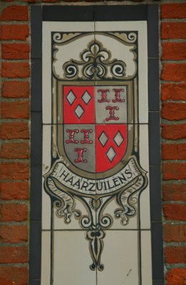
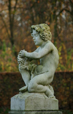
Het dorp is vooral bekend door het Kasteel de Haar. Oorspronkelijk lag het dorp dichter bij het kasteel.
In 1898 werd het dorp, op de kerk na, afgebroken om plaats te maken voor de huidige kasteeltuinen. Op de huidige locatie,
circa 2 kilometer van de oude, verrees een nieuw Haarzuilens, grotendeels ontworpen door architect P.J.H. Cuypers.
Ook dit was een typisch brinkdorp. Door alle bouwactiviteiten in en rondom het kasteel werd het dorp
verdubbeld.
Sinds de bouw van het dorp is er weinig veranderd. De bebouwing rondom de Brink heeft zich enigszins verdicht, en er zijn enkele
huizen bijgebouwd. Tot 1954 bleef Haarzuilens een zelfstandige gemeente, maar daarna nam Vleuten-De Meern het onder zijn hoede.
(Bron: Wikipedia)
Click on thumbnails below to see them enlarged - Click op de miniaturen om ze in een groter formaat te bekijken
 |
 |
 |
 |
 |
 |
 |
 |
 |
 |
 |
 |
 |
 |
 |
< Kasteel de Haar > |
| comment | share |
| Maaike Huizer | 28-Oct-2008 09:16 | |
| Ali Majdfar | 29-Nov-2007 10:30 | |