photo sharing and upload picture albums photo forums search pictures popular photos photography help login
Gerry Gantt Nature & Scenic Photography | profile | all galleries >> Thailand ประเทศไทย >> Chiang Mai Prov. จังหวัดเชียงใหม่ >> Saraphi District, Chiang Mai Province, Thailand >> Wiang Kum Kam Historic District >> Wat Phaya Mangrai วัดพญามังราย tree view | thumbnails | slideshow | map

Wat Phaya Mangrai วัดพญามังราย

Wat Phaya Mangrai, Wiang Kum Kam, Tambon Tha Wang Tan, Saraphi District, Chiang Mai Province, Thailand
วัดพญามังราย เวียงกุมกาม ตำบลท่าวังตาล อำเภอสารภี จังหวัดเชียงใหม่ ประเทศไทย

Wat Phaya Mangrai, วัดพญามังราย, is located in Wiang Kum Kam, Tambon Tha Wang Tan, Saraphi District, Chiang Mai Province, Thailand.
วัดพญามังราย อยู่ตำบลช้างคลานอำเภอสารภีจังหวัดเชียงใหม่ประเทศไทย

From an historical marker at the site of Wat Phaya Mangrai and Wat Phra Chao Ong Dam:

Wat Phra Chao Ong Dam-Phaya Mangrai

The temple got its name "Phra Chao Ong Dam" becaues of a burnt bronze Buddha image found in the area (Phra Chao in a northern dialect refers to the Buddha image). Another name used by the local people is "Phaya Mangrai", the name of the king who established Wiang Kum Kam. This temple is locaated in the area inside of and to the northwest of Wiang Kum Kam. The Department of Fine Arts excavated and restored this temple in 1989-1990.
The remains of the group of ruins known as Wat Phya Chao Ong Dam consist of a Vihara, a Chedi and square foundations. The Vihara was built in a retangular shape. A balustrade of the front stairway of the Vihara has a stucco spiral design (Tuo Ngae, a kind of Thai decorative pattern) as decoration. The Chedi, which is situated at the rear of the Vihara was constructed with a square base with indented corners on top of an unadorned lower base. In addition, about 5 meters to the south, the area has remnants of three rectangular foundations connected by pathways.
The remains in the group known as Wat Phaya Mangrai are situated on the south side of the first group. They consist of a porch of the main entrance, a boundary wall, a Cedi and an ordination hall (Ubosot). The Vihara, which faces the east has the Chedi built at the rear. The Chedi has a square base with indented corners which supported a relic chamber with a niche for a Buddha image in each direction.
About 100 meters from the front of these ruins is a trace of the old Ping River channel, together with a dike and a small pavilion. Monuments in the area insist that in the past this temple was a big monastery and an import one in Wiang Kum Kam. However, its other architectural structures may have been covered by earth or completely destroyed. These temples are dated to the 15th-17th centuries A.D.

วัดพระเจ้าองค์ดำ-พญามังราย
ชื่อ "พระเจ้าองค์ดำ" มาจากคำเรียกพระพุทธรูปองค์หนึ่งที่ขุดพบ ลักษณะเป็นพระพุทธรู
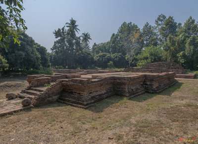
Wat Phaya Mangrai Ruins (DTHCM0810)
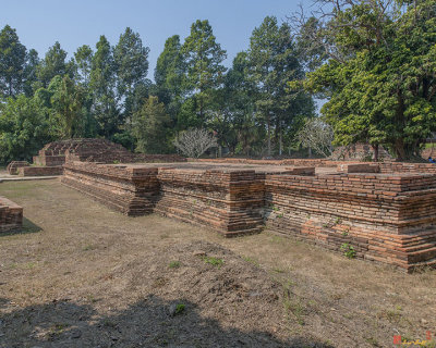
Wat Phaya Mangrai Wihan Ruins (DTHCM0811)
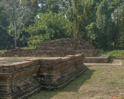
Wat Phaya Mangrai Chedi Ruins (DTHCM0812)
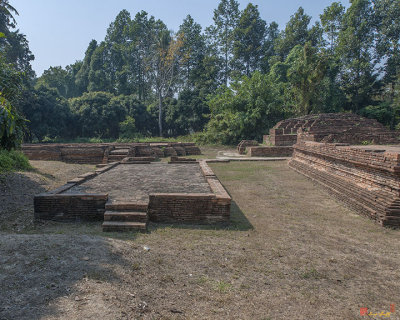
Wat Phaya Mangrai Ubosot Ruins (DTHCM0813)