


|
|
|
|
|
|
| George Kolb | profile | all galleries >> Galleries >> The Sunflower Mine in Arizona - Updated February 2013 | tree view | thumbnails | slideshow |
 Sunflower Mine Loop |
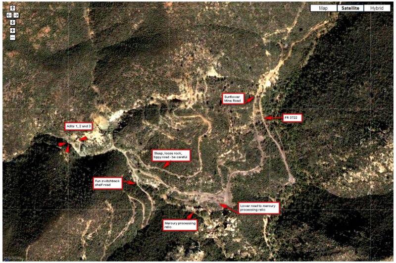 Aerial view of the Sunflower Mine area |
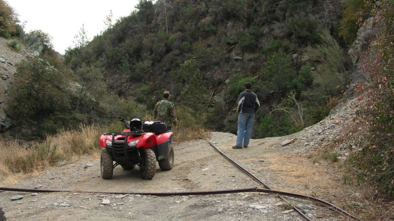
 Crossing Creek Just Before Mine |
 Resting on FR 25A |
 Kokopelli Figure on Rock |
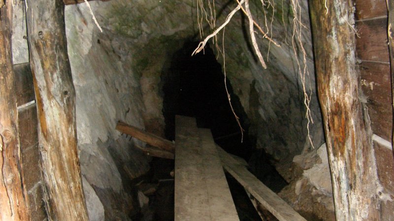
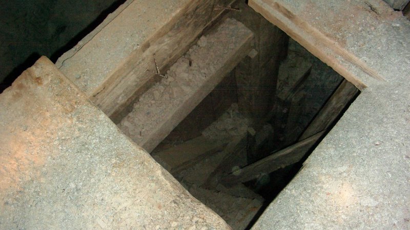
 Mine Shaft |
 |
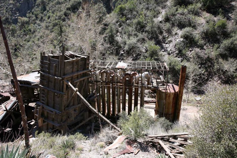 Sunflower Mine Refining Relic |
 Mercury Gas Cooling Tubes |
 |
 |
 Conveyor for Tailings |
 Ball Mill Feeding the Furnace |
 Overturned Truck with Ruins in Background |
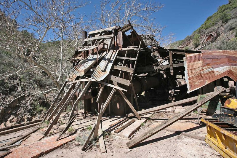 Collapsed Roof |
 Looking Toward Furnace |
 Gearing and Bearing Support for Pipes |
 |
 |
 |
 Upper Gantry Area |
 |
 Cooing Tubes from Across Wash |
 Ore Chute from Upper Road |
 |
 Past Mine |
 Oneida Mineshaft |
 |
 Returning on AZ Forest RT. 25 |
 Overlooking the Mazatzal Wilderness Area from Mt. Ord Road |
 Mazatzal Panorama |
 Narrow Gauge Track Exposed During 2008 Winter Rains |
 Road Continues to Erode - A Dangerous Tippy Spot |
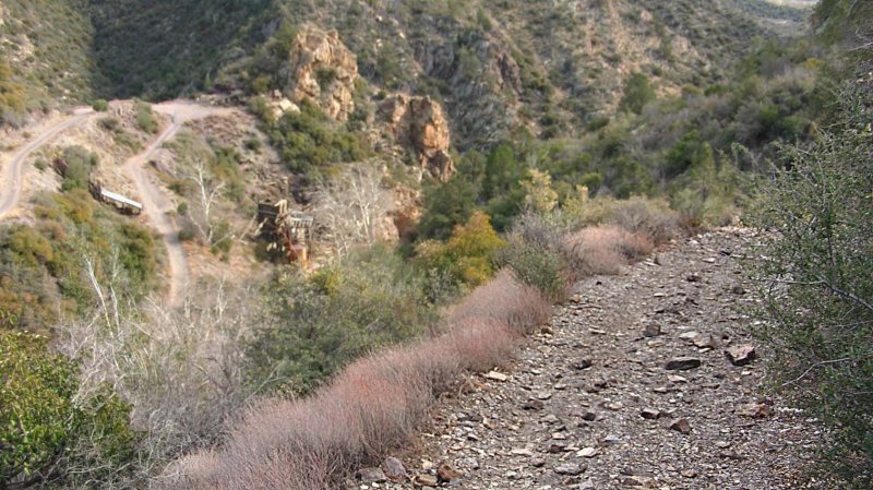
 Overlook of the Mercury Processing Building |
 FR201A Heading North |
 Overlook of FR 201 heading North |
 Jay Brooks |
 Junction of FR25a and FR3722 |
 Yes - This is the Route |
 Pete and Jay at junction of FR 201 and FR 201A |
 Beginning of Sunflower Mine Loop |
 |
 Bad Road |
 |
 Panorama |
 Tough Section |
 |
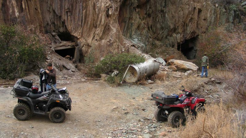
 One of Three Adits found |
 Second of Three Adits |
 Old Ore Car Tracks |
 Third of Three Adits |
 |
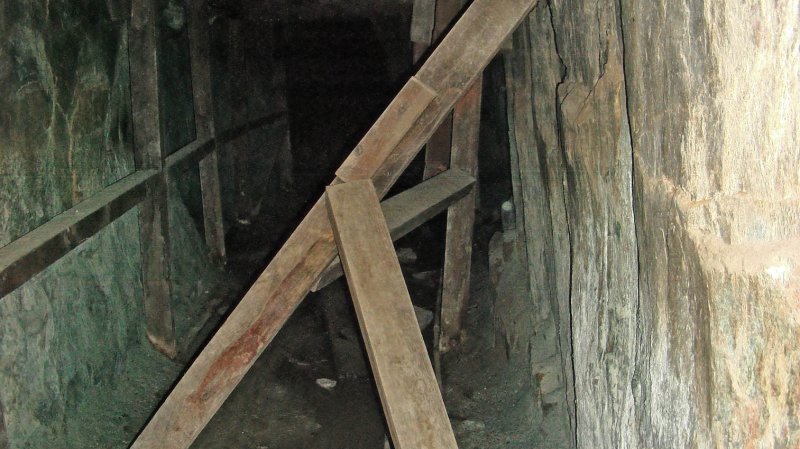
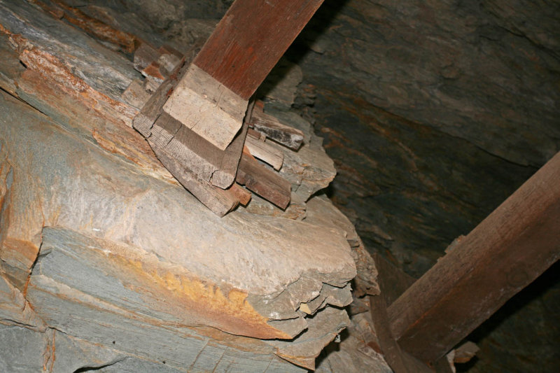
 Many Wooden Beams Are Used |
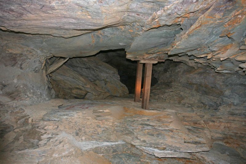
 Platform with Ladder to Lower Levels |
 Chocked Full of Minerals |
 |
 |
 |
 Collapsed Overhead Beams |
 |
 |
 Collapsed Roof - Guillotine-Like Rock |
 |
 |
 Switchback Road West of Mine |
 |
 |
 |
 |
 Narrow Shelf Road |
 Jay Inspecting the Rollers |
 |
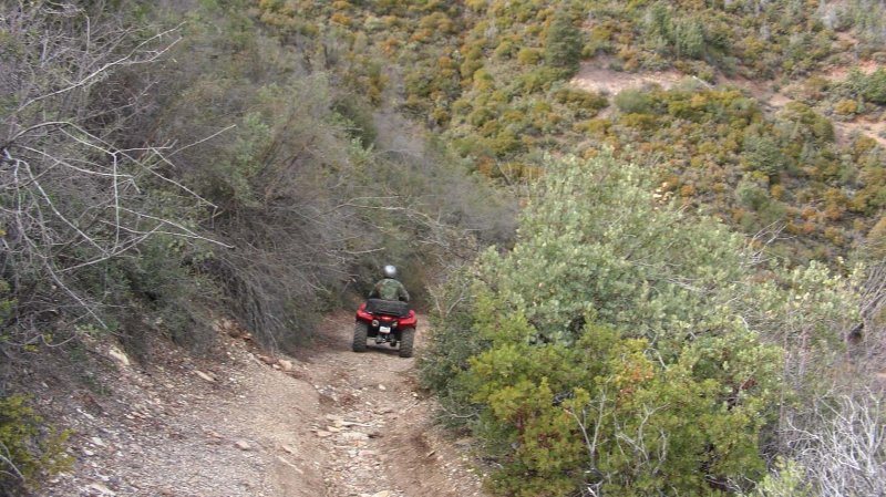
 Heading for Home |
 Butterfly on the Trail |
 This Loop is Sponsored by the Honeywell 4WD Club |
 Main Adit Entrance |
 Looking Straight Up in the Same Spot |
 Shimming to Shore Up the Beams |
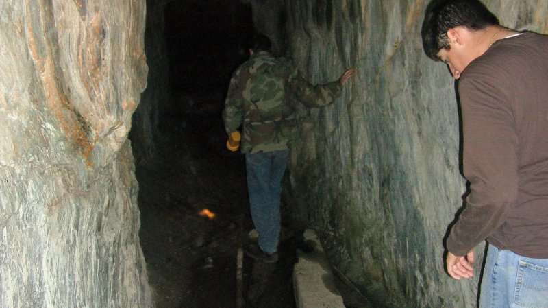
 Pete Checking Out the Passage |
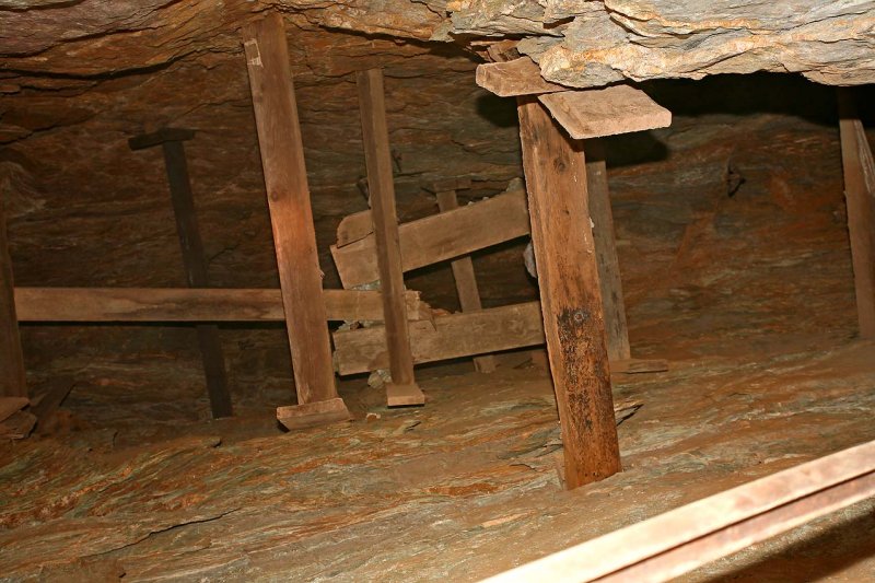
 More Beams Supporting the Cut |
 Lower Chamber with Fallen Ladder |
 Minerals Everywhere |
 Lower Chamber Access Supportive Structure |
 More Beams Deeper into the Adit |
 Steel Beams Bowing Under Stress |
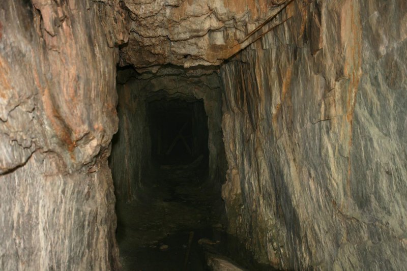
 Looking Toward the Entrance |
 Jay Making His way to the Exit |
 Another Adit Deep into the Mountain |
 |
 |
| comment | share |
| Frank | 16-Dec-2014 17:48 | |
| JOHN FLISS | 02-Jan-2008 02:46 | |
| Ken DeFusco | 29-Apr-2007 17:04 | |
| Jacky Lee | 03-Apr-2007 01:44 | |