photo sharing and upload picture albums photo forums search pictures popular photos photography help login
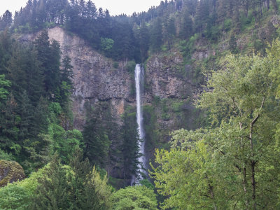
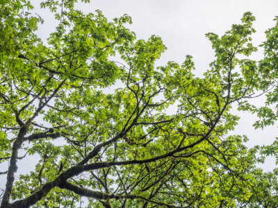
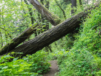
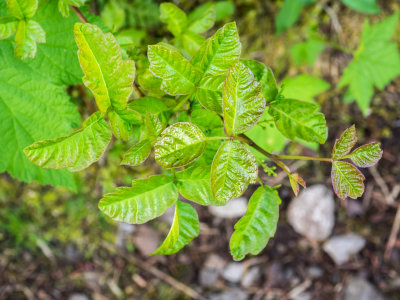
fjparis | profile | all galleries >> Galleries >> Franklin Ridge from Oneonta Trail, Columbia Gorge, Oregon, U.S.A. 2015 05 (May) 01 tree view | thumbnails | slideshow

Franklin Ridge from Oneonta Trail, Columbia Gorge, Oregon, U.S.A. 2015 05 (May) 01

Quite an adventure! Hiking distance: 12.3 miles. Hiking time: 11 hours, 12 minutes, and 54 seconds. Climbing: about 3,300 feet. Route: Paved Larch Mountain Trail from Multnomah Falls to Gorge Trail, to Oneonta Trail, to Franklin Ridge Trail, to Larch Mountain Trail, back to Multnomah Falls.

Got on the trail at 6:20 AM. Milestones:
1. 0:20:48.62 o'clock (20 minutes and 48.62 minutes into the hike) From start of the hike to the junction with the Gorge Trail that parallels a route above the Scenic Highway (0.5 miles from the car)
2. 1:13:09 o'clock (52 minutes and 21.25 seconds later -- 2.3 miles later) Reached the Oneonta Trailhead.
3. 1:33:29 o'clock (20 minutes and 19.28 seconds later -- 0.6 miles later) Reached the intersection with the cutoff to Horsetail Falls (passing Ponytail Falls).
4. 2:56:39 o'clock (1 hour, 23 minutes, and 10 seconds later) Reached Triple Falls on the Oneonta Trail (1.2 miles later).
5. 4:19:49 o'clock (1 hour, 23 minutes, and 9 seconds later) Reached the bridge across Oneonta Creek (1.4 miles later)
6. 4:42:56 o'clock (23 minutes and 9.90 seconds for lunch and rest stop)
7. 7:43:35 o'clock (3 hours, 0 minutes, and 36 seconds later) Reached the Franklin Ridge Trailhead (1.7 miles later)
8. 9:07:03 o'clock (1 hour, 23 minutes, and 28 seconds later) Reached the end of the Franklin Ridge Trail at the intersection with the Larch Mt. Trail (2.2 miles later). This timing included a 15 minute rest stop.
9. 11:12:54 o'clock (2 hours, 5 minutes, and 50 seconds later) Reached the car (2.4 miles later).

Notable events:
(1.) Traversed ridiculously steep Oneonta Trail rerouting after a landslide wiped out a section of the trail during the winter. Access to Triple Falls from the beginning of the Oneonta Trail at the intersection with the Gorge Trail was closed for months.
(2.) On the Oneonta Trail above the bridge across Oneonta Creek, encountered the most strenuous blow-down I ever successfully climbed over. Took me 18 minutes to figure out how to get past this one blow-down!
(3.) I had my 40-150mm lens on when I transitioned from the Franklin Ridge Trail to the Larch Mt. Trail. In order to have different photo opportunities than I usually do on this stretch of trail, I left that lens on. Usually I have my 12-40mm lens on then. The zoom telephoto gave me access to miniature waterfalls, which were the new photo opportunities.
(4) About half way down the paved Larch Mt. Trail, I started fast walking (almost jogging) for the first time ever, even passing up people! So although I was of course tired after this very strenuous, long hike, I was not at all completely worn out.

Took 405 photos of which 187 made the cut. Took my trekking poles and so necessarily all photos were hand-held (no tripod).
previous pagepages 1 2 3 4 5 6 7 8 9 10 11 12 ALL next page
P5010001.jpg *
P5010001.jpg *
P5010003.jpg *
P5010003.jpg *
P5010005.jpg *
P5010005.jpg *
P5010007.jpg
P5010007.jpg
P5010010.jpg
P5010010.jpg
P5010011.jpg
P5010011.jpg
P5010013.jpg *
P5010013.jpg *
P5010014.jpg *
P5010014.jpg *
P5010016.jpg
P5010016.jpg
P5010017.jpg
P5010017.jpg
P5010018.jpg
P5010018.jpg
P5010020.jpg
P5010020.jpg
P5010021.jpg *
P5010021.jpg *
P5010024.jpg
P5010024.jpg
P5010025.jpg
P5010025.jpg
P5010026.jpg *
P5010026.jpg *
previous pagepages 1 2 3 4 5 6 7 8 9 10 11 12 ALL next page