


|
|
|
|
|
|
| Todd Fischer | profile | all galleries >> Galleries >> Colorado Fall 2024 | tree view | thumbnails | slideshow | map |

:: Best of trip Fall 2024 :: |
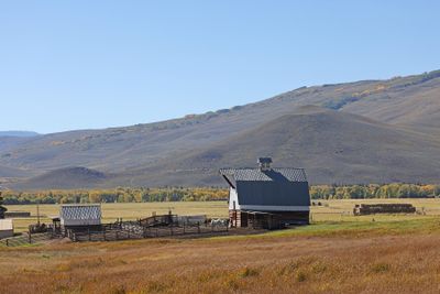
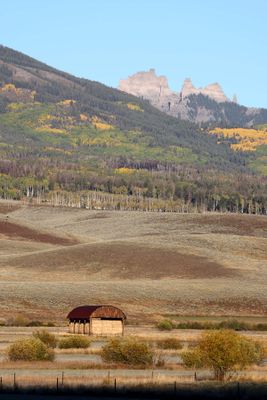
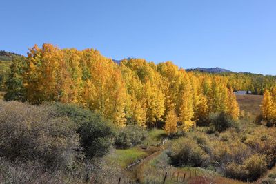
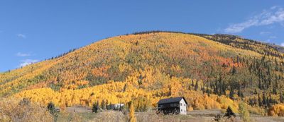
 6P5A0860 Capulin ranch.jpg |
 6P5A0892 Capulin sign.jpg |
 0T5A2563 FR 559 Huerfano County.jpg |
0T5A2567 Back side of Sangre de Cristo Mtns.jpg |
 0T5A2586 Near Westcliffe CO.jpg |
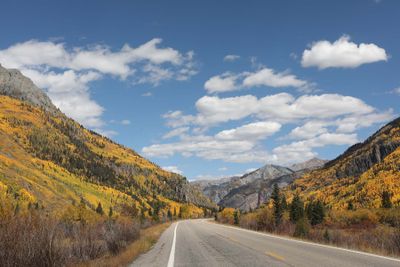
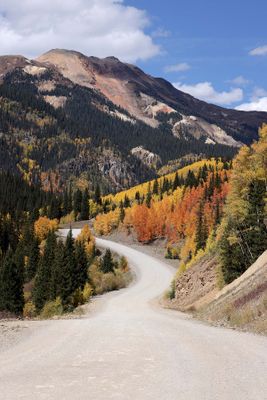
 0T5A2587 Long straight road in CO.jpg |
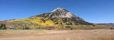
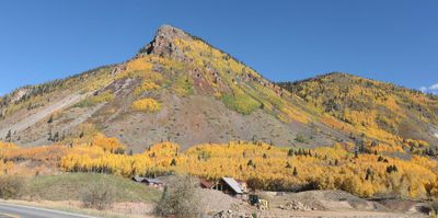
6P5A0942 Sangre de Cristo mountains.jpg |
0T5A2594 View from Westcliffe.jpg |
 6P5A0974 Clouds on the horizon.jpg |
 6P5A0978 Snowcapped Sangre de Cristos.jpg |
 6P5A0990 Early Fall on the Sangre de Cristos.jpg |
 6P5A1000 Ranch near Gardner CO.jpg |
 6P5A1008 On the road to Westcliffe.jpg |
 6P5A1052 East side of Sangre de Cristo mtns.jpg |
 6P5A0969 Long road to the mountains.jpg |
 6P5A0953 Frolicking pronghorn.jpg |
 6P5A1064 Pronghorn.jpg |
 6P5A1068 The Sangre de Cristo pronghorn.jpg |
 6P5A1083 Pronghorn near Westcliffe CO.jpg |
 6P5A1193 Pronghorn.jpg |
 6P5A1115 Near Westcliffe CO.jpg |
 6P5A1139 Historic Beckwith Ranch Westcliffe CO.jpg |
 6P5A1149 Historic Beckwith Ranch Westcliffe CO.jpg |
 6P5A1209 Ranch near Hartsel CO.jpg |
 0T5A2608 Guanella Pass view.jpg |
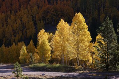
 0T5A2619 Aspen leaves detail.jpg |
 0T5A2652 Road to Kremmling.jpg |
 0T5A2656 Along Green Mountain Reservoir area.jpg |
 0T5A2667 Headed to Steamboat Springs.jpg |
 0T5A2669 Near Rabbit Ears Pass.jpg |
 0T5A2671 Near Rabbit Ears Pass.jpg |
 20240923_144237 Near Green Mountain Reservoir.jpg |
 6P5A1260 Hillside cloud shadows.jpg |
 6P5A1288 Nice house location.jpg |
 6P5A1306 Lots of colors east of Steamboat.jpg |
 6P5A1316 East of Steamboat Springs CO.jpg |
 6P5A1333 Aspen trunks watercolor.jpg |
 6P5A1361 Finger Rock Yampa CO.jpg |
 6P5A1359 Hawk on bale.jpg |
 0T5A2690 Near Toponas CO.jpg |
 6P5A1375 Near Toponas.jpg |
 6P5A1383 Ducks on the pond.jpg |
 20240924_080705 Ranch lake near Toponas CO.jpg |
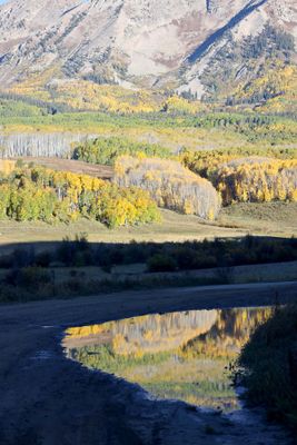
 Toponas Pond reflection Panorama.jpg |
 6P5A1369 An interesting angle.jpg |
 0T5A2714 Leadville area.jpg |
 0T5A2715 Cattle south of Leadville.jpg |
 20240924_100310 Rancho Escondido near Leadville .jpg |
 0T5A2721 South of Leadville.jpg |
 0T5A2722 Near Twin Lakes.jpg |
 0T5A2737 Twin Lakes CO.jpg |
 20240924_105447 Twin Lakes CO.jpg |
 20240924_115733 Independence Pass east side.jpg |
 6P5A1436 Oh deer.jpg |
 6P5A1446 Leaving Leadville.jpg |
 6P5A1458 Rancho Escondido.jpg |
 6P5A1471 Ranch south of Leadville.jpg |
 6P5A1477 Near Twin Lakes.jpg |
 6P5A1491 Twin Lakes area.jpg |
 6P5A1495 Profusion of colors.jpg |
 6P5A1500 Above tree line.jpg |
 6P5A1512 Near Twin Lakes CO.jpg |
 6P5A1516 Moon over the mtn.jpg |
 6P5A1522 Mt Elbert area.jpg |
 6P5A1523 Twin Lakes CO hill side.jpg |
 6P5A1525 Mt Elbert.jpg |
 6P5A1533 Buena Vista area.jpg |
 6P5A1536 Highest point of my drive.jpg |
 0T5A2784 Cottonwood Pass east side.jpg |
 6P5A1588 Jacks Cabin Rd near Crested Butte.jpg |
 6P5A1589 Ranch along Jacks Cabin Rd.jpg |
0T5A2788 Pano looking west from Cottonwood Pass.jpg |
 6P5A1605 Hillside near Crested Butte CO.jpg |
 0T5A2819 Mt Crested Butte.jpg |
 0T5A2823 Hillside near Gothic CO.jpg |
 0T5A2828 Gothic CO.jpg |
 0T5A2830 Gothic CO.jpg |
 0T5A2848 Near Gothic CO.jpg |
 6P5A1630 Cabin near Gothic.jpg |
 6P5A1636 Valley between Gothic and Crested Butte.jpg |
0T5A2860 Early morrning Ohio Creek Rd.jpg |
 6P5A1662 Ohio Creek Rd cattle early morning.jpg |
 0T5A2862 Hay barn on Ohio Creek Rd.jpg |
 0T5A2865 Along Ohio Creed Rd.jpg |
 0T5A2869 Ranch along Ohio Creek Rd.jpg |
 6P5A1676 Ohio Creek Rd.jpg |
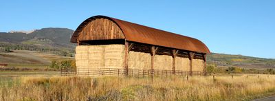
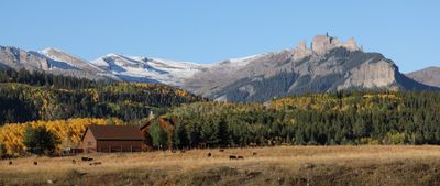
 6P5A1687 Hay barn and the Castles.jpg |
 6P5A1689 Along Ohio Creek Rd.jpg |
 6P5A1695 The Castles.jpg |
 6P5A1699 Along Ohio Creek Rd.jpg |
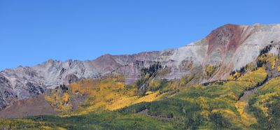
 6P5A1708 Falls colors and the Anthracite Range.jpg |
0T5A2871 Anthracite Range.jpg |
 6P5A1714 The Castles.jpg |
 6P5A1741 Puddle reflection.jpg |
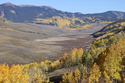
 0T5A2883 Ohio Creek Pass view.jpg |
 6P5A1711 Another view of the Castles.jpg |
 6P5A1720 Early morning Anthracite Range view.jpg |
 6P5A1732 Ranch with Castles view.jpg |
 6P5A1747 Fall view of the Castles.jpg |
 6P5A1772 The Castles.jpg |
 6P5A1778 The Castles.jpg |
 0T5A2890 East Beckwith Mtn.jpg |
 0T5A2897 Kebler Pass Rd.jpg |
 0T5A2902 East Beckwith Mtn Kebler Pass Rd.jpg |
 6P5A1806 West Beckwith.jpg |
 0T5A2937 Telluride hill side.jpg |
 0T5A2940 Aspen stand near Telluride.jpg |
 0T5A2951 Headed south from Telluride.jpg |
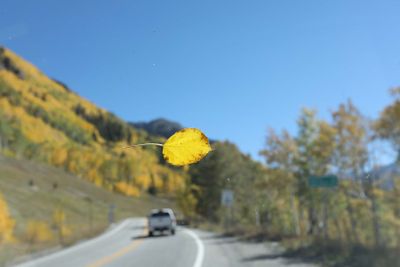 0T5A2957 Aspen leaf on windshield.jpg |
 0T5A3012 Aspen Ridge.jpg |
 6P5A1830 Telluride hill view.jpg |
 6P5A1835 Telluride hill side.jpg |
 6P5A1840 Telluride Mountain Village golf course.jpg |
 6P5A1850 Above Telluride.jpg |
 6P5A1865 Headed south from Telluride.jpg |
 0T5A2979 Trout Lake.jpg |
 0T5A2986 Trout Lake from road.jpg |
 0T5A3003 Colorful Colorado hill side.jpg |
 6P5A1878 Trout Lake.jpg |
 6P5A1895 Lizard Head.jpg |
 6P5A1899 Near Lizard Head.jpg |
 6P5A1914 Ridge of aspen.jpg |
 6P5A1920 Orangish aspen grove.jpg |
 6P5A1928 Bright hill side.jpg |
 0T5A3025 Hwy 550 Barn.jpg |
 0T5A3042 Lake along HWY 550.jpg |
 6P5A1931 Horses along HWY 550 MDH.jpg |
 6P5A1938 MDH horse.jpg |
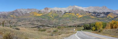
 0T5A3079 Million Dollar Highway.jpg |
 0T5A3086 Million Dollar Highway.jpg |
 0T5A3089 Million Dollar Hwy.jpg |
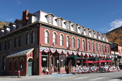
 0T5A3092 Silverton CO.jpg |
 0T5A3093 Silverton CO.jpg |
 0T5A3096 Silverton CO hill side.jpg |
 0T5A3098 Silverton CO area.jpg |
 0T5A3100 Headed north out of Silverton.jpg |
 0T5A3104 Hwy 550 N from Silverton.jpg |
 0T5A3117 Approaching Yankee Girl mine.jpg |
 0T5A3124 Yankee Girl Mine area.jpg |
 0T5A3129 Million Dollar Highway view.jpg |
 0T5A3154 Sun and shadows.jpg |
 0T5A3157 Million Dollar Highway view.jpg |
 0T5A3171 Crystal Lake reflection.jpg |
 20240926_114524 Crystal Lake reflections.jpg |
 0T5A3187 Headed N to Ouray CO.jpg |
 0T5A3193 Side mirror view.jpg |
 0T5A3194 Profusion of color.jpg |
 0T5A3200 Million Dollar Highway 550.jpg |
 0T5A3211 Million Dollar Highway view.jpg |
 0T5A3218 Shadows on the hills.jpg |
 0T5A3253 Alpine Loop colors.jpg |
 0T5A3258 Alpine Loop road near Silverton.jpg |
 0T5A3269 Near Silverton.jpg |
 0T5A3274 Silverton sunshine and shadows.jpg |
 0T5A3295 Molas Pass overlook.jpg |
 0T5A3309 Million Dollar Highway view.jpg |
 0T5A3317 Stop light in the middle of nowhere.jpg |
 20240926_132611 Silverton.jpg |
 20240926_134934 Molas Pass overlook.jpg |
 6P5A1972 Molas Pass pond and leaves.jpg |
 6P5A2211 Clouds reflection.jpg |
 6P5A1949 Color along the route.jpg |
 6P5A1958 Shadows and sunlight.jpg |
 6P5A1960 Highlighted aspens.jpg |
 6P5A1965 Pika.jpg |
 6P5A1977 Near Molas Pass.jpg |
 6P5A1984 MDH Mtn.jpg |
 6P5A1999 Big moose.jpg |
 6P5A2014 Variety of colors.jpg |
 6P5A2021 Old mine.jpg |
 6P5A2022 MDH hillside.jpg |
 6P5A2023 What a hillside.jpg |
 6P5A2031 Ironton Park Hwy 550.jpg |
 6P5A2036 Irontown Park area scenery.jpg |
 6P5A2044 Along the Million Dollar Highway.jpg |
 6P5A2047 Side mirror view.jpg |
 6P5A2051 Million Dollar Highway.jpg |
 6P5A2054 Hello yellow.jpg |
 6P5A2059 Million Dollar Highway view.jpg |
 6P5A2062 What incredible color.jpg |
 6P5A2077 Million Dollar Highway.jpg |
 6P5A2082 Million Dollar Hwy.jpg |
 6P5A2155 Curvy road Silverton.jpg |
 6P5A2163 Alpine Loop view.jpg |
 20240926_134038 Molas Lake cabin phone version.jpg |
 6P5A2195 Old building on Hwy 550.jpg |
 6P5A2197 Molas Lake cabin color mix v1.jpg |
 6P5A2197 Molas Lake cabin.jpg |
 6P5A2202 Kendall Mtn road.jpg |
 6P5A2234 Forest mixture.jpg |
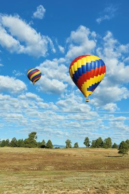 20240927_083136 Pagosa balloons.jpg |
 0T5A3320 Wolf Creek Pass overlook view.jpg |
 6P5A2253 East side Wolf Creek Pass.jpg |
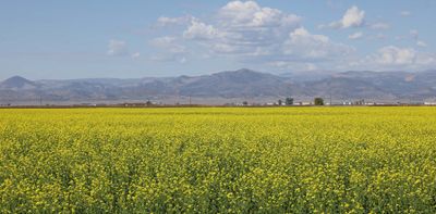 6P5A2262 San Luis Valley canola field.jpg |
 6P5A2267 Sandhill cranes near Monte Vista NWR.jpg |
 6P5A2275 Sandhill Cranes feeding near MVNWR.jpg |
 6P5A2301 West side of San Luis Valley.jpg |
 6P5A2309 Semi automated harvest.jpg |
 6P5A2326 Planting time.jpg |
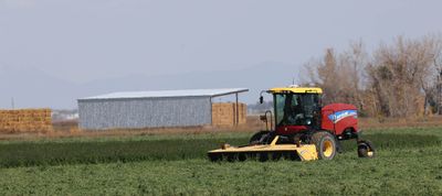 6P5A2331 Swather.jpg |
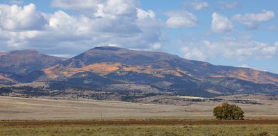
 0T5A3342 Clouds over Blanca Peak.jpg |
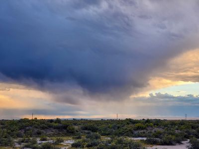
 0T5A3348 Rain clouds over the dunes.jpg |
 0T5A3364 Dune doom.jpg |
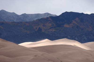
 0T5A3366 West side of dunes.jpg |
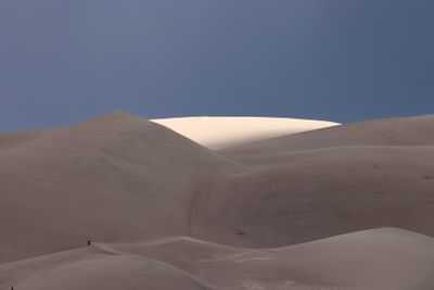
 0T5A3382 Great Sand Dunes National Park.jpg |
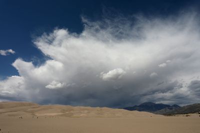
 0T5A3401 Clouds over Great Sand Dunes National Park.jpg |
 20240927_123609 Phone view of the dunes.jpg |
 20240927_130320 Blue shies and clouds.jpg |
 20240927_132654 Wide angle dunes and clouds.jpg |
 20240927_135053 Great Sand Dunes National Park.jpg |
 6P5A2354 GSDNP clouds.jpg |
 6P5A2362 Great Sand Dunes National Park.jpg |
 6P5A2379 Headed to the dunes.jpg |
 6P5A2383 Near top of first dune.jpg |
 6P5A2386 Dark clouds over the dunes GSDNP.jpg |
 6P5A2391 Shadow and sunlight.jpg |
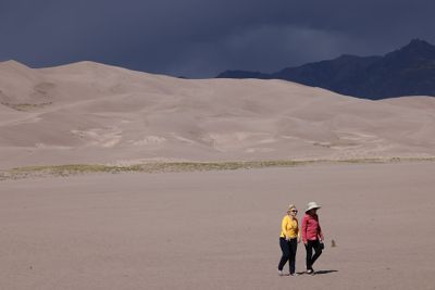 6P5A2395 Out for a stroll.jpg |
 6P5A2398 People and the dunes.jpg |
 6P5A2430 Ominous skies.jpg |
 6P5A2437 Blowing sand.jpg |
 6P5A2445 Changing conditions.jpg |
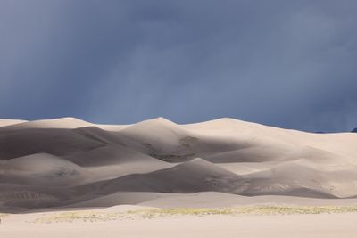 6P5A2450 Great Sand Dunes National Park great lighting.jpg |
 6P5A2464 Great Sand Dunes National Park.jpg |
 6P5A2469 Isolated light GSDNP.jpg |
 6P5A2480 Sunlight and dunes.jpg |
 6P5A2482 Dynamic dunes.jpg |
 6P5A2491 A panoply of light.jpg |
 6P5A2499 Awesome light.jpg |
 6P5A2505 Sand surfer returning.jpg |
 6P5A2533 Ridge walker.jpg |
 6P5A2547 Big expanse of sand.jpg |
 6P5A2554 Sand in the shoes.jpg |
 6P5A2607 Rain over the dunes.jpg |
 6P5A2609 Great Sand Dunes NP.jpg |
 6P5A2619 Blowing sand on highlighted dune.jpg |
 6P5A2622 Blowing in the wind.jpg |
 6P5A2628 Aliens at GSDNP.jpg |
 6P5A2668 Surreal dunes.jpg |
 6P5A2673 Sangre de Cristo mountains.jpg |
 6P5A2678 Late afternoon Sange de Cristo mtns.jpg |
 20240927_143836 Leaving the park view.jpg |
 20240927_183424 San Luis Valley CO.jpg |
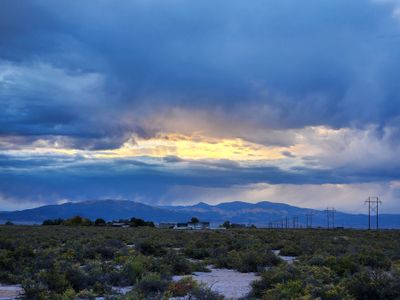 20240927_184140 Alamosa area late evening.jpg |
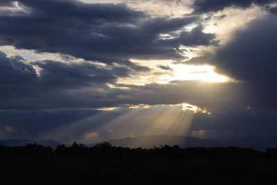
 6P5A2697 Colorado crepuscular rays.jpg |
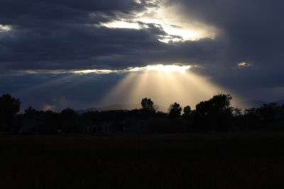
 6P5A2733 Alamosa area crepuscular rays.jpg |
 6P5A2748 Alamosa evening sky.jpg |
 0T5A3411 Blanca Peak early morning.jpg |
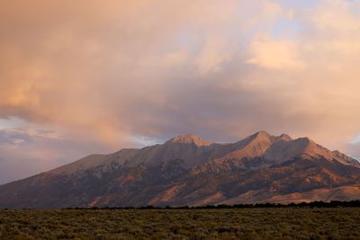
 0T5A3425 Blanca Peak.jpg |
 20240928_065055 Phone view of weather around Blanca Peak.jpg |
 20240928_070338 Wide angle phone view Sangre de Cristo.jpg |
 6P5A2781 Beautiful Sangre de Cristo mtns early morn.jpg |
 6P5A2798 Sangre de Cristo East side color.jpg |
 20240928_193218 Wichita Falls hotel sunset afterglow.jpg |
 20240929_071941 Leaving Wichita Falls.jpg |
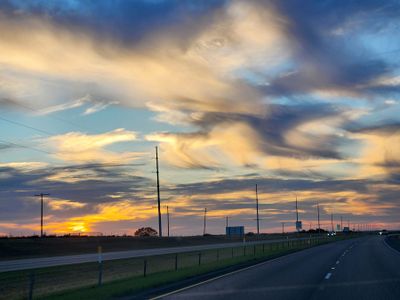 20240929_073203 Mares tails clouds.jpg |
| comment | share |