


|
|
|
|
|
|
| James | profile | all galleries >> The Great Road Trip >> Day 2 (April 22nd) | tree view | thumbnails | slideshow |
Went hunting for milk in the morning while the kids slept. Filled up with gas and milk at the local Chevron, the stopped in the general store next to the hotel. Since I gave the last of my cash as tips to the movers, and to use credit card was a $5 minimum, I had to buy croissants to get a coffee, though Ed, the cashier, was nice enough to offer to let me have it for free. The croissants were worth it. A pretty good little store, with a bakery attached and good coffee. Ed recommended we go to the Panum Crater and the south shore tufas, and drive the June Lake loop.
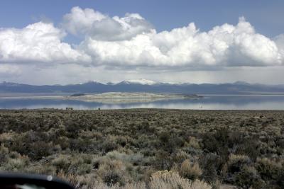
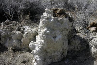
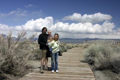
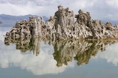
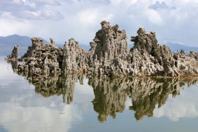
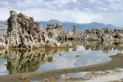
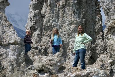
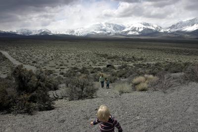
After loading up about 10:15am, we took Ed’s advice. We drove past the turnoff to the south shore tufas, then drove back, parked, and walked down to Mono lake and saw the tufas, and on the way back Kim noticed tracks that as best we can tell must have been a cougar’s on either side of the track. We loaded back up in the Pilot, went looking for Panum crater, which is an extinct volcano, and which was right next to us but so unimpressive we couldn’t tell where! We knew from the map, so we headed down some narrow gravel tracks, scratching the Pilot on the harsh scrub at the narrowest places, and after a couple of exploratory turns found the crater (well, the rim of it). We spent about 20 minutes walking up, taking in the view, and walking back down. There is a cinder cone inside the crater, but it doesn’t look like a cone any more. It looks like many of the other jagged and eroded hills hereabouts. Jed & Ava wanted to walk down into the crater (and who knows, climb the cinder cone?) but it would have caused them grief, and we had lots to do, so we grabbed them and hit the road.
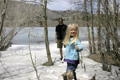
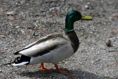
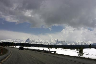
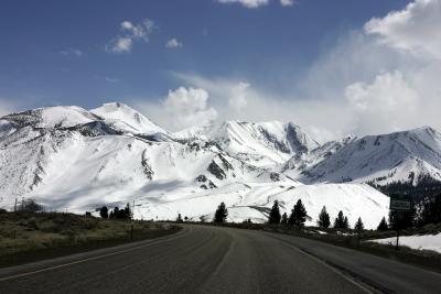
The north end of the June Lake loop was closed, so we drove in the south end, which takes you straight to the lake, and found a picnic table at a public campground by the lake. It was mostly frozen, except for the snow at the edge which allowed me to demonstrate to Ava the perils of approaching a frozen body of water too closing (a sudden crunch and a wet sock and shoe - luckily I was wearing shorts so I didn’t soak my pants). Jed mostly slept and Ava fed a couple of mallard ducks while we picnicked, and then we hit the road again ( to the strains of Willie Nelson). We wanted to see the Devil’s Postpiles and the ancient bristle cone pines, but the roads to both were still closed from the winter, so we beelined for Death Valley. Except for a stop in Bishop to fax an insurance form to Allied International, and another in Lone Pine to buy some new sleeping bags and a milkshake, and to try to figure out if any of the mountains we could see with their heads in the clouds was Mt Whitney (probably not, it was a bit further back, though on a clear day you can see it).
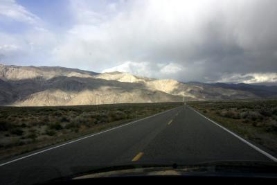
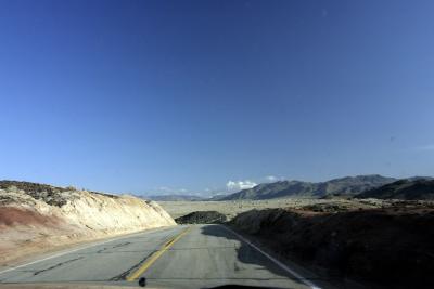
From Lone Pine, we took the turn to Death Valley. It was a pretty spectacular drive in. We took in the view from Father Crowley’s lookout, which was a rough quarter or half mile detour, and admired what we thought was Death Valley 6000 feet below us. Turned out it was the Paramint valley. And Death Valley was over one more mountain range. Just a taste of what the 1849 settlers stumbled unknowingly into (headed the other way of course). Coming down the next range I must have rode the brakes too long (not hard) because they started chattering badly - it wasn’t until we stopped at a rest area for a potty break that they cooled down - when we resumed the descent into DV the chattering had stopped, to our relief. We rolled up at Stovepipe Wells in DV about 7:40pm and set up camp before eating (at a restaurant!).
I managed to let Jed fall out of the car while Kim and Ava were cleaning up. He came out of a standing position in the drivers seat (where he had been pretty happily ensconced while I was unloading), face first onto the dirt and gravel of the parking lot. Scraped himself up pretty well and got lots of dirt into a cut next to his nose, which didn’t seem to come quite clean (but as of now seems to be healing ok).
 Mono Lake (DR-4584) |
 Tufa (DR4588) |
 Path to Mono Lake (DR4591) |
 South Mono Lake Tufas (3310) |
 Tufas, South Mono Lake |
 South Mono Lake Tufas (3314) |
 South Mono Lake Tufas (3318) |
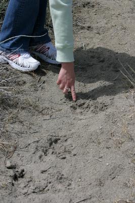 Cougar tracks? (3323) |
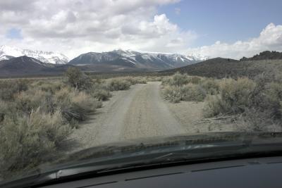 Track to Panum Crater (DR4595) |
 Ascending Panum Crater (DR4596) |
 Picnic at June Lake (DR4598) |
 Drake (3326) |
 South on Hwy ___? (DR4602) |
 South on Hwy ___? (DR4603) |
 West of Lone Pine to Mt Whitney (DR4606) |
 Headed to Death Valley (DR4609) |
 Headed to Death Valley (DR4612) |
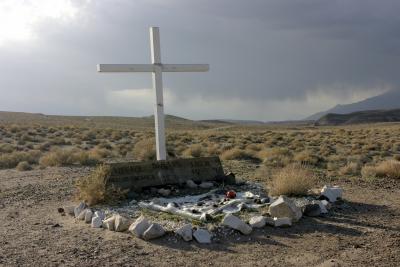 Pioneer Grave |
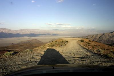 Father Crowley's lookout over Panamint Valley (DR4615) |
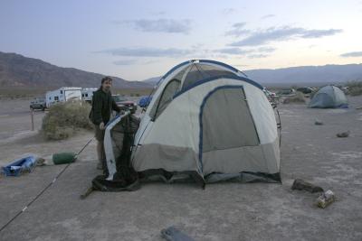 Setting camp at Stovepipe Wells (DR4619) |
| comment | share |