


|
|
|
|
|
|
| Candebat Drew | profile | all galleries >> North America >> United States >> 11 States Trip | tree view | thumbnails | slideshow |
 Arkansas.jpg |
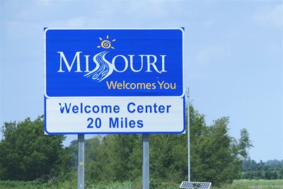 Missouri.jpg |
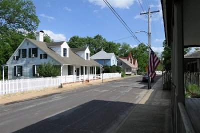
 Bolduc House and Bolduc-LeMeilleur Houses on S. Main Street.jpg |
 199 Merchant Street.jpg |
 Antoine Parfait Dufour - 1790.jpg |
 Bedroom - Jacques Guibourd House - 1806 (1).jpg |
 Bedroom - Jacques Guibourd House - 1806 (2).jpg |
 Dining Room - Jacques Guibourd House - 1806.jpg |
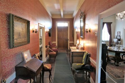 Entryway - Jacques Guibourd House - 1806.jpg |
 Attic - Jacques Guibourd House - 1806.jpg |
 Living Room - Jacques Guibourd House - 1806 (1).jpg |
 Living Room - Jacques Guibourd House - 1806 (2).jpg |
 Living Room - Jacques Guibourd House - 1806 (3).jpg |
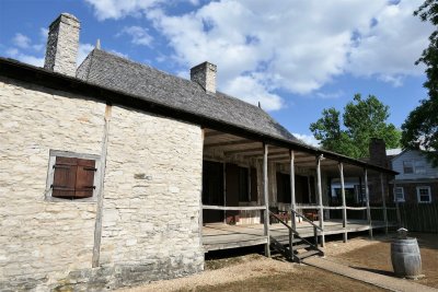
 Jacques Guibourd House - 1806.jpg |
 Ste. Genevieve Herald.jpg |
 Ste. Genevieve Catholic Church.jpg |
 Old Brick House - First Brick Building West of Mississippi River - 1785.jpg |
 Bolduc-LeMeilleur House Exterior - 1820 (1).jpg |
 Entrance Area in Bolduc House - 1792.jpg |
 First Room in Bolduc House - 1792.jpg |
 Second Room in Bolduc House - 1792 (1).jpg |
 Second Room in Bolduc House - 1792 (2).jpg |
 Bolduc House Garden - 1792.jpg |
 Third Room (Kitchen) in Bolduc House - 1792.jpg |
 Bolduc House Back - 1792 (1).jpg |
 Bolduc House Back - 1792 (2).jpg |
 Bolduc House Front - 1792.jpg |
 Bolduc House Porch - 1792.jpg |
 Bolduc-LeMeilleur House Interior - 1820 (1).jpg |
 Bolduc-LeMeilleur House Interior - 1820 (2).jpg |
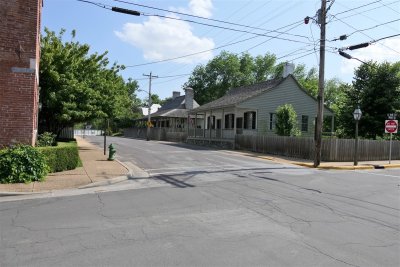
 S. Main Street in Ste. Genevieve.jpg |
 Bolduc-LeMeilleur House Exterior - 1820 (2).jpg |
 Dr. Walter Fenwick House - 1805.jpg |
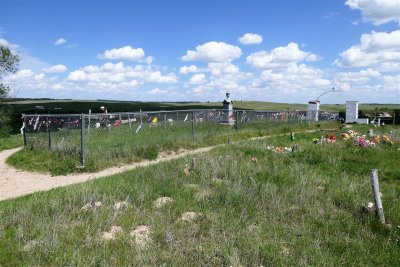
 Ste. Genevieve Memorial Cemetery (1).jpg |
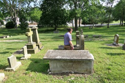 Dad at Ste. Genevieve Memorial Cemetery.jpg |
 Ste. Genevieve Memorial Cemetery (2).jpg |
 Green Tree Tavern Front - 1790.jpg |
 Green Tree Tavern Back - 1790.jpg |
 Bequette-Ribault House Front - 1807.jpg |
 Bequette-Ribault House Back - 1807.jpg |
 Kansas.jpg |
 Nebraska.jpg |
 SE Nebraska Countryside.jpg |
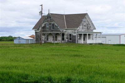
 Abandoned Homestead Near Lewiston, Nebraska.jpg |
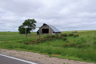 Old Barn Near Lewiston, Nebraska.jpg |
 Modern Sinclair Gas Station (1).jpg |
 Modern Sinclair Gas Station (2).jpg |
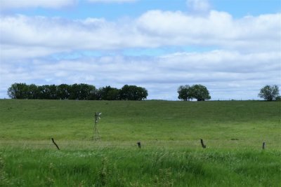
 Pawnee County Farmland Treeline.jpg |
 Modernized Historic Homestead in Cage County (1).jpg |
 Modernized Historic Homestead in Cage County (2).jpg |
 Modernized Historic Homestead in Cage County (3).jpg |
 Amount of Homestead Land in Each State.jpg |
 Homestead National Monument of America Heritage Center.jpg |
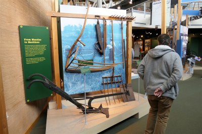
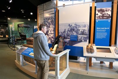
 Homestead National Monument of America Heritage Center Displays (1).jpg |
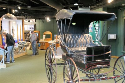
 Homestead National Monument of America Heritage Center Displays (2).jpg |
 Homestead National Monument of America Heritage Center Displays (3).jpg |
 Homestead National Monument of America Heritage Center Displays (4).jpg |
 Homestead National Monument of America Heritage Center Displays (5).jpg |
 Homestead National Monument of America Heritage Center Displays (6).jpg |
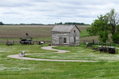 Palmer's Cabin at Homestead National Monument - 1867.jpg |
 Inside Palmer's Cabin at Homestead National Monument - 1867 (1).jpg |
 Inside Palmer's Cabin at Homestead National Monument - 1867 (2).jpg |
 Freeman School - 1872 (1).jpg |
 Freeman School - 1872 (2).jpg |
 Map of Land Ownership in Cage County.jpg |
 Inside Freeman School - 1872.jpg |
 Nebraska State Capitol.jpg |
 Downtown Lincoln (1).jpg |
 Downtown Lincoln (2).jpg |
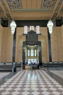
 Omaha Union Station Exterior - Art Deco - 1931.jpg |
 Omaha Union Station Main Hall - Art Deco - 1931 (1).jpg |
 Omaha Union Station Main Hall - Art Deco - 1931 (2).jpg |
 Omaha Union Station Main Hall - Art Deco - 1931 (3).jpg |
 Omaha Union Station Main Hall - Art Deco - 1931 (4).jpg |
 Omaha Union Station Ticket Counter.jpg |
 Durham Museum (1).jpg |
 Durham Museum (2).jpg |
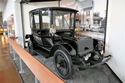 Rauch and Lang Electric Car - 1920 - Durham Museum.jpg |
 Durham Museum Exhibit Hall.jpg |
 Downtown Omaha from Heartland of America Park.jpg |
 Conagra Lake - Heartland of America Park.jpg |
 Dad at Heartland of America Park (1).jpg |
 Dad at Heartland of America Park (2).jpg |
 Dad at Heartland of America Park (3).jpg |
 I-480 Bridge Over High Waters of Missouri River.jpg |
 Military Monument - Heartland of America Park (1).jpg |
 Military Monument - Heartland of America Park (2).jpg |
 First National Bank in Downtown Omaha - 193 Meters.jpg |
 Dakota Sioux Casino and Hotel Room.jpg |
 Pizza, Wine, and Whiskey to Celebrate Birthday.jpg |
 Dakota Sioux Casino at Night.jpg |
 Dakota Sioux Hotel at Night.jpg |
 Dakota Sioux Casino.jpg |
 Dakota Sioux Hotel at Day.jpg |
 Dakota Sioux Casino at Day.jpg |
 Countryside in Lake Traverse Reservation.jpg |
 Abandoned Homestead in Lake Traverse Reservation (1).jpg |
 Abandoned Homestead in Lake Traverse Reservation (2).jpg |
 Abandoned Homestead in Lake Traverse Reservation (3).jpg |
 I-29 in Lake Traverse Reservation.jpg |
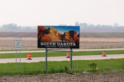 South Dakota.jpg |
 North Dakota.jpg |
 Dad at the North and South Dakota Border (1).jpg |
 Dad at the North and South Dakota Border (2).jpg |
 Farm off I-29.jpg |
 I-29 Flat Roads.jpg |
 St. John's Lutheran Church and Cemetery - 1872 - Galchutt.jpg |
 St. John's Lutheran Church - 1872 - Galchutt.jpg |
 GPS Guiding Us to Fort Abercrombie.jpg |
 Fort Abercrombie State Historic Site Visitors Center.jpg |
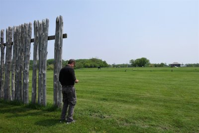 Dad at Fort Abercrombie Stockades.jpg |
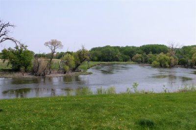 Red River at Fort Abercrombie.jpg |
 Red River at Fort Abercrombie - South Dakota and Minnesota Border.jpg |
 Minnesota from South Dakota Side of Red River - Fort Abercrombie State Park.jpg |
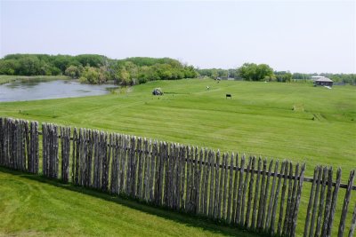
 Fort Abercrombie Facing North.jpg |
 Drew at Guardhouse.jpg |
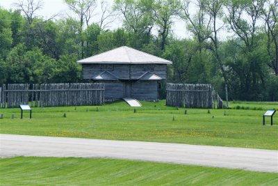
 Overview of Fort Abercrombie.jpg |
 Fort Abercrombie Blockhouse.jpg |
 Stateline of Minnesota and South Dakota.jpg |
 Fort Abercrombie from Minnesota.jpg |
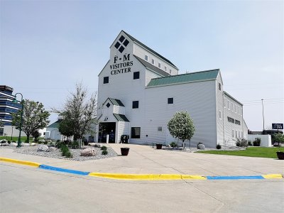 Fargo-Moorhead Visitors Center.jpg |
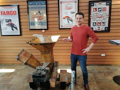 Drew with Fargo Woodchipper.jpg |
 West Acres Regional Shopping Center.jpg |
 Roger Maris Museum at West Acres Regional Shopping Center (1).jpg |
 Roger Maris Museum at West Acres Regional Shopping Center (2).jpg |
 Roger Maris Museum at West Acres Regional Shopping Center (3).jpg |
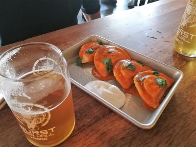 Sriracha Pierogies - Wurst Bier Hall.jpg |
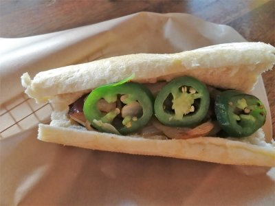 Traditional German Bratwurst with Jalepenos - Wurst Bier Hall.jpg |
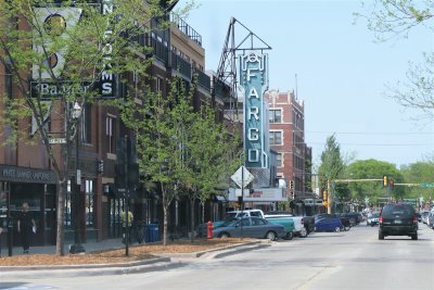 Fargo Theater on Broadway N.jpg |
 Fargo Theater Sign.jpg |
 Fargo Train Station.jpg |
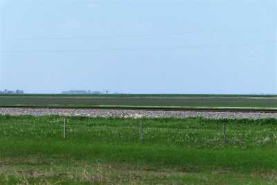 Eastern North Dakota Plains.jpg |
 Empty North Dakota Highway.jpg |
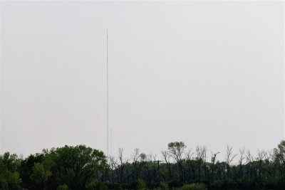
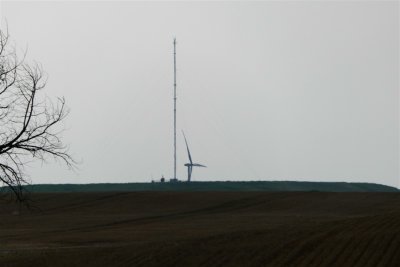
 KVLY-TV Mast Six Miles Out - 629 Meters.jpg |
 KVLY-TV Mast.jpg |
 KVLY-TV Mast Guy Anchors.jpg |
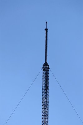
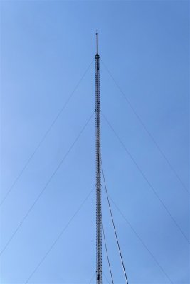 Top Section - KVLY-TV Mast.jpg |
 Transmitting Array - KVLY-TV Mast.jpg |
 KVLY-TV Mast (2).jpg |
 KRDK-TV Masts - 628 and 224 Meters.jpg |
 KVLY-TV Mast (3).jpg |
 Hi-Line Railroad Bridge.jpg |
 Hi-Line Railroad Bridge - 1908 - 1180 Meters (4).jpg |
 Hi-Line Railroad Bridge - 1908 - 1180 Meters (1).jpg |
 Hi-Line Railroad Bridge - 1908 - 1180 Meters (2).jpg |
 Hi-Line Railroad Bridge - 1908 - 1180 Meters (3).jpg |
 Steel Lattice Structure - Hi-Line Railroad Bridge (1).jpg |
 Steel Lattice Structure - Hi-Line Railroad Bridge (2).jpg |
 Steel Lattice Structure - Hi-Line Railroad Bridge (3).jpg |
 Underview of Rail Line - Hi-Line Railroad Bridge (1).jpg |
 Underview of Rail Line - Hi-Line Railroad Bridge (2).jpg |
 White Buffalo - National Buffalo Museum.jpg |
 Buffalo and Baby - National Buffalo Museum.jpg |
 Bison Antiquus Skeleton - National Buffalo Museum.jpg |
 Buffalos in the Field - National Buffalo Museum (1).jpg |
 Buffalos in the Field - National Buffalo Museum (2).jpg |
 Buffalos in the Field - National Buffalo Museum (3).jpg |
 National Buffalo Museum (1).jpg |
 National Buffalo Museum (2).jpg |
 White Buffalo Exhibit - National Buffalo Museum.jpg |
 Dad at the World's Largest Buffalo - National Buffalo Museum (2).jpg |
 Dad at the World's Largest Buffalo - National Buffalo Museum (1).jpg |
 Drew with World's Largest Buffalo - National Buffalo Museum.jpg |
 World's Largest Buffalo - National Buffalo Museum.jpg |
 Buffalos in the Field - National Buffalo Museum (4).jpg |
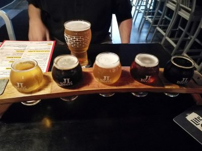 Flight of Regional Beers - JL Beers.jpg |
 Bacon Cheddarpeno Burger and Chips - JL Beers.jpg |
 Duck-Billed Dinosaur Fossils - North Dakota Heritage Center & State Museum.jpg |
 Horse Exhibit - Governors Gallery - North Dakota Heritage Center & State Museum.jpg |
 Fire Engine - Governors Gallery - North Dakota Heritage Center & State Museum.jpg |
 Xiphactinus Skeleton - Adaptation Gallery - North Dakota Heritage Center & State Museum.jpg |
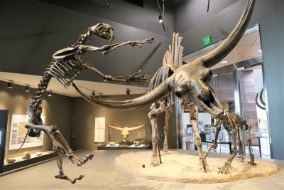
 Triceratops and T-Rex - Adaptation Gallery - North Dakota Heritage Center & State Museum.jpg |
 Pteranodon and Babies - Adaptation Gallery - North Dakota Heritage Center & State Museum.jpg |
 Champsosaurus Gigas Skeleton - Adaptation Gallery - North Dakota Heritage Center & State Museum.jpg |
 Smilodon S_Museum.jpg |
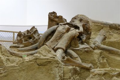
 Mastodon Skeleton - North Dakota Heritage Center & State Museum.jpg |
 Erskine Automobile Model 52 - 1929.jpg |
 1900 Holland Special - North Dakota Heritage Center & State Museum.jpg |
 North Dakota Heritage Center & State Museum.jpg |
 The Pioneer Family - Bismarck Capital Monument.jpg |
 North Dakota State Capitol - Art Deco - 1934.jpg |
 Skyscraper on the Prarie - North Dakota State Capitol - 1934.jpg |
 Drew at the North Dakota State Capitol.jpg |
 Dad at the North Dakota State Capitol (1).jpg |
 Dad at the North Dakota State Capitol (2).jpg |
 Dad Driving in Rural North Dakota.jpg |
 Frontier Weapons - Sheldon Gallery - North Dakota Lewis & Clark Interpretive Center.jpg |
 Sheldon Gallery - North Dakota Lewis & Clark Interpretive Center.jpg |
 Dugout Canoe - North Dakota Lewis & Clark Interpretive Center.jpg |
 Lewis, Clark, and Chief Sheheke Statues - 12 Feet - North Dakota Lewis & Clark Interpretive Center.jpg |
 Drew and Seaman - Fort Mandan.jpg |
 Statue of Seaman - Lewis's Newfoundland Dog - Fort Mandan.jpg |
 Missouri River from Fort Mandan (1).jpg |
 Missouri River from Fort Mandan (2).jpg |
 Missouri River from Fort Mandan (3).jpg |
 Blacksmith - Fort Mandan.jpg |
 Fort Mandan Historically Accurate Recreation.jpg |
 Drew with a Blunderbuss - Fort Mandan.jpg |
 Dad with a Blunderbuss - Fort Mandan.jpg |
 Charbonneau Family Room - Fort Mandan.jpg |
 Clark's Desk - Fort Mandan.jpg |
 Lewis's Desk - Fort Mandan.jpg |
 Enlisted Men's Quarters - Fort Mandan.jpg |
 Defensive Cannon and Flag - Fort Mandan.jpg |
 Entrance Gates - Fort Mandan.jpg |
 Missouri River from North Dakota Highway 200.jpg |
 Fort Clark Historic Site Marker.jpg |
 Mandan Village Area - Fort Clark.jpg |
 Fort Clark Area.jpg |
 Dad at Fort Clark.jpg |
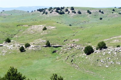
 Mandan Earth Mound House Pits - Fort Clark (1).jpg |
 Mandan Earth Mound House Pits - Fort Clark (2).jpg |
 Missouri River Bed - Fort Clark.jpg |
 Mandan Earth Mound House Pits - Fort Clark (3).jpg |
 Hidatsa Winter Cache Pit - Knife River Indian Villages National Historic Site.jpg |
 Knife River Indian Villages National Historic Site Vistors Center.jpg |
 Hidatsa Earth Mound Home Recreation Interior - Knife River Indian Villages National Historic Site (1).jpg |
 Hidatsa Earth Mound Home Recreation Interior - Knife River Indian Villages National Historic Site (2).jpg |
 Hidatsa Earth Mound Home Recreation - Knife River Indian Villages National Historic Site.jpg |
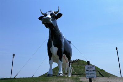 Salem Sue - World's Largest Holstein Cow - New Salem (1).jpg |
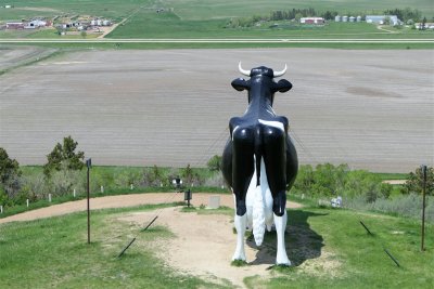 Salem Sue - World's Largest Holstein Cow - New Salem (2).jpg |
Panorama of Salem Sue Hill.jpg |
 New Salem - North Dakota.jpg |
 Countryside West of New Salem.jpg |
 Drew with Salem Sue (1).jpg |
 Drew with Salem Sue (2).jpg |
 Inside Sunset Cafe - New Salem.jpg |
 Lunch at Sunset Cafe - New Salem.jpg |
 Outside Sunset Cafe - New Salem.jpg |
 Glacial Hills.jpg |
 Homestead off of I-94.jpg |
 Drew with Grasshoppers in the Field - Enchanted Highway.jpg |
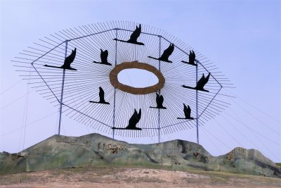 Geese in Flight - The Enchanted Highway.jpg |
 Cannonball Saloon - Regent (1).jpg |
 Deer Crossing - The Enchanted Highway.jpg |
 Rolling Hills Along 100th Ave SW - The Enchanted Highway (1).jpg |
 Rolling Hills Along 100th Ave SW - The Enchanted Highway (2).jpg |
 Rolling Hills Along 100th Ave SW - The Enchanted Highway (3).jpg |
 Black Terrain - 100th Ave SW.jpg |
 Rolling Hills Along 100th Ave SW - The Enchanted Highway (4).jpg |
 Abandoned Brick Homestead - 100th Ave SW (1).jpg |
 Abandoned Brick Homestead - 100th Ave SW (2).jpg |
 Abandoned Brick Homestead - 100th Ave SW (3).jpg |
 Abandoned Brick Homestead - 100th Ave SW (4).jpg |
 Rolling Hills Along the 100th Ave SW - The Enchanted Highway.jpg |
 Cannonball Saloon - Regent (2).jpg |
 Cannonball Saloon - Regent (3).jpg |
 Downtown Regent.jpg |
 Abandoned Homestead Farmsite on 100th Ave SW.jpg |
 Electric Windmills Along 100th Ave SW.jpg |
 Grasshopers in the Field - The Enchanted Highway.jpg |
 Fisherman's Dream - The Enchanted Highway.jpg |
 Pheasants on the Prairie - The Enchanted Highway.jpg |
 North Side of Black Butte.jpg |
 Black Butte - 2894 Feet.jpg |
 Teddy Rides Again - The Enchanted Highway.jpg |
 Tin Family - The Enchanted Highway.jpg |
 Regent, North Dakota.jpg |
 New Sculpture for Enchanted Highway.jpg |
 Former Regent High School.jpg |
 More Recent Abandoned Homestead - State Highway 22 (1).jpg |
 More Recent Abandoned Homestead - State Highway 22 (2).jpg |
 More Recent Abandoned Homestead - State Highway 22 (3).jpg |
 More Recent Abandoned Homestead - State Highway 22 (4).jpg |
 More Recent Abandoned Homestead - State Highway 22 (5).jpg |
 Buttes and Glacial Hills West of US Highway 85 Near Buffalo, South Dakota (1).jpg |
 Buttes and Glacial Hills West of US Highway 85 Near Buffalo, South Dakota (2).jpg |
 Buttes and Glacial Hills West of US Highway 85 Near Buffalo, South Dakota (3).jpg |
 Buttes and Glacial Hills West of US Highway 85 Near Buffalo, South Dakota (4).jpg |
 Drew at the Geographic Center of the 50 US States.jpg |
 Dad at the Geographic Center of the 50 US States.jpg |
Panorama of the Geographic Center of the 50 US States.jpg |
 Buttes and Glacial Hills West of US Highway 85 Near Buffalo, South Dakota (5).jpg |
 Buttes and Glacial Hills West of US Highway 85 Near Buffalo, South Dakota (6).jpg |
 Buttes and Glacial Hills West of US Highway 85 Near Buffalo, South Dakota (7).jpg |
 Buttes and Glacial Hills West of US Highway 85 Near Buffalo, South Dakota (8).jpg |
 Geographic Center of the 50 United States (1).jpg |
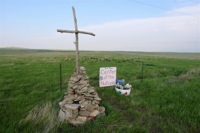 Geographic Center of the 50 United States (2).jpg |
 Traffic Light in Nowhere South Dakota.jpg |
 Arrowhead Motel - Sundance, Wyoming (1).jpg |
 Arrowhead Motel - Sundance, Wyoming (2).jpg |
 Arrowhead Motel - Sundance, Wyoming (3).jpg |
 Black Hills from US Highway 85 (1).jpg |
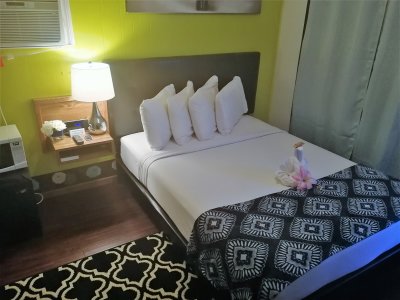 Arrowhead Motel Room - Sundance, Wyoming.jpg |
 Black Hills from US Highway 85 (2).jpg |
 Arrowhead Motel Bathroom - Sundance, Wyoming.jpg |
 Sunset in Western South Dakota (1).jpg |
 Sunset in Western South Dakota (2).jpg |
 Wyoming.jpg |
 French Dip and Wings - Longhorn Saloon & Grill.jpg |
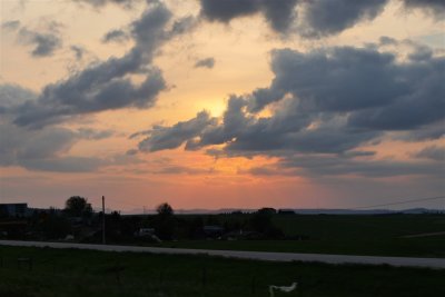
 Sunset Over Wyoming (1).jpg |
 Sunset Over Wyoming (2).jpg |
 Sunset Over Wyoming (3).jpg |
 Sunset Over Wyoming (4).jpg |
 Roudy Group - Longhorn Saloon & Grill.jpg |
 Attention to Detail - Arrowhead Motel, Sundance (1).jpg |
 Attention to Detail - Arrowhead Motel, Sundance (2).jpg |
 Main Street at Night - Sundance.jpg |
 The Turf Bar and Lounge - Sundance, Wyoming (1).jpg |
 The Turf Bar and Lounge - Sundance, Wyoming (2).jpg |
 The Turf Bar and Lounge - Sundance, Wyoming (3).jpg |
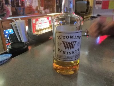 Wyoming Whiskey - Turf Bar and Lounge.jpg |
 Dad at The Turf Bar and Lounge - Sundance, Wyoming.jpg |
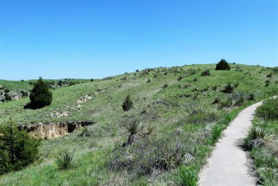
 Trail Around Devils Tower (8).jpg |
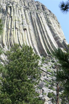
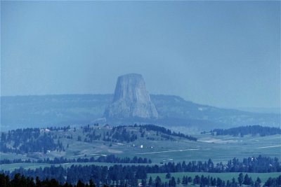 Devils Tower Through Forrest Fire Haze.jpg |
 Landscape Around Devils Tower.jpg |
 Scenic Drive to Devils Tower.jpg |
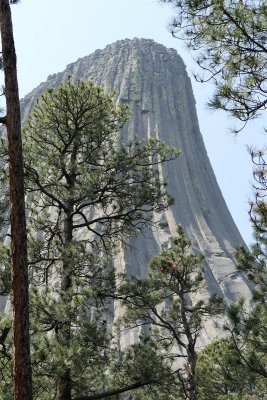
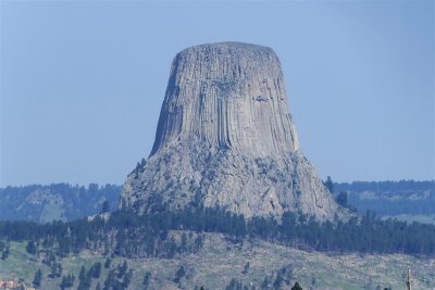 Devils Tower Two Miles Away.jpg |
 Dad at Devils Tower (1).jpg |
 Dad at Devils Tower (2).jpg |
 Dad at Devils Tower (3).jpg |
 Dad at Devils Tower (4).jpg |
 Dad at Devils Tower (5).jpg |
 Dad at Devils Tower (6).jpg |
 Drew at Devils Tower (1).jpg |
 Drew at Devils Tower (2).jpg |
 Drew at Devils Tower (3).jpg |
 Red Sandstone Cliffs Near Devils Tower.jpg |
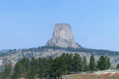 Devils Tower One Mile Out (1).jpg |
 Devils Tower One Mile Out (2).jpg |
 Trail Around Devils Tower (1).jpg |
 Trail Around Devils Tower (2).jpg |
 Trail Around Devils Tower (3).jpg |
 Landscape From Devils Tower.jpg |
 Trail Around Devils Tower (4).jpg |
 Hikers on Devils Tower (1).jpg |
 Hikers on Devils Tower (2).jpg |
 Trail Around Devils Tower (5).jpg |
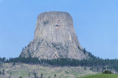
 Closeup of Columns.jpg |
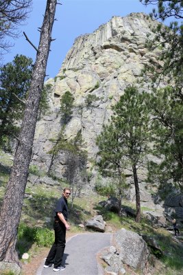 Dad at Devils Tower.jpg |
 Trail Around Devils Tower (6).jpg |
 Trail Around Devils Tower (7).jpg |
 Tatanka Story of Bison Museum.jpg |
 Main St. in Deadwood.jpg |
 Clerk of Couty of Lawrence County.jpg |
 Adams House (1).jpg |
 Adams House (2).jpg |
 Wild Bill Hickok Gravesite - Mt. Moriah Cemetery.jpg |
 Calamity Jane Gravesite - Mt. Moriah Cemetery.jpg |
 Mt. Moriah Cemetery.jpg |
 Deadwood from Mt. Moriah Cemetery.jpg |
 Franklin Hotel from Mt. Moriah Cemetery.jpg |
 Chinese Section - Mt. Moriah Cemetery (1).jpg |
 Chinese Section - Mt. Moriah Cemetery (3).jpg |
 Chinese Section - Mt. Moriah Cemetery (2).jpg |
 Mt. Moriah Cemetery Entrance.jpg |
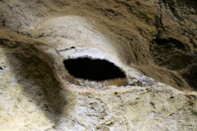
 Stairways in Jewel Cave.jpg |
 Dogtooth Spar.jpg |
 Gypsum Crystals.jpg |
 Dad and Ranger in Jewel Cave.jpg |
 Calcite Crystals - Black Color is From Manganese Dioxide (1).jpg |
 Calcite Crystals - Black Color is From Manganese Dioxide (2).jpg |
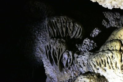
 Stalactites Forming.jpg |
 Jellyfish Flowstone Formations (1).jpg |
 Jellyfish Flowstone Formations (2).jpg |
 Jellyfish Flowstone Formations (3).jpg |
 Inside Cave Popcorn.jpg |
 Stalactite Soda Straw and Stalagmite.jpg |
 Soda Straw.jpg |
 Manganese Oxide Coated Dogtooth Spar.jpg |
 Cave Popcorn.jpg |
 Rimstone Formation.jpg |
 Dogtooth Spar Geode.jpg |
 Geode Formation.jpg |
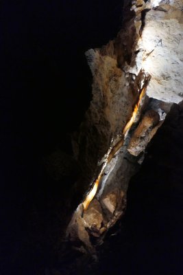 Cave Bacon - Long Ribbon Drapery (1).jpg |
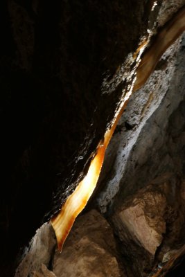 Cave Bacon - Long Ribbon Drapery (2).jpg |
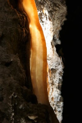
 Cave Bacon - Long Ribbon Drapery (3).jpg |
 Cave Bacon - Long Ribbon Drapery (4).jpg |
 Cave Bacon - Long Ribbon Drapery (5).jpg |
 Mineral Patterns in Ceiling.jpg |
 Cave Lighting.jpg |
 Iron Oxide Tinted Formation.jpg |
 Mammoth Site - Hot Springs, South Dakota (1).jpg |
 Mammoth Site - Hot Springs, South Dakota (2).jpg |
 Mammoth Site - Hot Springs, South Dakota (3).jpg |
 Mammoth Site - Hot Springs, South Dakota (4).jpg |
 Mammoth Site - Hot Springs, South Dakota (5).jpg |
 Mammoth Site - Hot Springs, South Dakota (6).jpg |
 Mammoth Site - Hot Springs, South Dakota (7).jpg |
 Mammoth Site - Hot Springs, South Dakota (8).jpg |
 Mammoth Site - Hot Springs, South Dakota (9).jpg |
 Mammoth Site - Hot Springs, South Dakota (10).jpg |
 Mammoth Site - Hot Springs, South Dakota (11).jpg |
 Mammoth Site Laboratory.jpg |
 Bison Along Needles Highway - South Dakota Highway 87 (1).jpg |
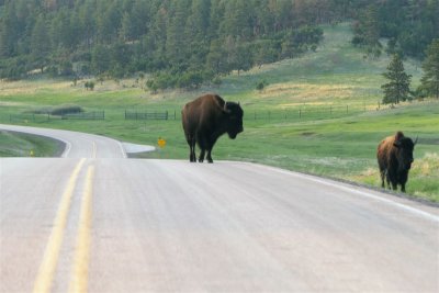
 Dad With Roadside Bison (1).jpg |
 Dad With Roadside Bison (2).jpg |
 Bison Along Needles Highway - South Dakota Highway 87 (2).jpg |
 Bison Along Needles Highway - South Dakota Highway 87 (3).jpg |
 Dad With Roadside Bison (3).jpg |
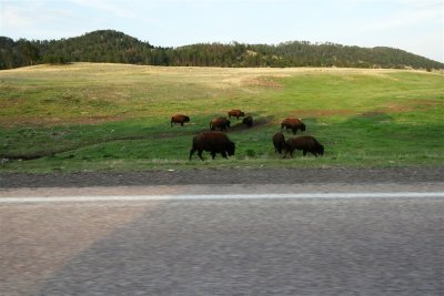 Bison Along Needles Highway - South Dakota Highway 87 (4).jpg |
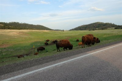 Bison Along Needles Highway - South Dakota Highway 87 (5).jpg |
 Bison Along Needles Highway - South Dakota Highway 87 (6).jpg |
 Bison Along Needles Highway - South Dakota Highway 87 (7).jpg |
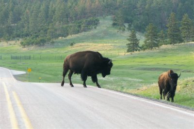 Bison Along Needles Highway - South Dakota Highway 87 (8).jpg |
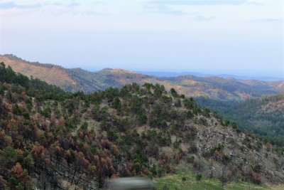 Black Hills from Needles Highway.jpg |
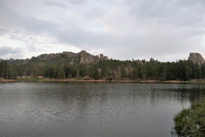
 Sylvan Lake - Custer State Park (1).jpg |
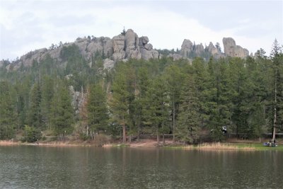 Sylvan Lake - Custer State Park (2).jpg |
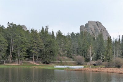 Sylvan Lake - Custer State Park (3).jpg |
 Sylvan Lake - Custer State Park (4).jpg |
 Sylvan Lake - Custer State Park (5).jpg |
 Sylvan Lake - Custer State Park (6).jpg |
 Sylvan Lake - Custer State Park (7).jpg |
 Sylvan Lake - Custer State Park (8).jpg |
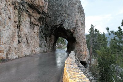 Single-Lane Tunnel - Needles Highway - Custer State Park.jpg |
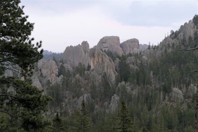 Needle-like Rock Formations from Needles Highway - Custer State Park (1).jpg |
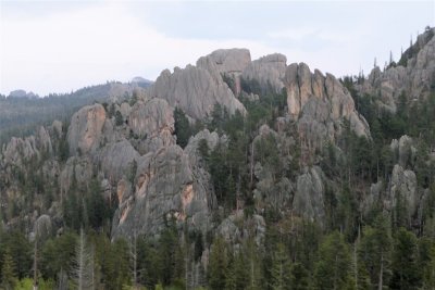 Needle-like Rock Formations from Needles Highway - Custer State Park (2).jpg |
 George Washington and Thomas Jefferson - Mount Rushmore National Memorial.jpg |
 Theodore Roosevelt and Abraham Lincoln - Mount Rushmore National Memorial.jpg |
 Abraham Lincoln - Mount Rushmore National Memorial.jpg |
 Four Presidents - Mount Rushmore National Memorial.jpg |
 Mount Rushmore at Night (1).jpg |
 Mount Rushmore at Night (2).jpg |
 Giant Steak Barrito - Guadalajara's Mexican Restuarants - Rapid City.jpg |
 Wall Drug - Wall, South Dakota (1).jpg |
 Wall Drug - Wall, South Dakota (2).jpg |
 Wall Drug - Wall, South Dakota (3).jpg |
 Buffalo Burger - Wall Drug.jpg |
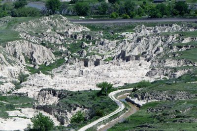
 Entrance to Badlands National Park.jpg |
 Praries North of Badlands.jpg |
 Badlands from Pinnacles Overlook (1).jpg |
 Badlands from Pinnacles Overlook (2).jpg |
 Badlands from Pinnacles Overlook (3).jpg |
 Badlands from Pinnacles Overlook (4).jpg |
 Badlands from Pinnacles Overlook (5).jpg |
 Badlands from Ancient Hunters Overlook (4).jpg |
 Badlands from Pinnacles Overlook (6).jpg |
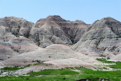
Panorama of the Badlands.jpg |
 Prarie to Badlands Scenery Change.jpg |
 Badlands from Pinnacles Overlook (7).jpg |
 Badlands from Pinnacles Overlook (8).jpg |
 Badlands from Pinnacles Overlook (9).jpg |
 Badlands from Pinnacles Overlook (10).jpg |
 Praries North of Pinnacles Overlook.jpg |
 Pronghorn (Antelope) in the Badlands (1).jpg |
 Pronghorn (Antelope) in the Badlands (2).jpg |
 Badlands from Ancient Hunters Overlook (1).jpg |
 Badlands from Ancient Hunters Overlook (5).jpg |
 Badlands from Ancient Hunters Overlook (2).jpg |
 Badlands from Ancient Hunters Overlook (3).jpg |
 Badlands Loop Road Western Area.jpg |
 Landscape on Badlands Loop Road (1).jpg |
 Landscape on Badlands Loop Road (2).jpg |
 Yellow Mounds Overlook from Conata Basin Overlook.jpg |
 Yellow Mounds from Conata Basin Overlook (1).jpg |
 Yellow Mounds from Conata Basin Overlook (2).jpg |
 Looking South from Conata Basin Overlook.jpg |
 Badlands from Homestead Overlook.jpg |
 Badlands from Panorama Point (1).jpg |
 Badlands from Panorama Point (2).jpg |
 Badlands from Panorama Point (3).jpg |
 Scenary Along Badlands Loop Road (1).jpg |
 Scenary Along Badlands Loop Road (2).jpg |
 Badlands Loop Road Eastern Area.jpg |
 Notch Trail (1).jpg |
 Notch Trail (2).jpg |
 Notch Trail (3).jpg |
 Notch Trail (4).jpg |
 Notch Trail (5).jpg |
 Dad in the Badlands (1).jpg |
 Dad in the Badlands (2).jpg |
 Drew in the Badlands (1).jpg |
 Drew in the Badlands (2).jpg |
 Chinese Family at Notch Trail (1).jpg |
 Chinese Family at Notch Trail (2).jpg |
 Badlands and Cattle from State Highway 44.jpg |
 Prairie Dog Running into Hiding.jpg |
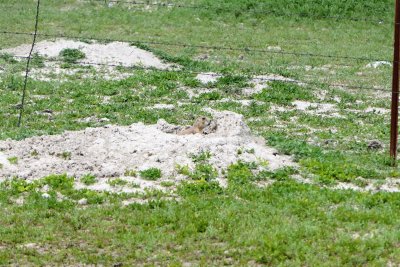 Prairie Dog Coming Out to Shout.jpg |
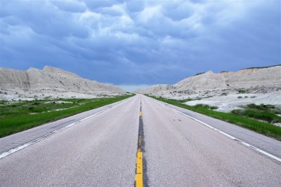 Badlands Along South Dakota State Highway 44.jpg |
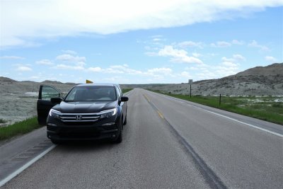 Dad's Car on State Highway 44.jpg |
 Cloud Front Over Southwestern Area of Badlands.jpg |
 Massacre of Wounded Knee Memorial Site.jpg |
 Present-Day Site of the Wounded Knee Massacre.jpg |
 Possibly a Closed Church - Wounded Knee Cemetery.jpg |
 Wounded Knee Cemetery.jpg |
 Beautiful Gravesite of Veteran Norbert Sheo Two Two Cox.jpg |
 Memorial Monument of Native American's Killed at Wounded Knee (1890) - Wounded Knee Cemetery.jpg |
 Mass Grave from the Wounded Knee Massacre - 1890.jpg |
 Beautiful Gravesite of Nada Agnes - White Buffalo Chief - Wounded Knee Cemetery.jpg |
 Hail Storm - Crawford Cemetery.jpg |
 Hailstorm - Crawford Cemetery (1).jpg |
 Hailstorm - Crawford Cemetery (2).jpg |
 Hailstorm - Crawford Cemetery (3).jpg |
 Hailstorm - Crawford Cemetery (4).jpg |
 Hailstorm - Crawford Cemetery (5).jpg |
 Hailstorm - Crawford Cemetery (6).jpg |
 Hailstorm - Crawford Cemetery (7).jpg |
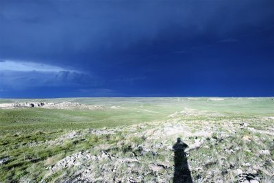
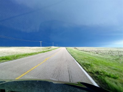 Storm Over Scottsbluff.jpg |
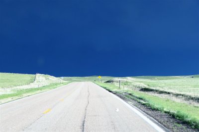 Storm Over Western Nebraska - State Highway 71 Outside Scottsbluff (1).jpg |
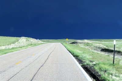 Storm Over Western Nebraska - State Highway 71 Outside Scottsbluff (4).jpg |
 Storm Over Western Nebraska - State Highway 71 Outside Scottsbluff (5).jpg |
 Storm Over Western Nebraska - State Highway 71 Outside Scottsbluff (6).jpg |
 Storm Over Western Nebraska - State Highway 71 Outside Scottsbluff (7).jpg |
Storm Over Western Nebraska - State Highway 71 Outside Scottsbluff (8).jpg |
Storm Over Western Nebraska - State Highway 71 Outside Scottsbluff (9).jpg |
Storm Over Western Nebraska - State Highway 71 Outside Scottsbluff (10).jpg |
 Storm Over Western Nebraska - State Highway 71 Outside Scottsbluff (11).jpg |
 Storm Over Western Nebraska - State Highway 71 Outside Scottsbluff (12).jpg |
 Storm Over Western Nebraska - State Highway 71 Outside Scottsbluff (13).jpg |
Panorama of Storm Over Scottsbluff.jpg |
 Drew's Barbed Wire Souvenir (1).jpg |
 Drew's Barbed Wire Souvenir (2).jpg |
 Drew's Barbed Wire Souvenir (3).jpg |
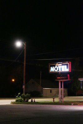
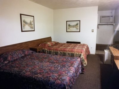 Capri Motel - Scottsbluff (8).jpg |
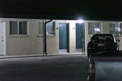
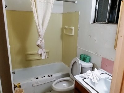 Capri Motel - Scottsbluff (7).jpg |
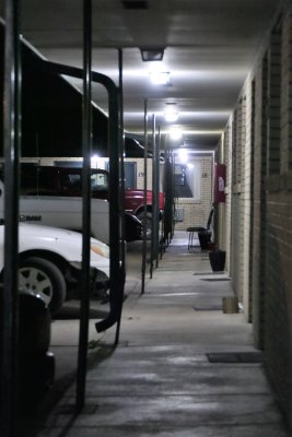
 Capri Motel - Scottsbluff (6).jpg |
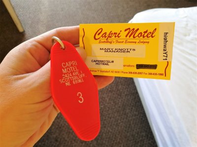
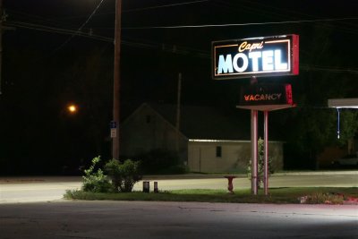 Capri Motel - Scottsbluff (1).jpg |
 Capri Motel - Scottsbluff (2).jpg |
 Capri Motel - Scottsbluff (3).jpg |
 Capri Motel - Scottsbluff (4).jpg |
 Capri Motel - Scottsbluff (5).jpg |
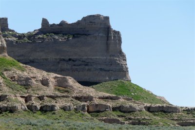
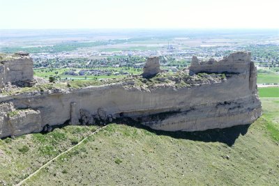
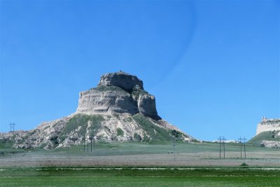 Sentinel Rock - Scotts Bluff National Monument.jpg |
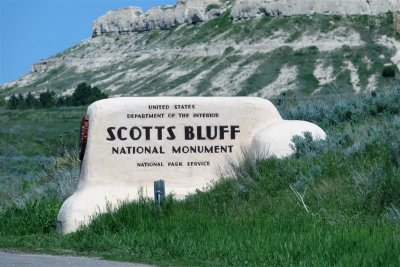 Scotts Bluff National Monument Entrance.jpg |
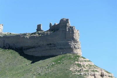 Saddle Rock - Scotts Bluff National Monument (1).jpg |
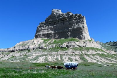 Wagon in Front of Eagle Rock - Scotts Bluff National Monument.jpg |
 Saddle Rock - Scotts Bluff National Monument (2).jpg |
 Saddle Rock from Parking Lot - Scotts Bluff National Monument.jpg |
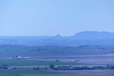 Chimney Rock from Scotts Bluff National Monument.jpg |
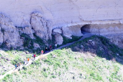 Hikers on Saddle Rock Trail - Scotts Bluff National Monument.jpg |
 Saddle Rock from South Overlook Path - Scotts Bluff National Monument.jpg |
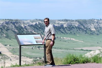 Dad at South Overlook Path - Scotts Bluff National Monument.jpg |
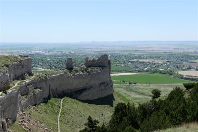
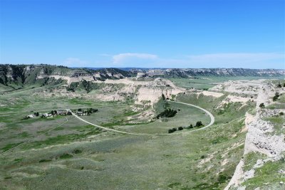 Mitchell Pass from South Overlook Path - Scotts Bluff National Monument.jpg |
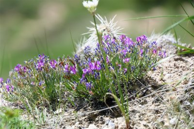
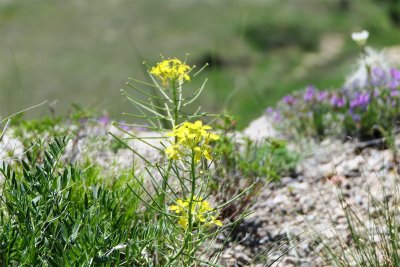 Wildflowers on Scotts Bluff National Monument (1).jpg |
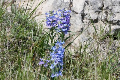
 Wildflowers on Scotts Bluff National Monument (2).jpg |
 Wildflowers on Scotts Bluff National Monument (3).jpg |
 Badlands and Riparian Area - Scotts Bluff National Monument.jpg |
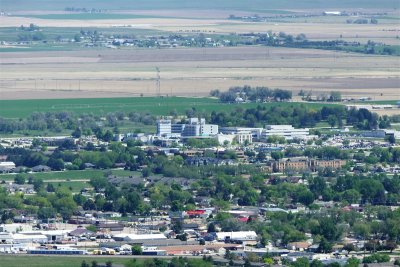 Regional West Medical Center and Capri Motel from Scotts Bluff.jpg |
 Hills West of Scotts Bluff National Monument.jpg |
 Chimney Rock National Historic Site (1).jpg |
 Chimney Rock National Historic Site (2).jpg |
 Chimney Rock National Historic Site (3).jpg |
 Dad at Chimney Rock.jpg |
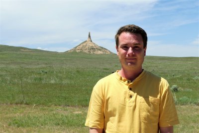 Drew at Chimney Rock.jpg |
 Wagon at Chimney Rock.jpg |
 Top of Chimney Rock Through Binoculars.jpg |
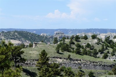
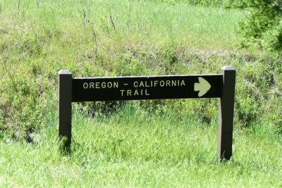 Oregon-California Trail - Ash Hollow State Historical Park.jpg |
 Ravine Caused By Wagon Travel - Ash Hollow State Historical Park (1).jpg |
 Wagon Wheel Ruts from Oregon Trail - Ash Hollow State Historical Park.jpg |
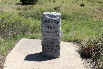 Oregon Trail Marker - 1912 - Ash Hollow State Historical Park.jpg |
 Ravine Caused By Wagon Travel - Ash Hollow State Historical Park (2).jpg |
 Ravine Caused By Wagon Travel - Ash Hollow State Historical Park (3).jpg |
 Ravine Caused By Wagon Travel - Ash Hollow State Historical Park (4).jpg |
 Dad on the Oregon Trail (1).jpg |
 Oregon Trail Path - Ash Hollow State Historical Park.jpg |
 Dad on the Oregon Trail (2).jpg |
 Pastures Near Oregon Trail - Ash Hollow State Historical Park.jpg |
 Pony Express Marker - Gothenburg.jpg |
 1850 Weapons - Pony Express Station and Museum - Gothenburg.jpg |
 Pony Express Mochila for Governmental and Other Mail - Pony Express Museum - Gothenburg.jpg |
 Sam Machette Pony Express Station - 1854 - Gothenburg.jpg |
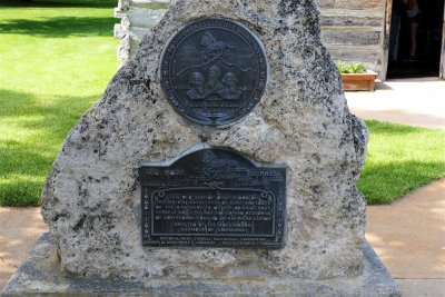
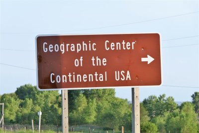 Geographical Center of the Continental USA Sign - Lebanon, Kansas.jpg |
 Geographical Center of the Continental USA Marker - Lebanon, Kansas.jpg |
 Geographical Center of the Continental USA Plaque - Lebanon, Kansas.jpg |
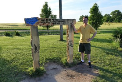 Drew at the Geographical Center of the Continental USA - Lebanon, Kansas.jpg |
 Marker at the Geographical Center of the Continental USA - Lebanon, Kansas.jpg |
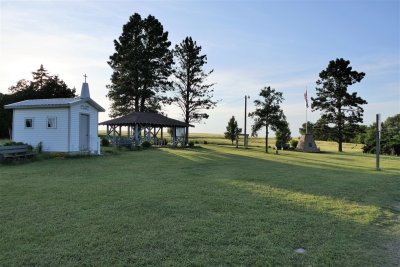
 US Center Chapel - Lebanon, Kansas (1).jpg |
 US Center Chapel - Lebanon, Kansas (2).jpg |
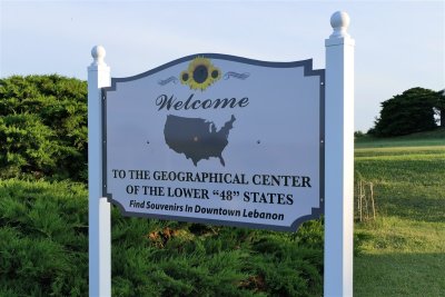 Welcome to the Geographic Center of the Lower 48 States.jpg |
 Geographic Center of the Continental US Site.jpg |
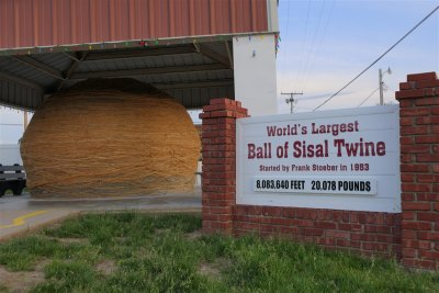 World's Largest Ball of Sisal Twine - 1500+ Miles.jpg |
 Cawker City's Ball of Twine - 43 Feet Circumference.jpg |
 World's Largest Ball of Twine - Cawker City.jpg |
 Dad at the World's Largest Ball of Twine (1).jpg |
 Dad at the World's Largest Ball of Twine (3).jpg |
 Dad at the World's Largest Ball of Twine (2).jpg |
 Old Style Gas Station - Cawker City.jpg |
 World's Largest Ball of Twine Visitor's Log.jpg |
 Ball of Twine Inn - Cawker City.jpg |
| comment | share |