photo sharing and upload picture albums photo forums search pictures popular photos photography help login
Bryan Murahashi | all galleries >> Galleries >> 2017 - PAD When I can > Approaching the Cube on Mt Umunhum
previous | next
22-SEP-2017

Approaching the Cube on Mt Umunhum

view map

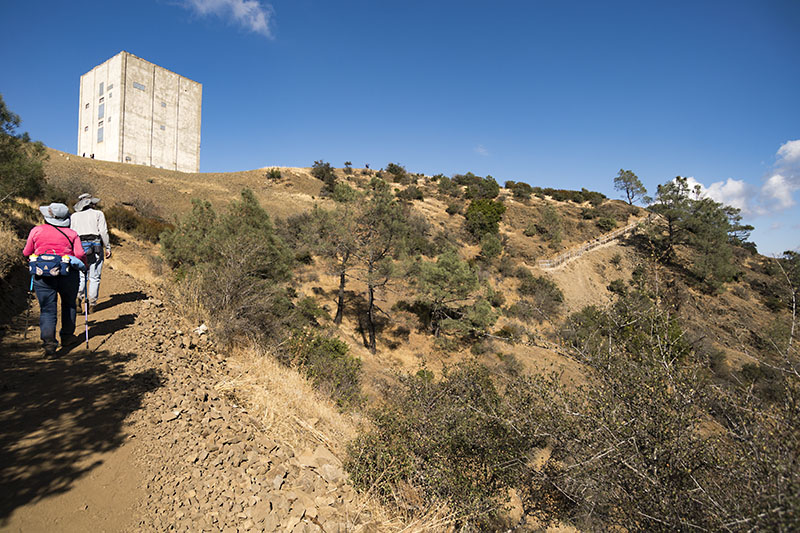
This large tower once had a large rotating radar for use to detect enemy aircraft during the Cold War.
It was part of the Almaden Air Force Station.

Mount Umunhum is the the third tallest peak in the San Francisco Bay Area. It offers views of the Santa Clara Valley and of the Pacific Ocean.

After extensive cleanup and sddressimg neighbor concerns, this peak is now part of the Sierra Azul Open Space Preserve.
It was opened to the public earlier this week.

We hiked the gentle graded 3.5 miles to the top from the Bald Mountain parking lot.


other sizes: small medium original auto
share
Dennis Hoyne26-Sep-2017 02:23
This looks like a pleasant place to hike, that cube seems to add an "other worldly' feel to the image. V
Tom LeRoy24-Sep-2017 12:56
Spectacular place set on the mountain, looks like a plenty steep climb. Wish I could have been stationed here when I was in the Air Force. V
Hank Vander Velde24-Sep-2017 01:29
Sounds like a nice place to hike. A nice well composed image including some of the hikers.
Karen Stuebing23-Sep-2017 21:38
Interesting architecture on the building. I like your angle and the hikers in the frame.
Walter Otto Koenig23-Sep-2017 18:36
Great that this is open to the public. Thanks for including the information.
globalgadabout23-Sep-2017 16:35
a good impression captured here of the walk to the top...3.5 miles of steady climbing though!!...I would still be in the parking lot searching for the escalator..
Yvonne23-Sep-2017 11:10
Quite a healthy stroll to the top... great shot! v