


|
|
|
|
|
|
| Kazuo Lim Khee Boon | profile | all galleries >> My Trekking Rendezvous >> Penang Trekking Trails & Tracks >> [16] Ayer Itam - Rain Gauge 29 - Ayer Itam Trail | tree view | thumbnails | slideshow |
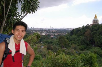
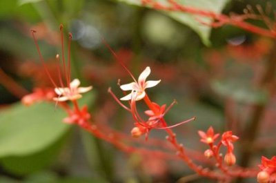
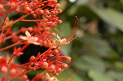
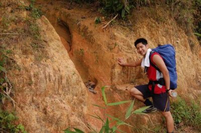
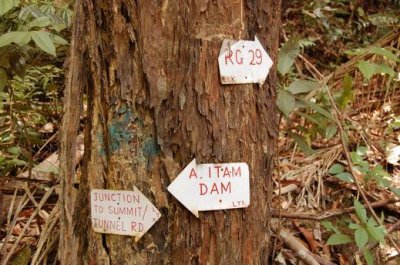
[03] Ayer Itam - Rain Gauge 29 - Ayer Itam Trail
| Elevation | NA |
| Distance | 8.0 km |
| Location | Penang Island |
| Country | Malaysia |
| Starting Point | Ayer Itam |
| Mid Point | Rain Gauge 29 |
| Destination | Ayer Itam |
| Difficulty | Moderate to Tough |
| Load | 16kg |
| Latest Attempt | 12th July 2008 |
| SHAUN's Blogspot | @ URL: http://mymountainadventures.blogspot.com/2008/07/air-itam-rain-gauge-29-air-itam.html |
 |
Looking for any suitable photos for yourself, business, book publication or etc? Click HERE [Boon's Gallery] to purchase now |
 |
Visit Shaun's blog about his mountain adventures here |
 |
Visit Shaun's blog about his running escapades here |
 DSC_0285.JPG |
 DSC_0283.JPG |
 DSC_0281.JPG |
 DSC_0280.JPG |
 DSC_0277.JPG |
 DSC_0276.JPG |
 DSC_0275.JPG |
 DSC_0272.JPG |
 DSC_0271.JPG |
 DSC_0262.JPG |
 DSC_0261.JPG |
 DSC_0260.JPG |
 DSC_0259.JPG |
 DSC_0258.JPG |
 DSC_0242.JPG |
 DSC_0241.JPG |
 DSC_0238.JPG |
 DSC_0211.JPG |
 DSC_0210.JPG |
 DSC_0206.JPG |
 DSC_0205.JPG |
 DSC_0203.JPG |
 DSC_0201.JPG |
 DSC_0196.JPG |
 DSC_0195.JPG |
 DSC_0194.JPG |
 DSC_0193.JPG |
 DSC_0192.JPG |
 DSC_0190.JPG |
 DSC_0189.JPG |
 DSC_0186.JPG |
 DSC_0183.JPG |
 DSC_0181.JPG |
 DSC_0179.JPG |
 DSC_0176.JPG |
 DSC_0174.JPG |
 DSC_0172.JPG |
 DSC_0167.JPG |
 DSC_0164.JPG |
 DSC_0163.JPG |
 DSC_0158.JPG |
 DSC_0152.JPG |
 DSC_0149.JPG |
 DSC_0145.JPG |
 DSC_0146.JPG |
 DSC_0151.JPG |
 DSC_0155.JPG |
 DSC_0160.JPG |
 DSC_0161.JPG |
 DSC_0162.JPG |
 DSC_0165.JPG |
 DSC_0166.JPG |
 DSC_0170.JPG |
 DSC_0173.JPG |
 DSC_0177.JPG |
 DSC_0178.JPG |
 DSC_0180.JPG |
 DSC_0182.JPG |
 DSC_0185.JPG |
 DSC_0191.JPG |
 DSC_0200.JPG |
 DSC_0202.JPG |
 DSC_0204.JPG |
 DSC_0207.JPG |
 DSC_0208.JPG |
 DSC_0245.JPG |
 DSC_0246.JPG |
 DSC_0247.JPG |
 DSC_0248.JPG |
 DSC_0249.JPG |
 DSC_0250.JPG |
 DSC_0251.JPG |
 DSC_0252.JPG |
 DSC_0253.JPG |
 DSC_0254.JPG |
 DSC_0255.JPG |
 DSC_0256.JPG |
 DSC_0257.JPG |
 DSC_0269.JPG |
 DSC_0270.JPG |
 DSC_0273.JPG |
 DSC_0274.JPG |
 DSC_0278.JPG |
 DSC_0282.JPG |
| comment | share |
| wong pk | 17-Jul-2008 06:15 | |
| Kazuo Lim Khee Boon | 12-Jul-2008 08:20 | |