


|
|
|
|
|
|
| Kazuo Lim Khee Boon | profile | all galleries >> My Travel Album >> Indonesia >> Bali >> Karangasem | tree view | thumbnails | slideshow |
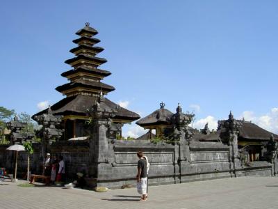
Karangasem
Karangasem is a regency (kabupaten) located at eastern part of Bali, Indonesia. Karangasem was devastated when Mount Agung erupted in 1963, ultimately killing 1900 people. Karangasem formerly was a kingdom before Bali was conquered by the Dutch. The regency dominated by the mighty Gunung Agung. The east has many places of interest and some great beaches. Bali's highest mountain is Gunung Agung (3,142 meters), towering majestically over eastern and northern Karangasem. The most disastrous volcanic eruption took place on 17th March 1963 when Agung laterally blew its top. Streams of lava and hot volcanic mud poured down to the sea in the southeast of the island, covering roads and isolating the eastern end of the island. The whole island was covered in ash and crops were wiped out. It obliterated many villages and temples, and killed thousands of people. Most of those killed were either burned to death or suffocated by the searing clouds of hot gas rushing down the volcanic slopes. It wiped out the entire villages of Sorga and Lebih high on the slopes of Agung. Surprisingly, Besakih, just six kilometers from the crater, suffered little damage.
Gunung Agung |
| comment | share |