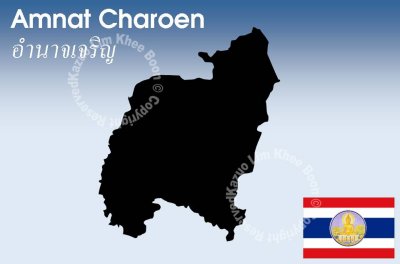
Amnat Charoen is one of the north-eastern provinces of Thailand. Neighboring provinces are (clockwise from the south) Ubon Ratchathani, Yasothon and Mukdahan. To the east it borders Salavan of Laos.
The province is located in the Mekong valley. A long footpath along some of the river allows people to enjoy the view. In dry season, from February to May, water in Mekong River descends, and allows islands to appear. Such famous islands include Kaeng Tanglang at Si Sombun Village, close to Amphoe Chanuman, and Kaeng Hin Khan at Ban Hin Khan, 30 kilometres south of Amphoe Chanuman. The other two rivers in the province are the Lam Sae Bok and Lam Sae Bai. Phu Sa Dok Bua National Park is partially located in Amnat Charoen Province.