


|
|
|
|
|
|
| Brian McMorrow | profile | all galleries >> Subsaharan Africa >> Zambia >> Zambia Flying Safari 2010 >> FLKF-FLLI | tree view | thumbnails | slideshow |
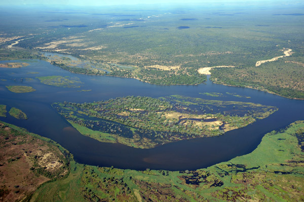
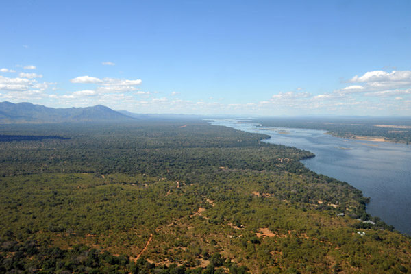 Looking east along the Zambian side of the Lower Zambezi |
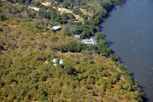 Baines River Camp, Lower Zambezi |
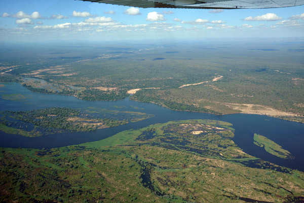
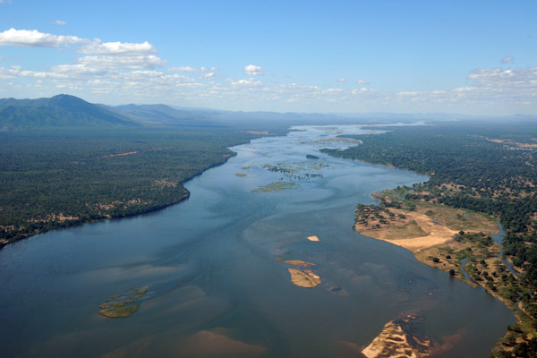 Zambezi River - Zambia on the left, Mana Pools National Park in Zimbabwe on the right |
 Mana Pools National Park, Zimbabwe |
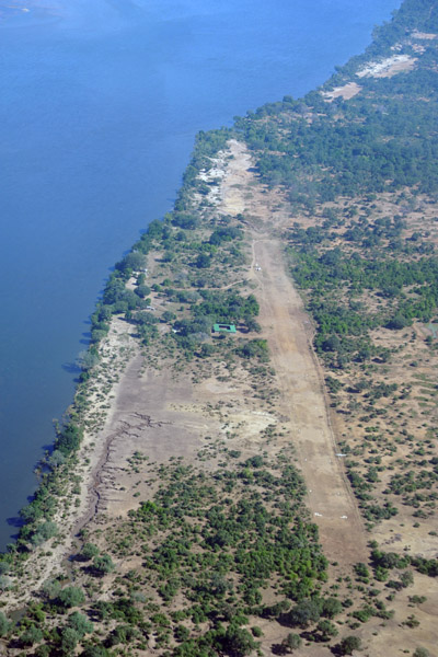
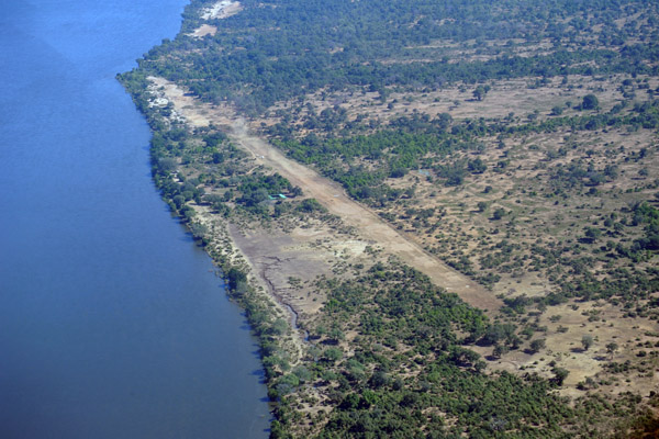 Kayila Airstrip, Zambia (FLKF) |
 V5-JOG liftoff from Kayila |
 Looking across the Zambezi River to an airstrip in Zimbabwe |
 Airstrip in the Hurungwe Safari Area, Zimbabwe (S15 50.1/E029 10.5) |
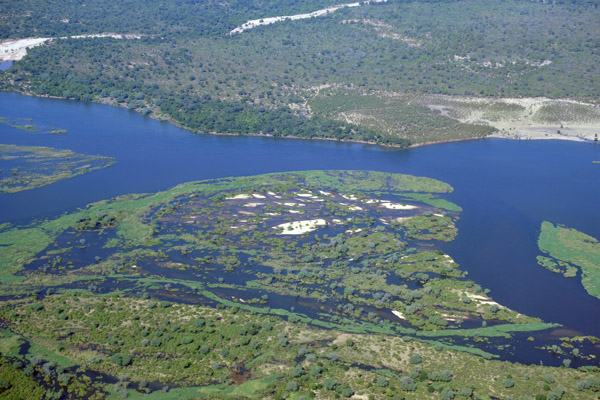
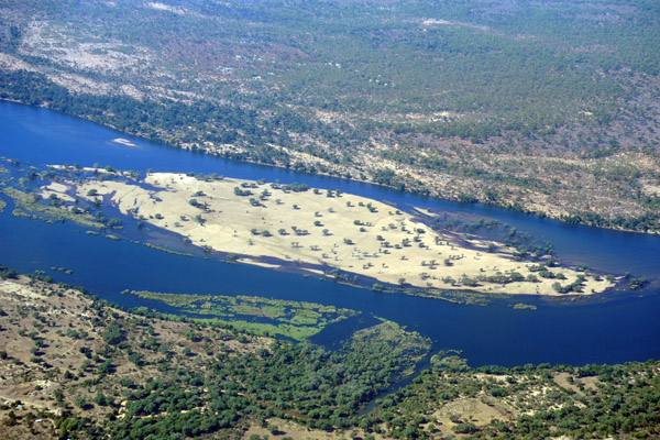
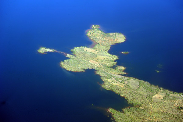
 Island in the Lower Zambezi River |
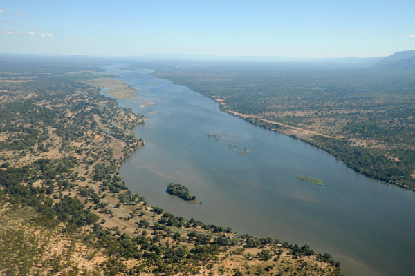
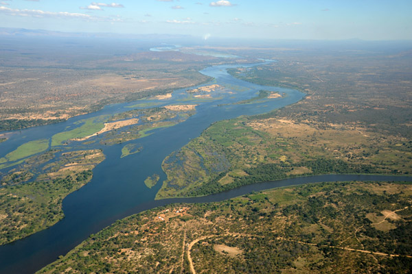
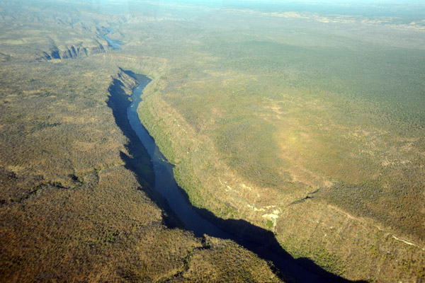
 Lower Zambezi River - Zambia & Zimbabwe |
 The high water level of the Zambezi (May 2010) has flooded areas normally dry |
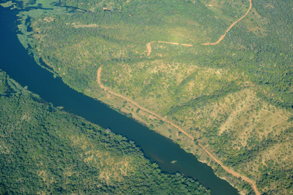
 Zambezi River just east of Chiawa |
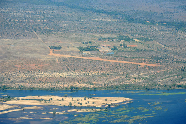
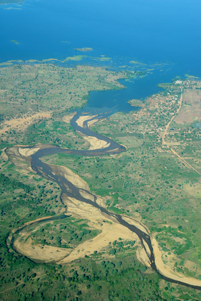
 Agriculture on the Zambian side of the Zambezi River along the RD491 between Chiawa and Chirundu |
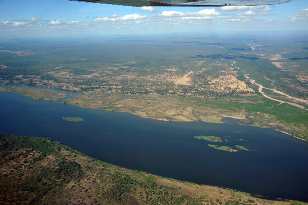
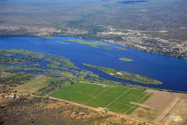
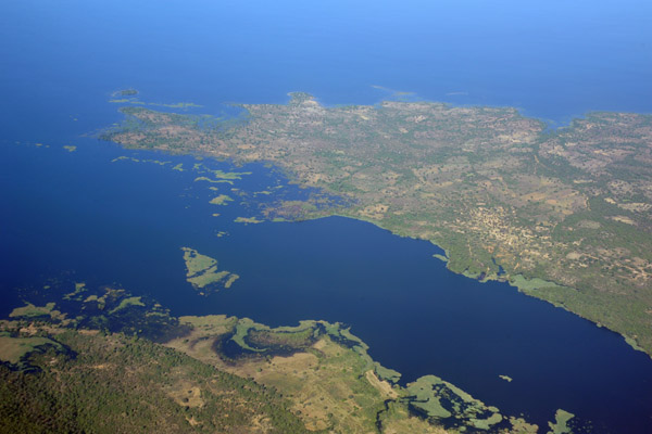
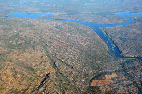
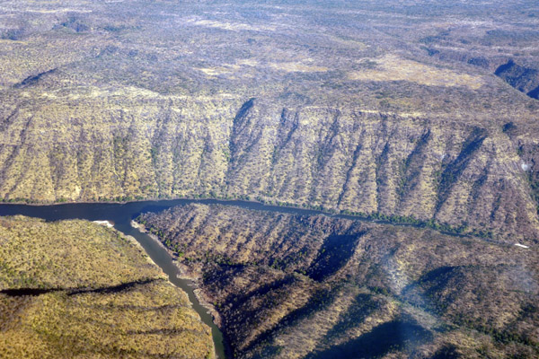
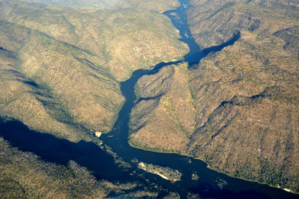
 Kafue River joining the mighty Zambezi from the right |
 Confluence of the Kafue River and Zambezi River |
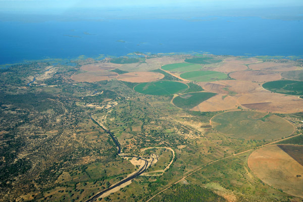
 Zambian fields irrigated with river water near the confluence of the Kafue and Zambezi Rivers |
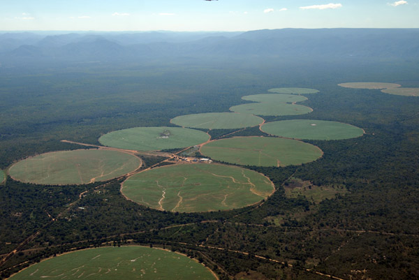 Zambian fields irrigated with river water near the confluence of the Kafue and Zambezi Rivers |
 Zimbabwean Airstrip east of the bridge at Chirundu |
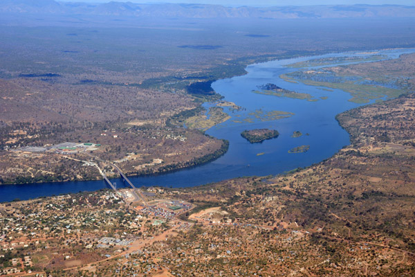
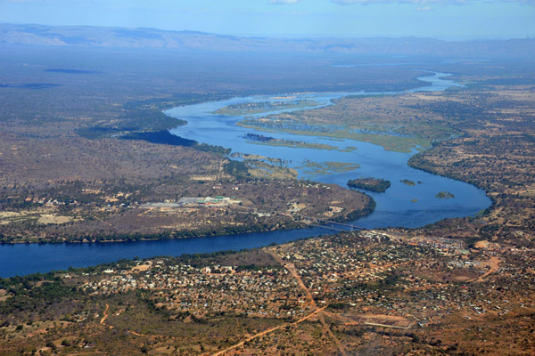 Zambezi River at Chirundu, Zambia |
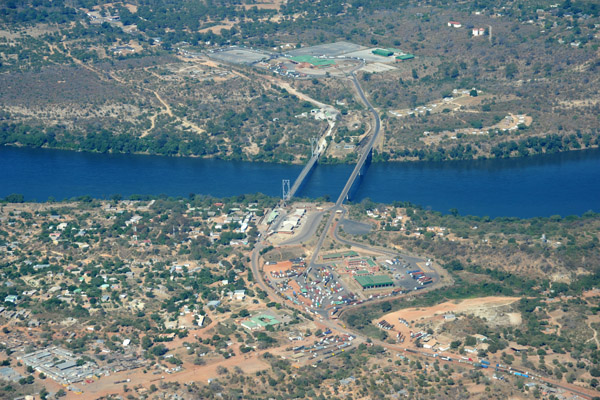
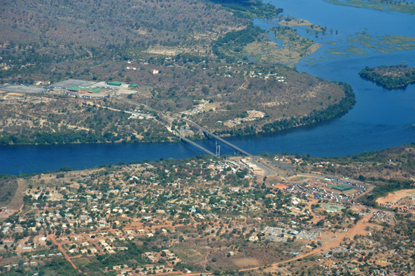 Twin international bridges connecting Chirundu, Zambia with Zimbabwe across the Zambezi River |
 Zambezi River at Chirundu, Zambia |
 Twin international bridges connecting Chirundu, Zambia with Zimbabwe across the Zambezi River |
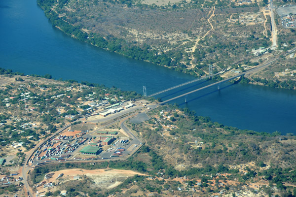 Zambian customs & immigration post at Chirundu on the Zambezi River |
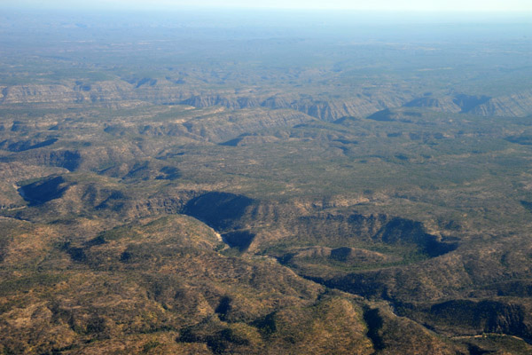
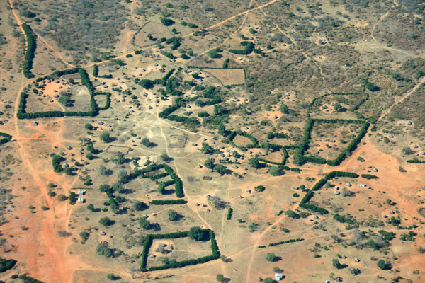 Traditional villages in Zambia surrounded by tall hedges |
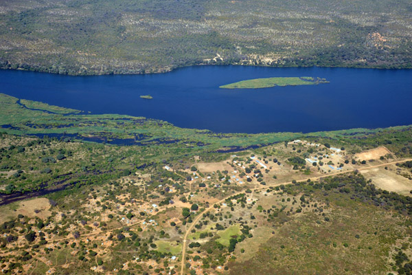
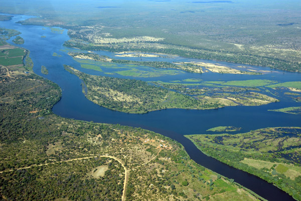
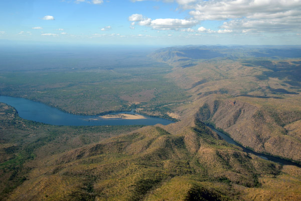
 Large island in the Zambezi River upstream from Chirundu (S16 18.7/E028 49.6) |
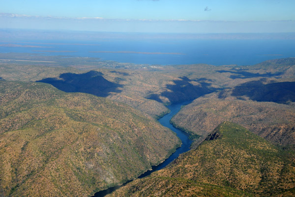
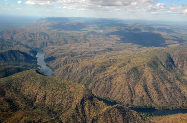
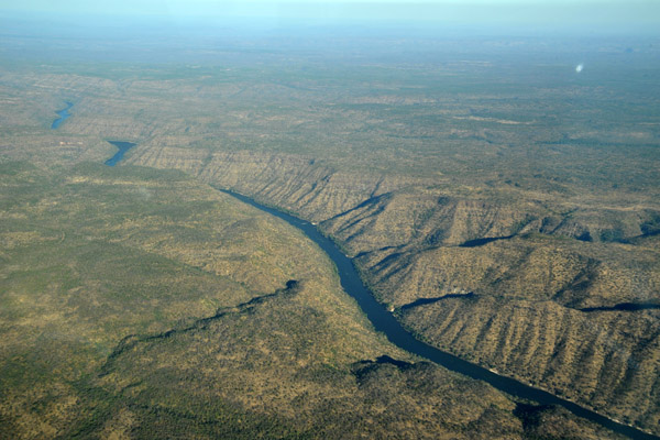
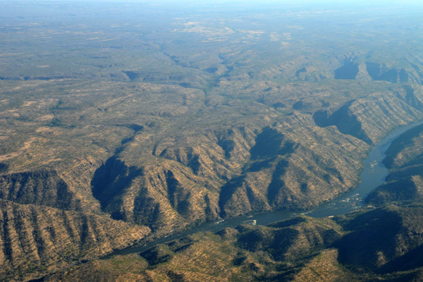
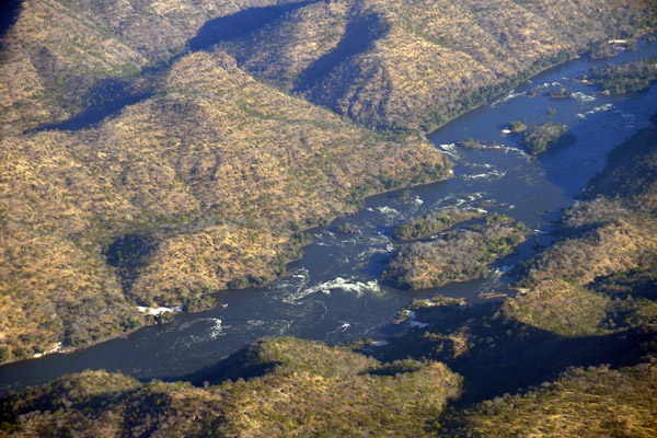
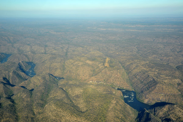
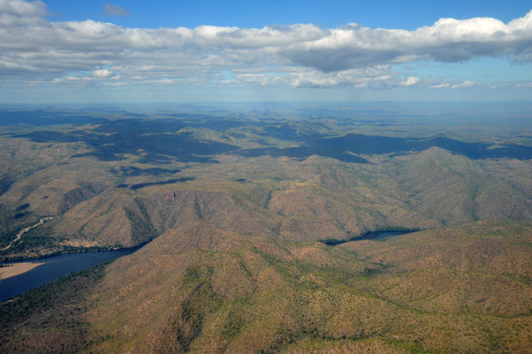 Zambezi River emerging from Kariba Gorge |
 Zambezi River emerging from Kariba Gorge |
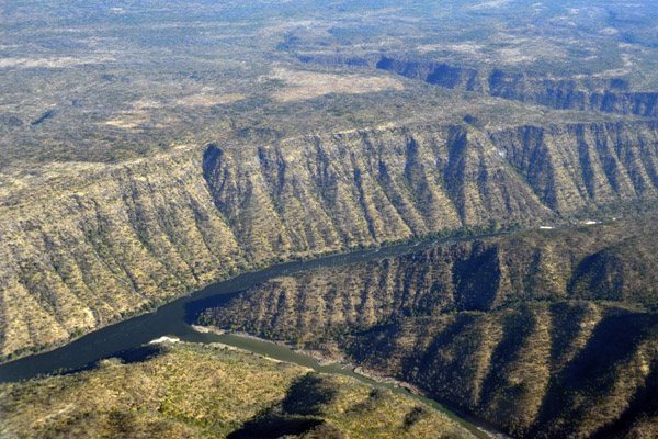
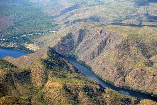 Kariba Gorge, Zambia-Zimbabwe |
 Zambezi River - Kariba Gorge |
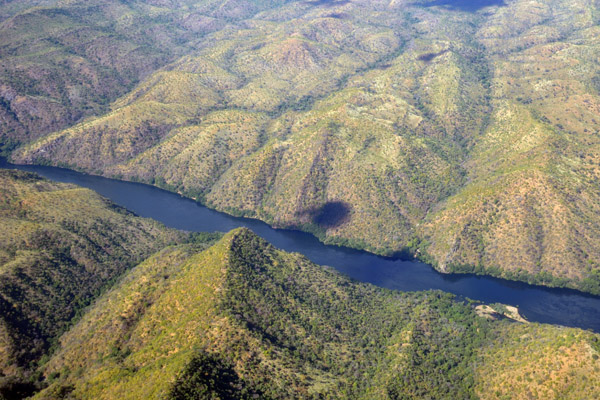 Zambezi River - Kariba Gorge |
 Zambezi River - Kariba Gorge |
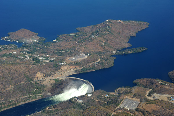
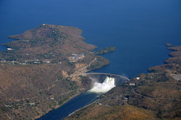 The Kariba Dam, Zambia-Zimbabwe |
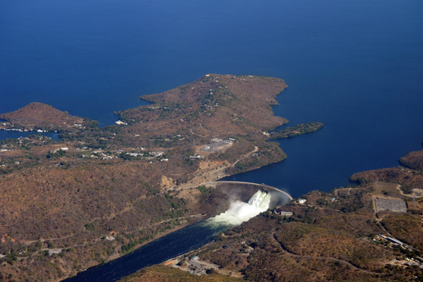 The Kariba Dam, one of the largest in the world - 420 ft tall and 1900 ft long |
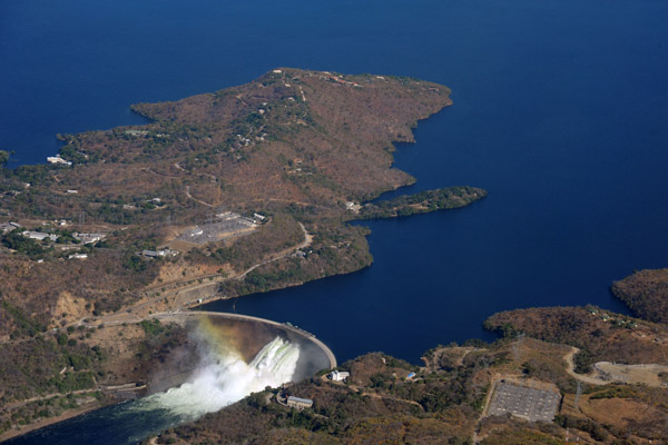 The Kariba Dam, built 1955-1959, holds back the 2100 square mile Lake Kariba |
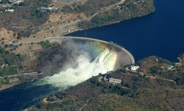 Rainbow in the mist of the Kariba Dam torrent |
 There is an incredible amount of water flowing through the Kariba Dam |
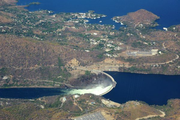 The hydroelectric plant at the Kariba Dam 1266 MW of electricity to Zambia and Zimbabwe |
 Siavonga, Zambia, on the north shore of Lake Kariba |
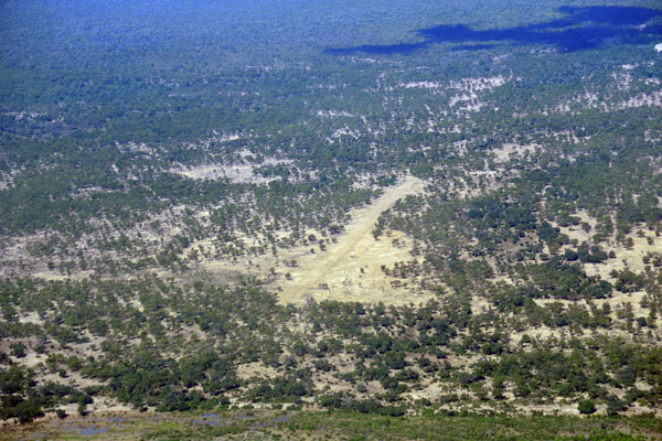
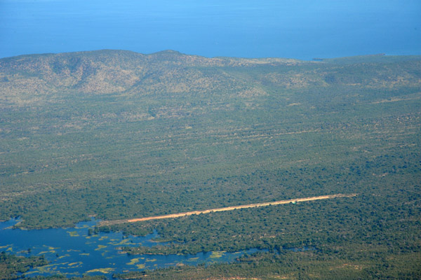
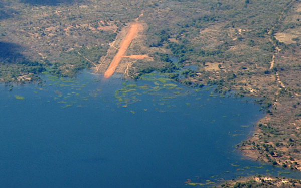 Zambian airstrip on the eastern end of Lake Kariba |
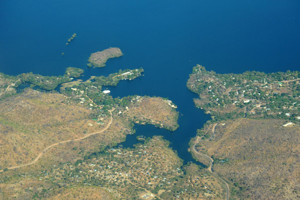
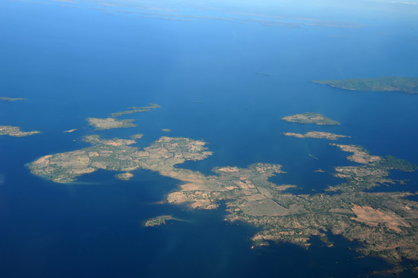
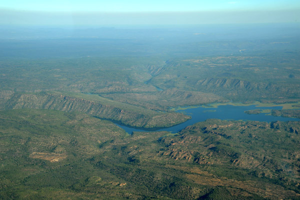
 Zambian side of Lake Kariba |
 Zambian side of Lake Kariba |
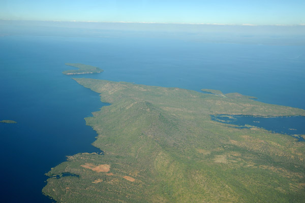
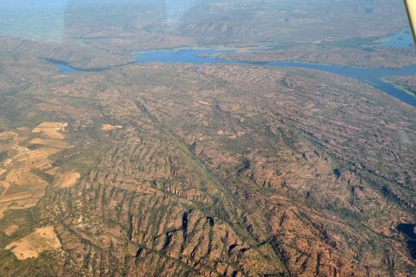
 Lake Kariba extends 174 mile upstream of the dam |
 Lake Kariba, Zambia |
 Zambian airstrip on Lake Kariba (S16 47.3/E028 00.5) |
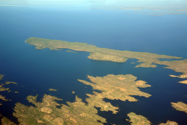
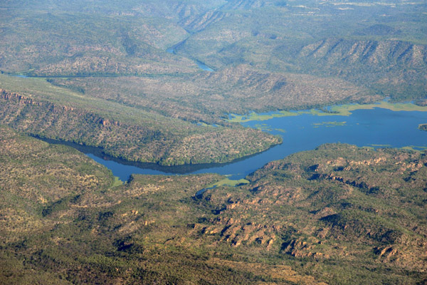
 Sikolwenzala Hills, Lake Kariba, Zambia |
 Lake Kariba, Zambia |
 A small river entering Lake Kariba with a road (S16 58.0/E027 38.9) |
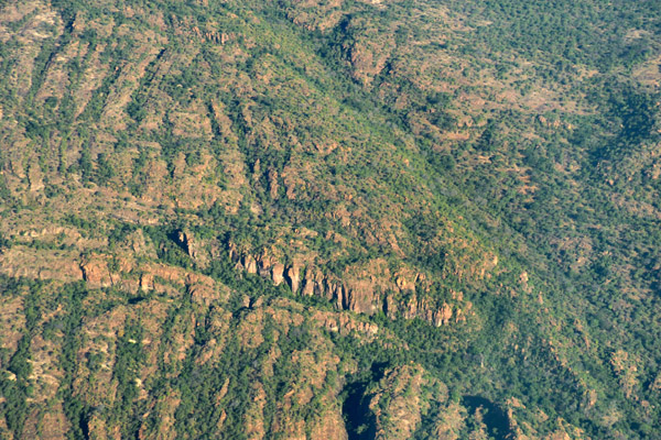
 North shore of Lake Kariba |
 River and village on Lake Kariba (S17 07/E027 32) |
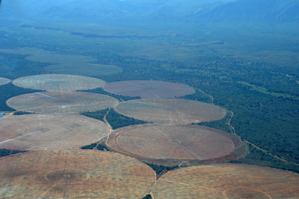
 Irrigated fields at Sinazongwe on the Zambia side of Lake Kariba |
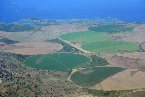 Irrigated fields at Sinazongwe on the Zambia side of Lake Kariba |
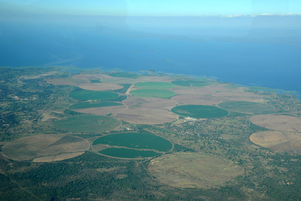 Irrigated fields at Sinazongwe on the Zambia side of Lake Kariba |
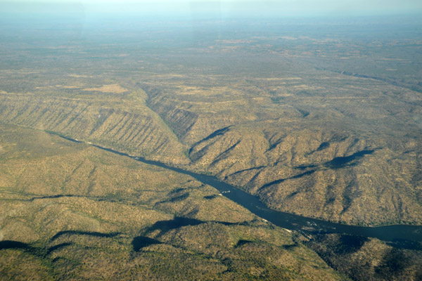
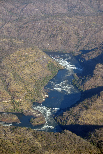
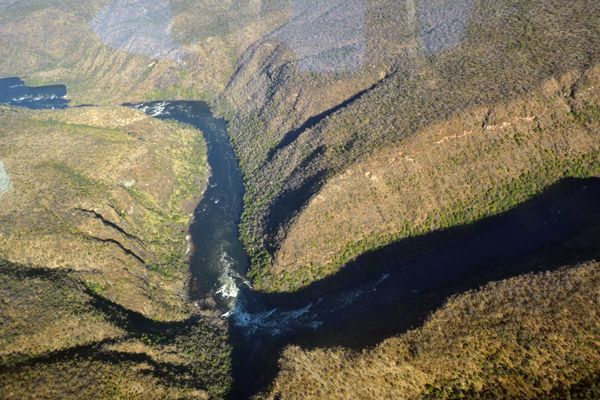
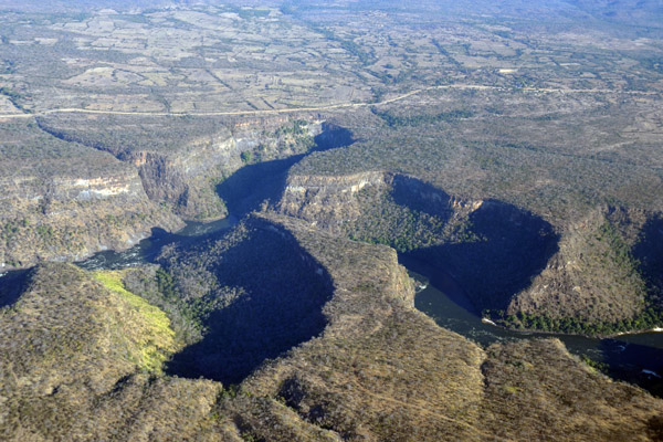
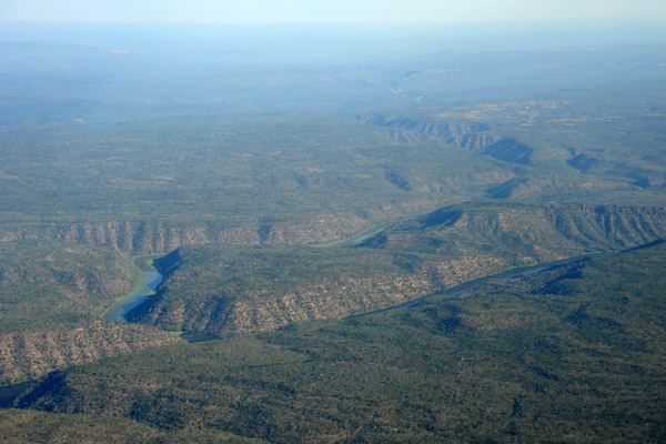 Lukos River from Zimbabwe joining the Zambezi in the canyonlands between Victoria Falls and Lake Kariba (S17 59/E26 55) |
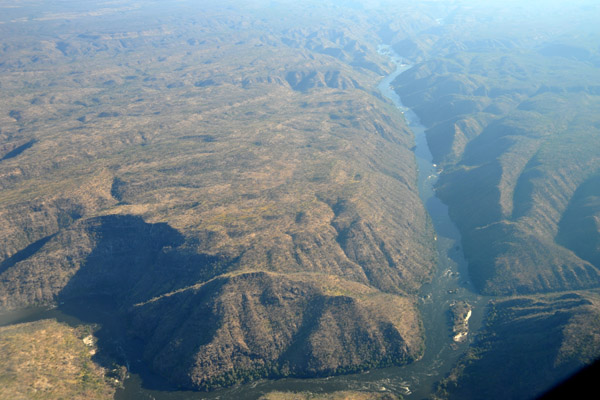
 Zambezi River Gorge - S17 59.6/E026 52.0 |
 Zambezi River Gorge upstream from the Lukos Confluence |
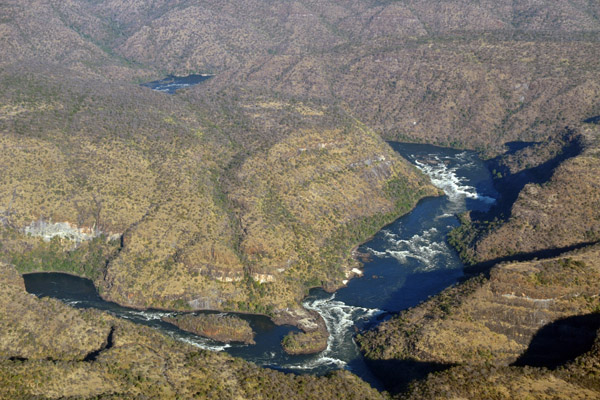
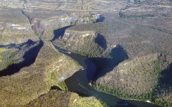
 Reddish cliffs on the Zambian side of the the Zambezi Gorge (S 17 57.2/E026 50.8) |
 Zambian side of the the Zambezi Gorge upstream from the Lukos River confluence(S 17 57.2/E026 50.8) |
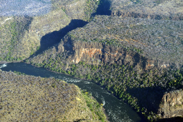
 River flowing into the Zambezi from the Zambian side (S17 58.2/E026 49.4) |
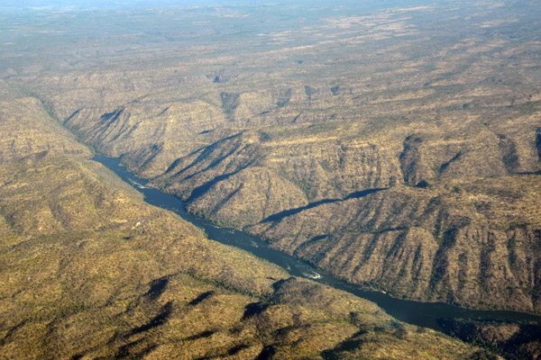
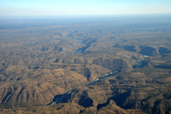
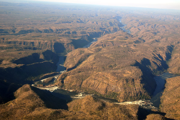
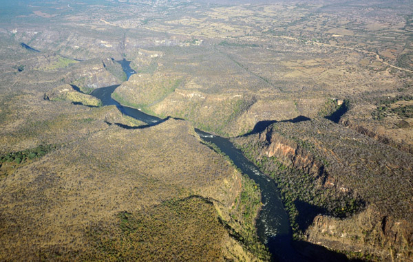
 Canyonlands downstream of Victoria Falls, Zambia |
 Zambezi Gorge, Zambia-Zimbabwe |
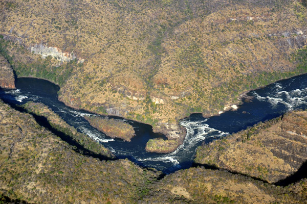
 Small river joining the Zambezi from the Zambia side (S17 56.1/E026 23.6) |
 Small river joining the Zambezi from the Zambia side (S17 56.1/E026 23.6) |
 Zambezi River Gorge (S17 56.4/E026 22.2) |
 Zambezi River looking across to Zimbabwe from Zambia |
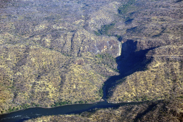 Dry waterfall on the Zimbabwe side - must be impressive when flowing (N17 56.4/E026 20.1) |
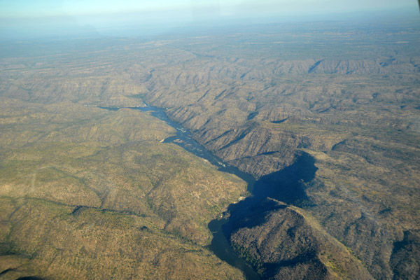
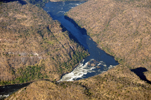
 Straight section of the Zambezi River Gorge |
 Middle Zambezi - (S17 55.0/E026 14.8) |
 Middle Zambezi - (S17 53/E026 13) |
 Zambezi River Gorge (S17 54/E026 14) |
 Zambezi River Gorge (S17 53.4/E026 13.4) |
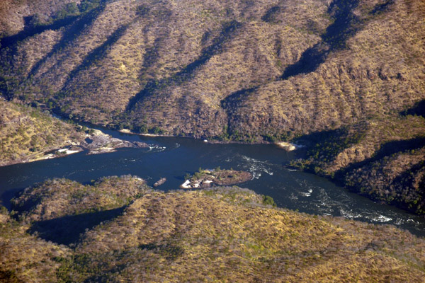
 Islands and rapids in the Zambezi River (S17 54.6/E026 09.6) |
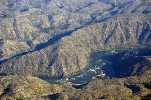 Zambezi River rapids with what is an island in low water season (S17 55.0/E026 08.3) |
 Clifftop airstrip on the Zimbabwe side (S17 55.9/E026 07.0) |
 Clifftop airstrip on the Zimbabwe side (S17 55.9/E026 07.0) |
 Zambezi River rapids beyond the Day 1 takeout |
 Zambezi River Rapids 24.5km (direct) from the Victoria Falls Bridge |
 Zambezi River Rapids - S17 56.1/E26 05.2 |
 We had booked rafting for the end of May, but the rafting companies said the river was still too high at this time |
 Could this be The Narrows (S17 56.8/E026 05.9) |
 Zambei River Rapids looking across at Zimbabwe |
 Rapids on the Zambezi River (S17 58.3/E026 02.6) |
 Calm straight section of the Zambezi River Gorge |
 Zambezi River at Whitewater Rafting Takeout 2 and the Rapid 27 Falls |
 Zambezi River at Whitewater Rafting Takeout 2 (S17 59.7/E025 57.5) |
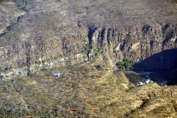
 Gorges Lodge on the Zimbabwean cliffs high above the Zambezi River |
 Zambezi River passing the Gorges Lodge, Zimbabwe |
 Overland Missions Operational Base at Rapid 14 |
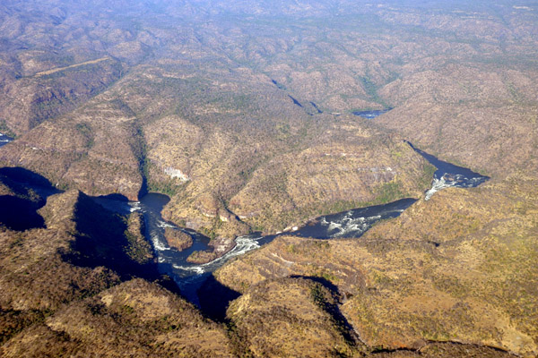
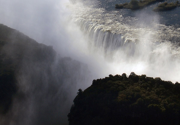
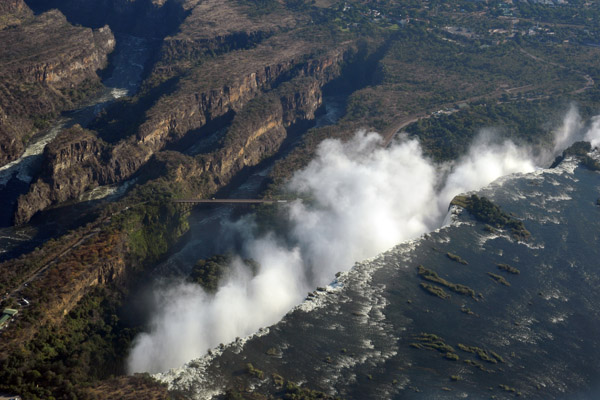
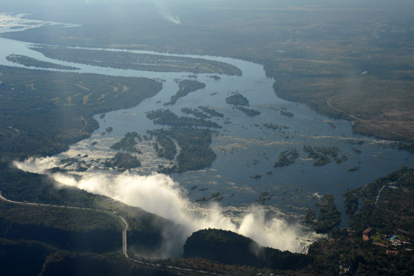 Victoria Falls in the afternoon from the Zambian side |
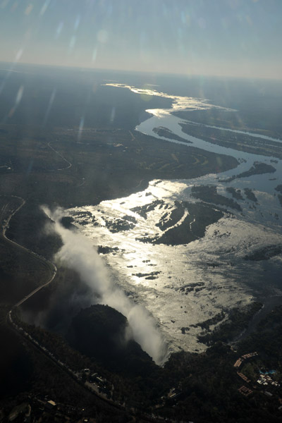
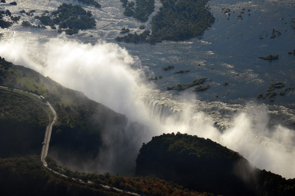 Victoria Falls |
 Victoria Falls |
 Victoria Falls |
 Victoria Falls - afternoon |
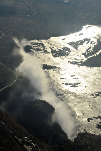 Victoria Falls - afternoon |
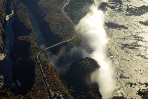 Victoria Falls |
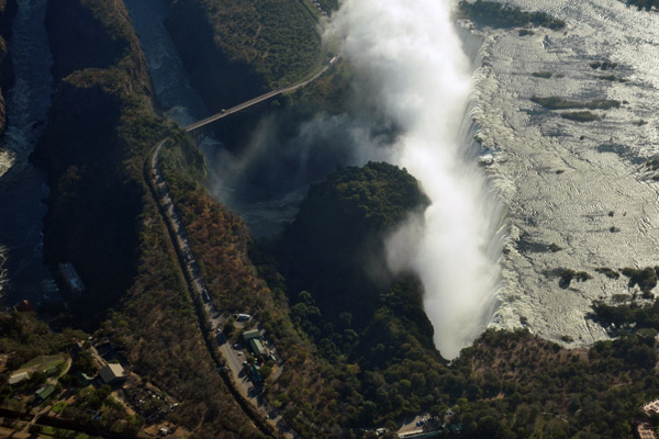 Victoria Falls |
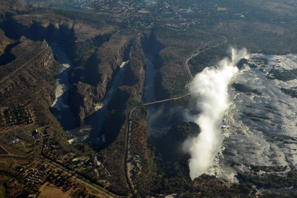 Victoria Falls |
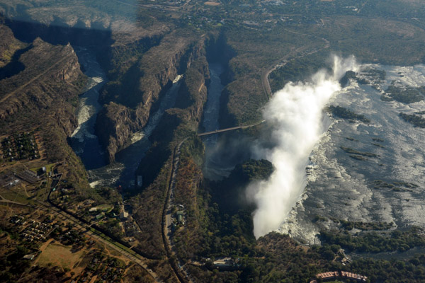 Victoria Falls |
 Victoria Falls |
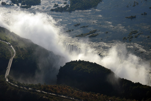
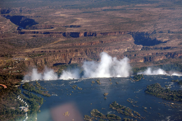 Victoria Falls with the Batoka Gorge |
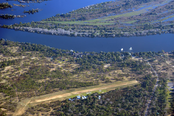 Microlight airstrip near the Zambezi Waterfront Lodge, Livingstone |
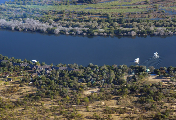 Zambezi Waterfront Lodge, Livingstone |
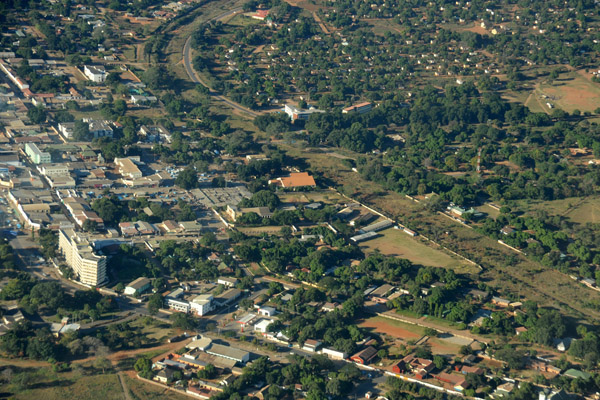 Downtown Livingstone, Zambia |
 Downtown Livingstone, Zambia |
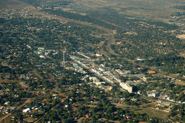
 Livingstone, Zambia |
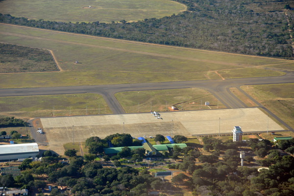 Livingstone Airport |
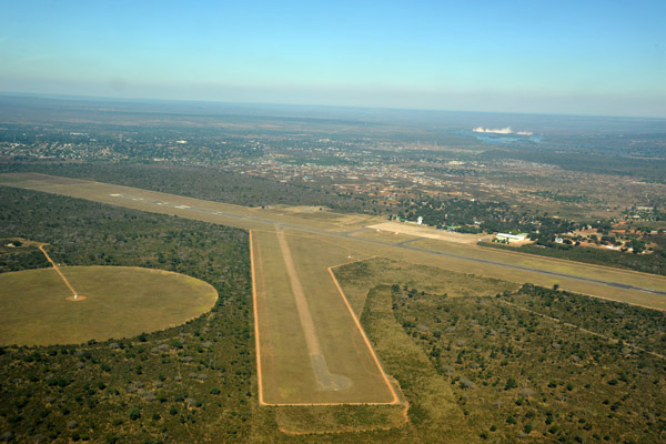
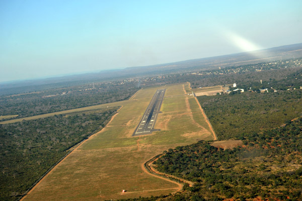 Turning final for Runway 10 at FLLI |
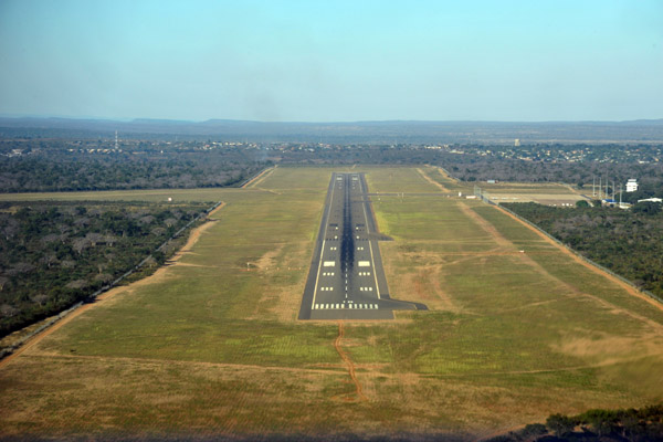 Short final Runway 10 at Livingstone Airport (FLLI) |
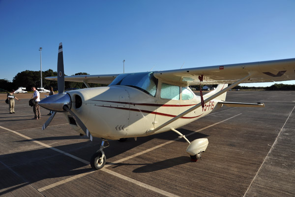 V5-FIS back at Livingstone |
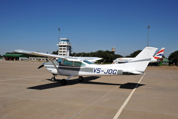 V5-JOG at Livingstone |
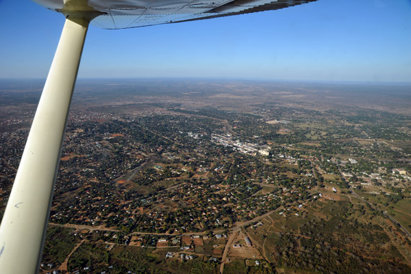
 Livingstone Airport from the north with Victoria Falls in the background |
| comment | share |