


|
|
|
|
|
|
| Brian McMorrow | profile | all galleries >> Asia >> Tajikistan >> Pamir Valley | tree view | thumbnails | slideshow |
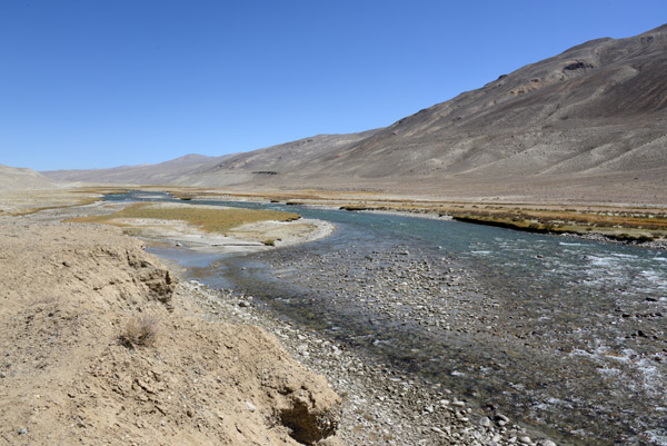 Here, the Pamir River looks shallow enough to be able to walk across to Afghanistan |
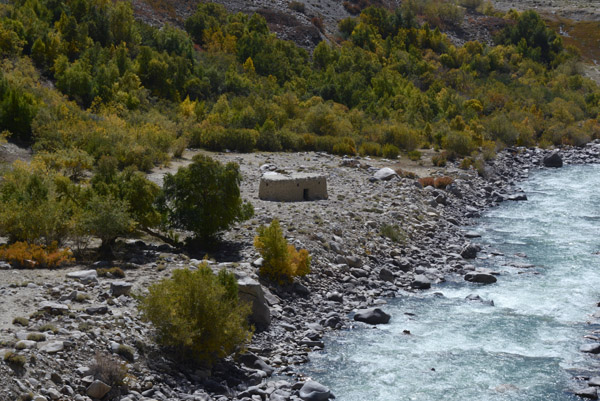
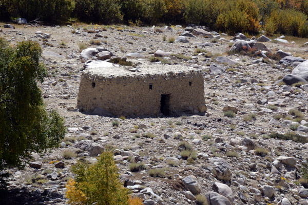
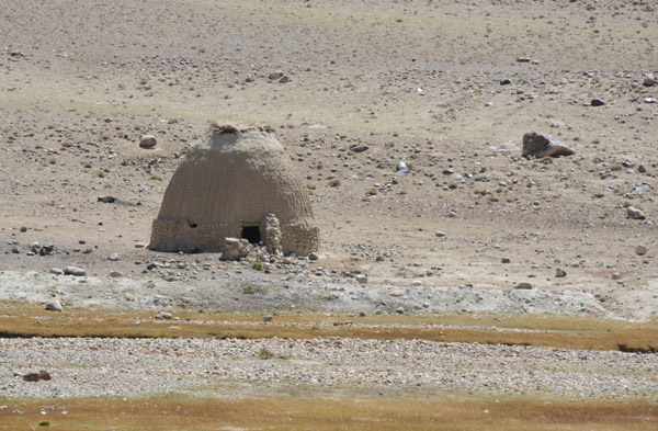 An interesting beehive shaped hut, Pamir Valley, Aghanistan |
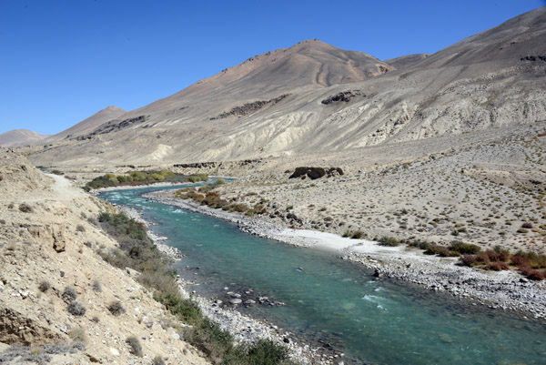
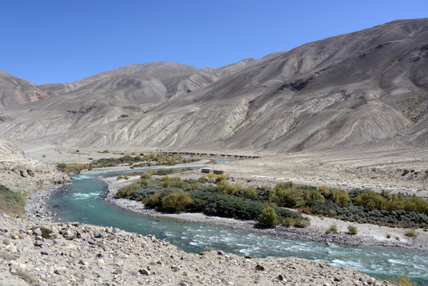
 The Pamir River separating the Wakhan Corridor of Afghanistan from Tajikistan |
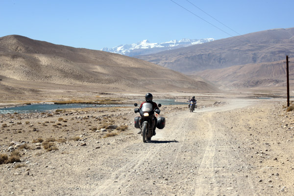 Motorcycle Tourists, Pamir Valley, Tajikistan |
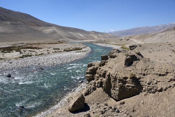
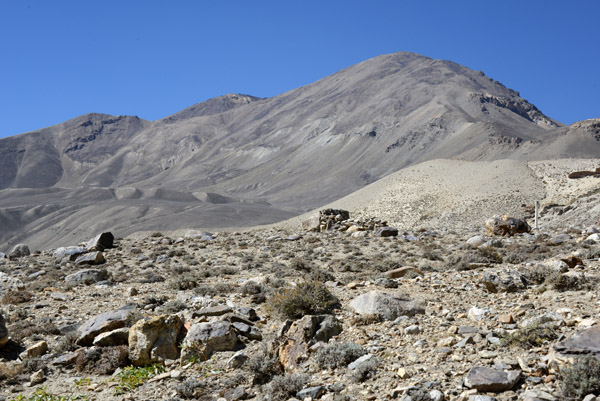
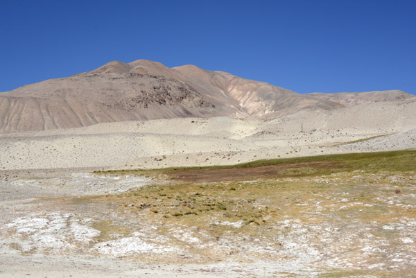 Tajikistan side of the Pamir Valley |
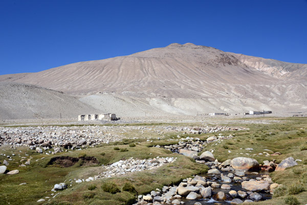 Abandoned buildings, Pamir Valley, Tajikistan |
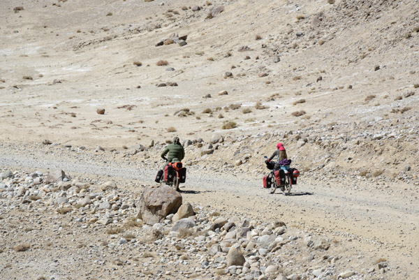 World Cycling, what a difficult route |
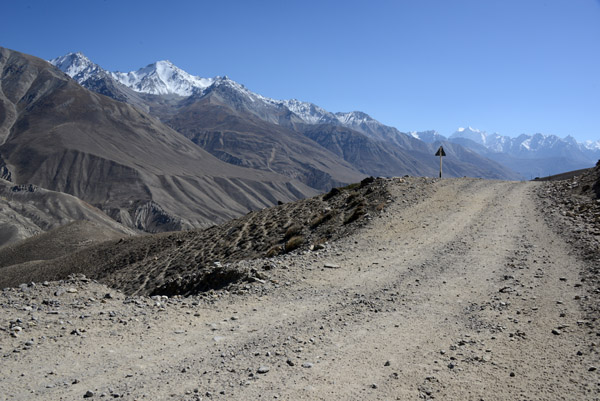
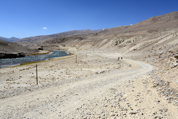 The dirt road along the Tajik side of the Pamir River |
 The Wakhan Corridor of Afghanistan is part of the larger Badakhshan Province |
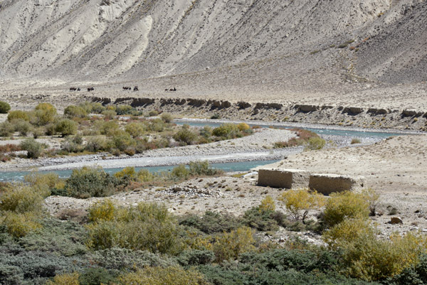
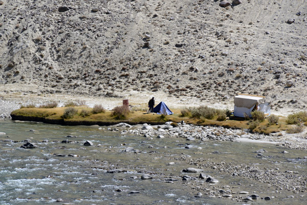 A man camping on the Afghanistan side of the Pamir River near the confluence of the Ali-suu |
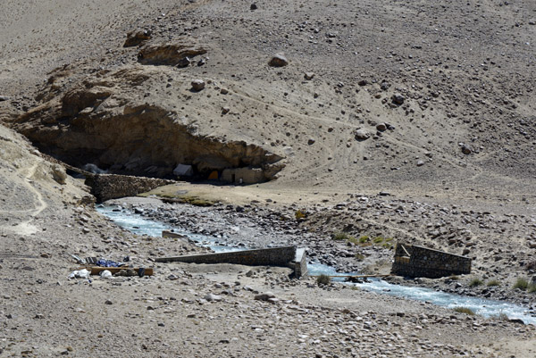 A bridge in Afghanistan, destroyed or perhaps never completed |
 The smaller bridge in the background is visible in 2008 Google Earth imagery with no sign of the second bridge |
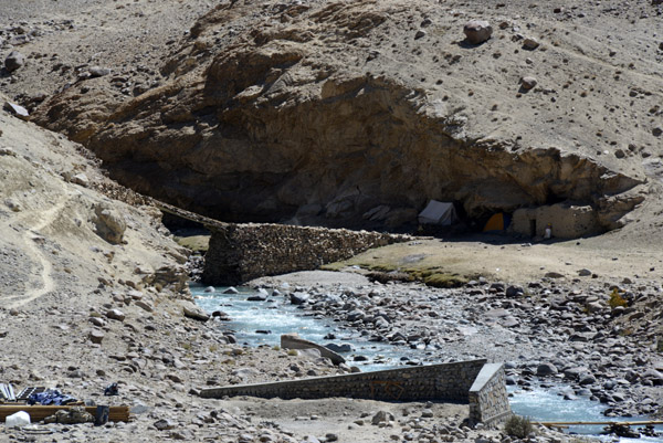
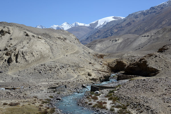 Another view of the two bridges looking up the valley into Afghanistan |
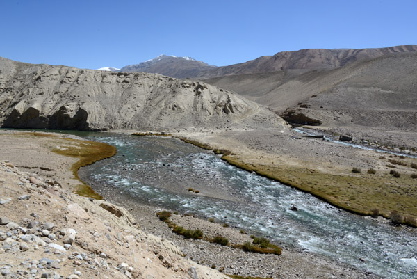
 Confluence of the 'Ali-Suu River with the Pamir River, Wakhan Corridor, Afghanistan |
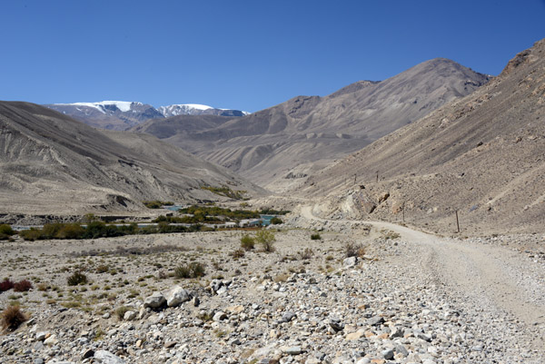
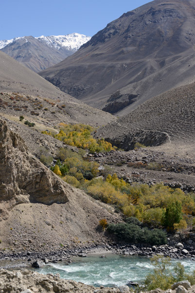
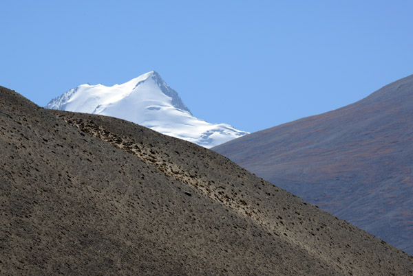 A snow capped peak in the center of the Wakhan Corridor, perhaps 18,000 feet tall |
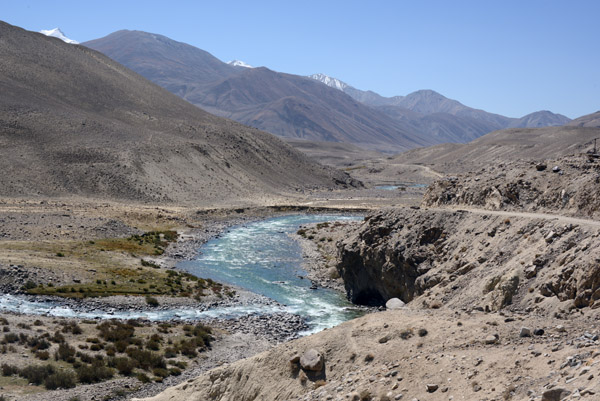
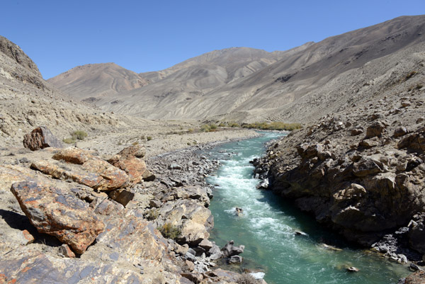
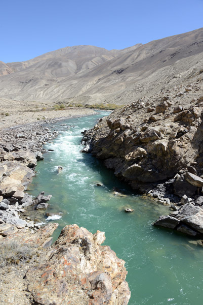
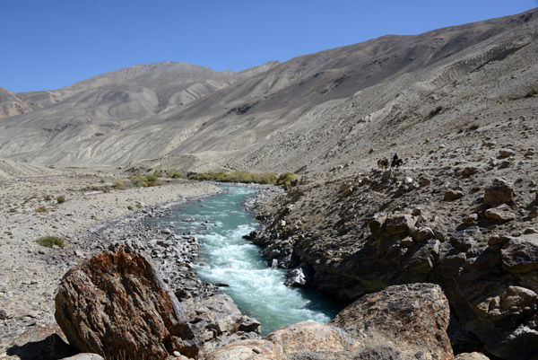
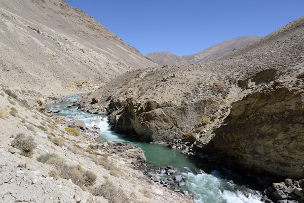
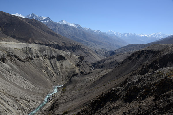
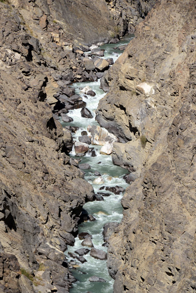
 The Pamir River as it enters a canyon |
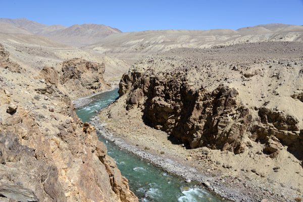 A canyon on the Pamir River which separates Tajikistan and the former USSR from the Wakhan Corridor of Afghanistan |
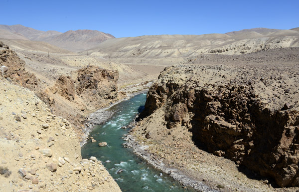 A canyon on the Pamir River which separates Tajikistan and the former USSR from the Wakhan Corridor of Afghanistan |
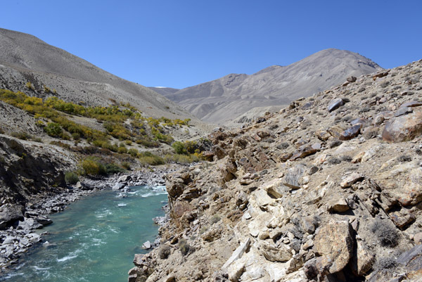
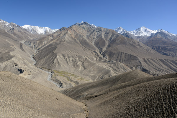
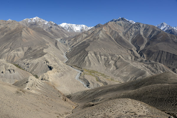
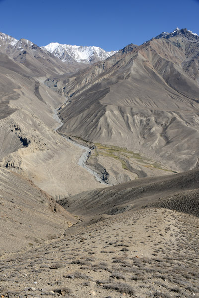
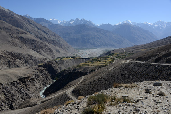
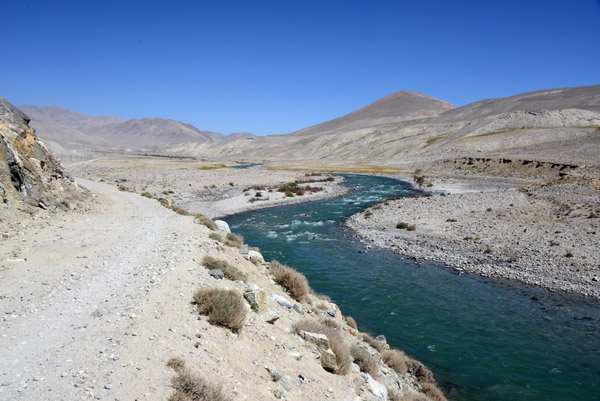 The Pamir Valley widens once again as the road returns to river level |
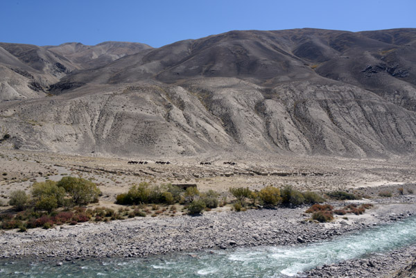
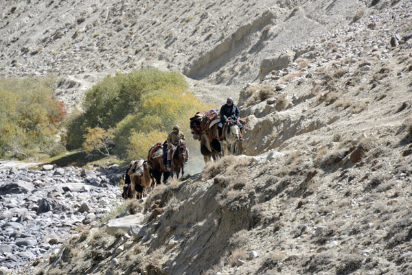
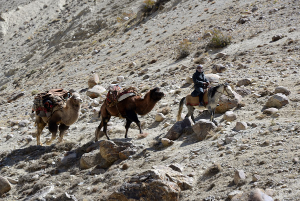
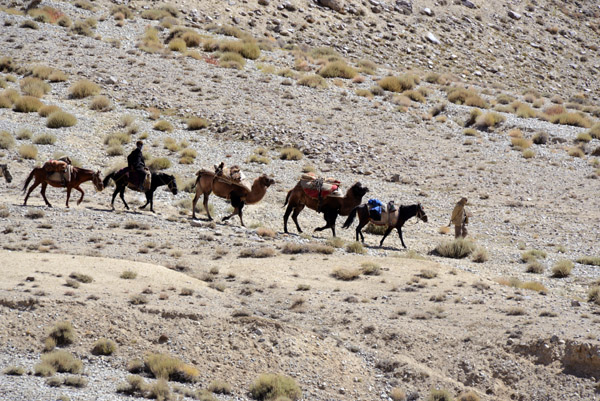 A sight as old, or older, than the Silk Road - a small caravan of camels on the Afghanistan side of the Pamir River |
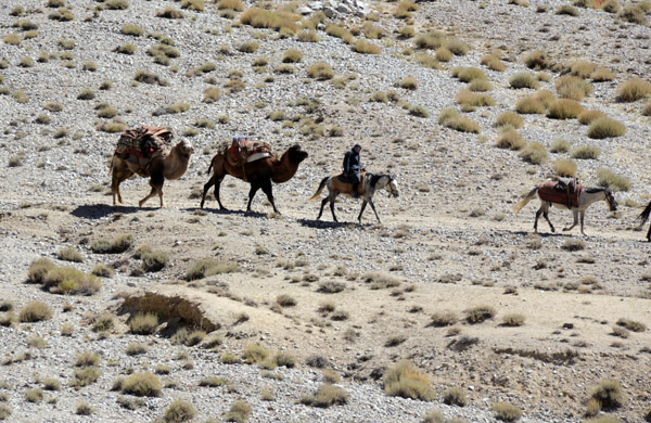 A man leading two bactrian camels, Pamir Valley, Afghanistan |
 Another man in the caravan leads a string of 3 camels |
 Camel caravan in the roadless Pamir Valley of Afghanistan's Wakhan Corridor |
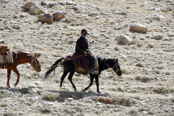
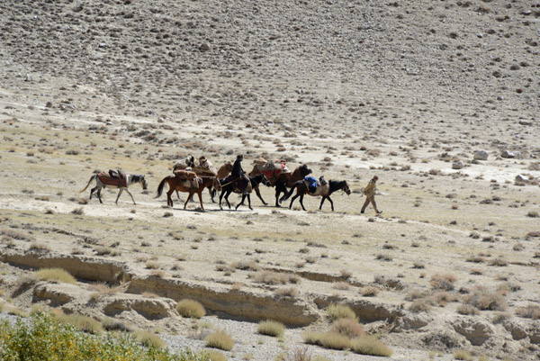 A man walks ahead, leading his horse as the rest follow |
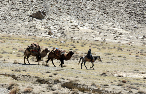 These are the Central Asian 2-humped camels as opposed to the more common one humped camels of the Middle East |
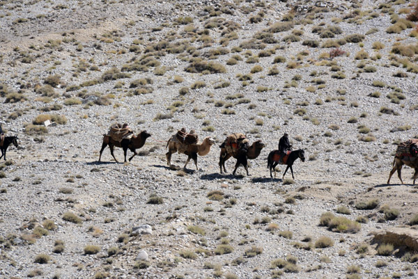
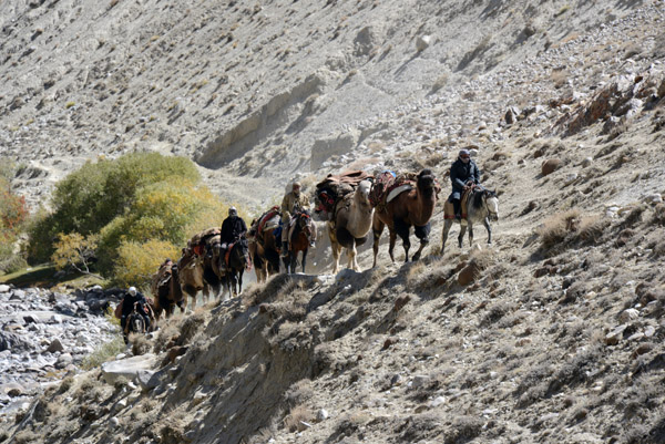
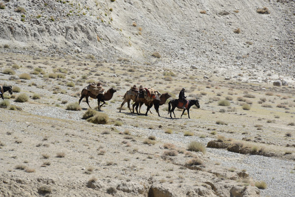 Camel caravan, Pamir Valley, Afghanistan |
 Camel caravan, Pamir Valley, Afghanistan |
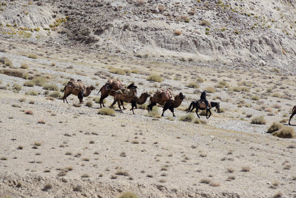
 The caravan rides along the base of the mountains a bit back from the Pamir River which forms the border |
 Pamir River dividing Tajikistan and Afghanistan |
 Camel caravan, Pamir Valley, Afghanistan |
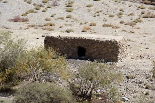 A stone hut, Pamir Valley, Afghanistan |
 Compared to the trail on the Afghanistan side, the dirt road in Tajikistan is a major thoroughfare |
 Pamir Valley, Tajikistan-Afghanistan |
 A pair of mudbrick houses along the Pamir River, Afghanistan |
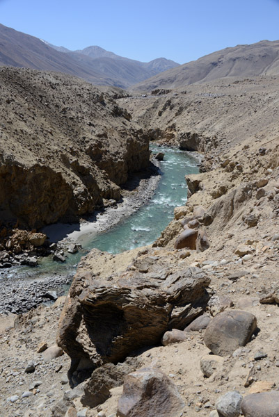
 The Pamir River enters another narrow canyon |
 This looks like a good spot for a picnic |
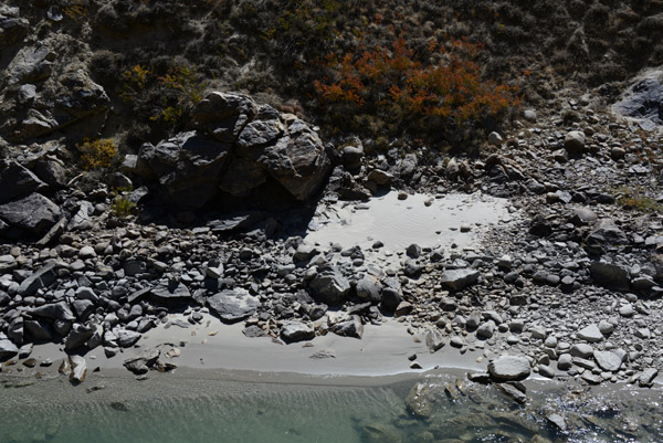 A small sandy "beach" on the Pamir River, Afghanistan |
 Pamir River, Tajikistan-Afghanistan |
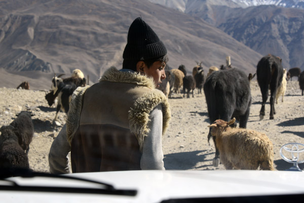
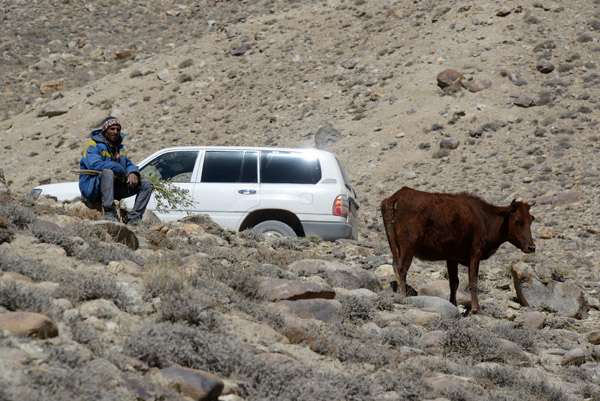 A local man keeping watch over his cow in the Pamir Valley |
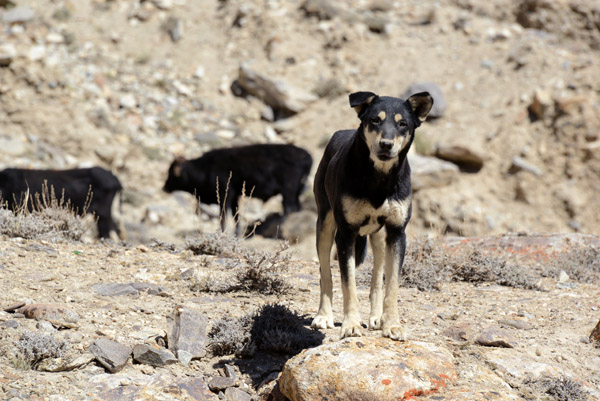 Working dog in the Pamir Valley, Tajikistan |
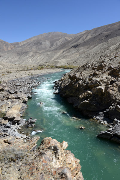
 Pamir River, Tajikistan-Afghanistan |
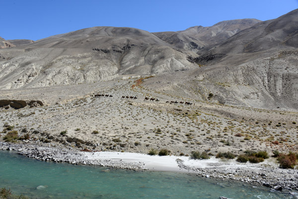
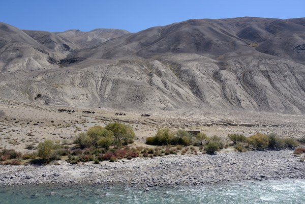
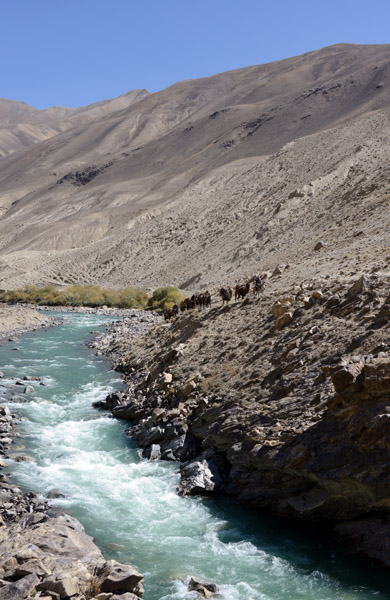
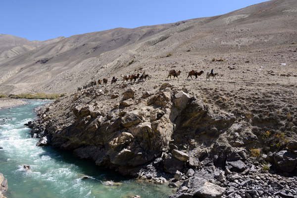
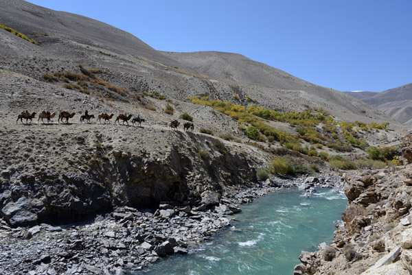
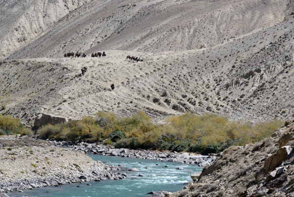 The caravan we passed earlier comes into sight as its makes its way slowly along the Pamir River |
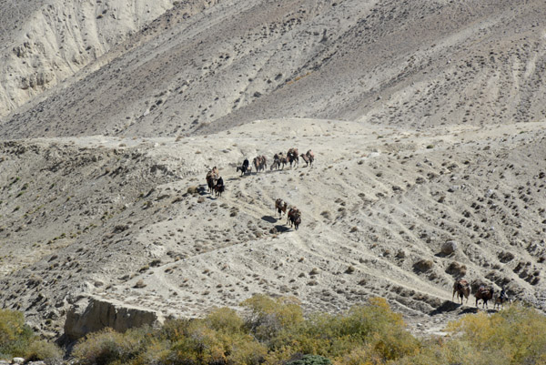 Look at all the different paths that have been worn out over centuries of hoofed traffic following this ancient trade route |
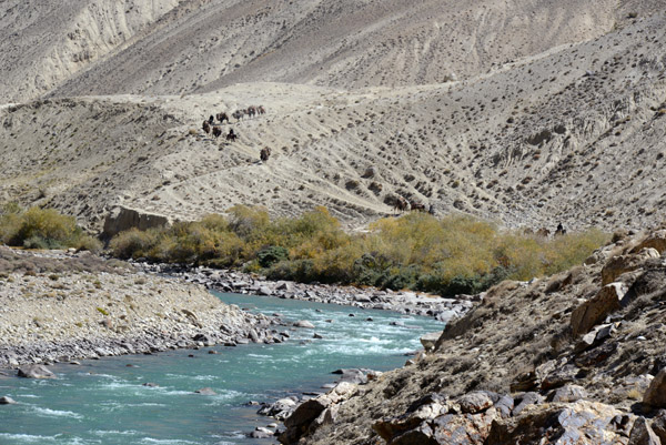 Wider view of the Pamir River with the caravan descending the slope in the background |
 I decided this small canyon where the river runs through a narrow gorge would be a nice place to sit and watch the caravan pass |
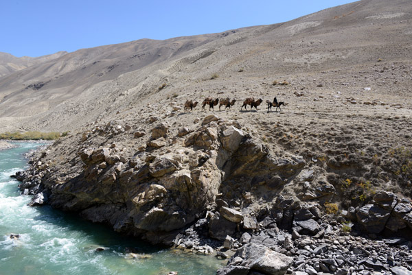
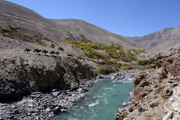
 The caravan approaches such a short distance away |
 Like something out of Silk Road history |
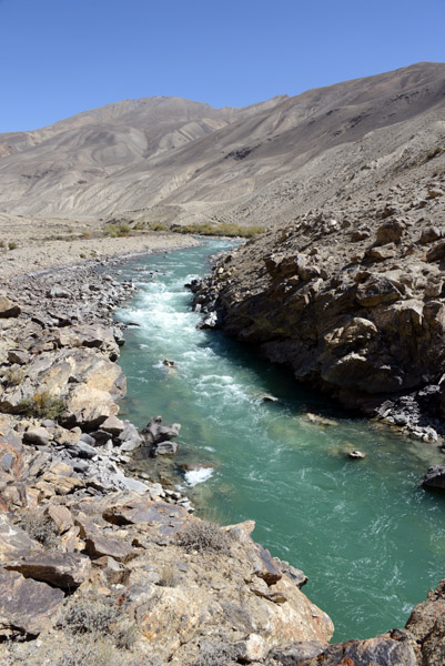
 Narrow gorge on the Pamir River |
 The caravan leader glances across the river into another world |
 No sign of Kalashnikovs...maybe they're tucked away somewhere safe |
 A camel caravan just adds to the stunning landscape |
 Just a stone's throw away, Afghanistan |
 The caravan passes by at on the other side of the Pamir River |
 What luck to have witnessed something like that across the river in Afghanistan...it makes me want to visit that country |
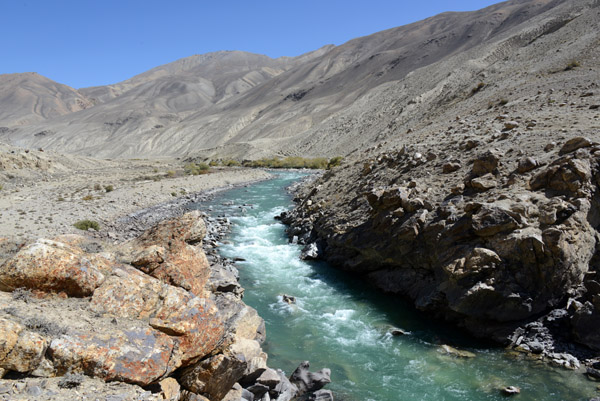
 The river can't be much more than 20m wide here, if that |
 More photos of this caravan I've posted in a small Afghanistan gallery |
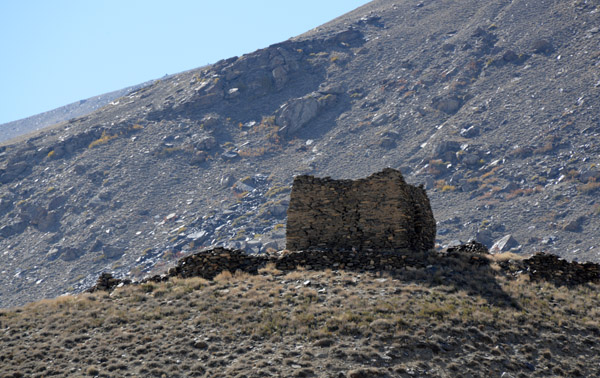
 What looks like the remains of a small stone shelter |
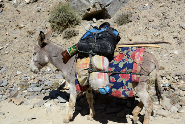 Not as impressive as the camels on the other side, a fully laden donkey complete with a big plastic bottle of beer |
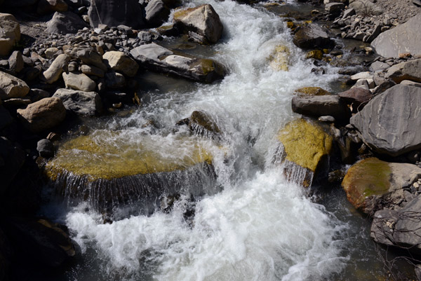
 Rapids in a narrow section of the Pamir River, perhaps someday a site of adventures sports like rafting, inshallah |
 A small oasis of lushness in what is the otherwise forbidding landscape of the Pamir Valley |
 A small mudbrick hut in a clearing surrounded by trees, Wakhan Corridor, Afghanistan |
 Perhaps these shelters are small caravansaries for caravans like the one I had just passed |
 The dirt road, the former frontier of the USSR |
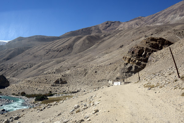
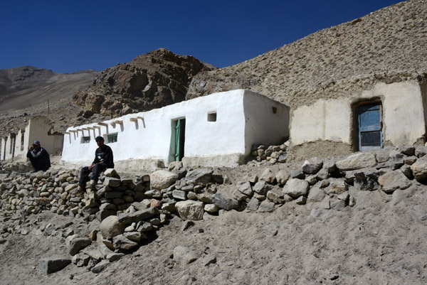 A couple of locals in one of the first habitable looking buildings we've seen on the Tajik side of the Pamir Valley |
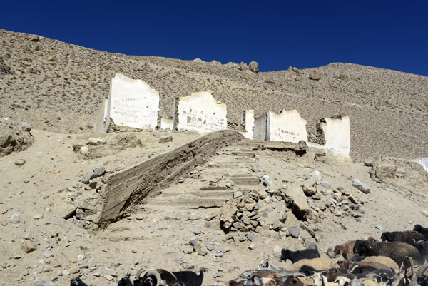 Most of the other places look more like this, crumbling ruins |
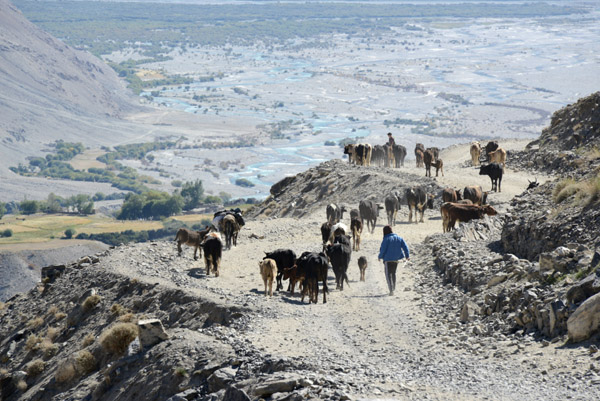
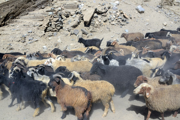 Goat jam kicking up dust |
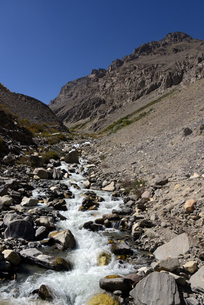
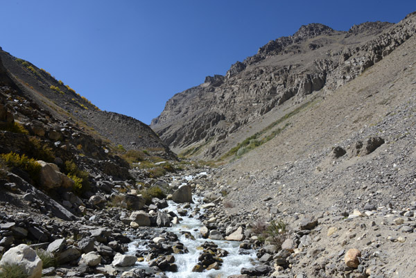
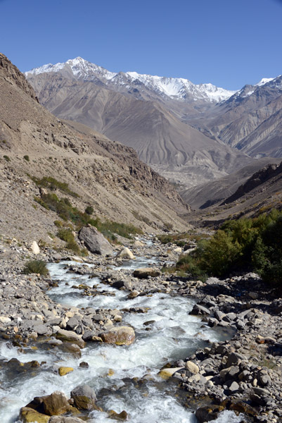
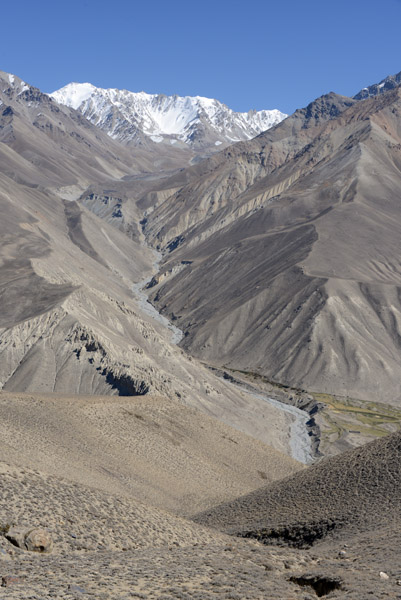
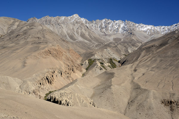
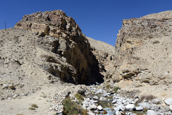 A small stream flowing out of a narrow canyon on the Tajik side of the Pamir Valley |
 Note the narrow trail descending down this hillside on the Afghan side of the Pamir River |
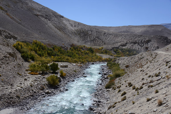
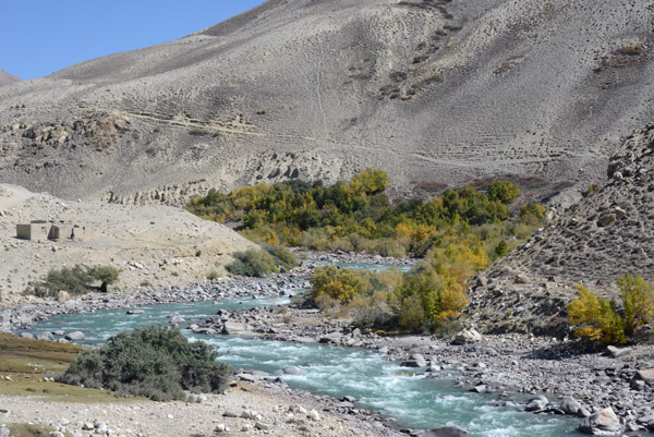
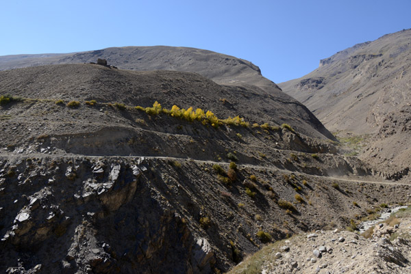
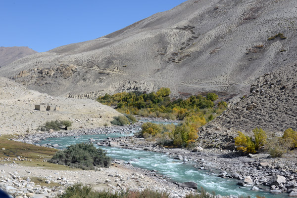 It looks like September is bring on the autumn colors in this high altitude valley |
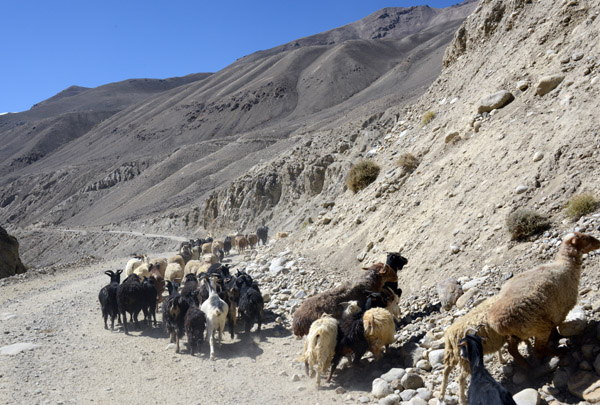 Some of the sheep head for the hills as we pass by...smart sheep |
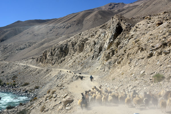 Unfortunately, not all are as smart as the first bunch |
 A small valley leads deep into Afghanistan's Wakhan Corridor |
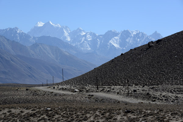
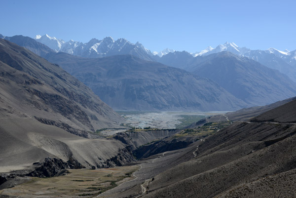
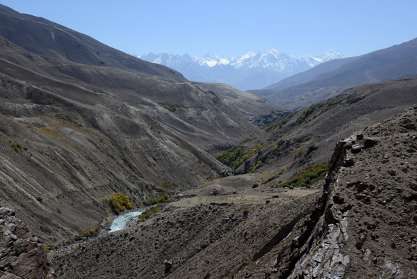 Our destination for tonight, the Wakhan Valley, is in front of the distant range of the Hindu Kush |
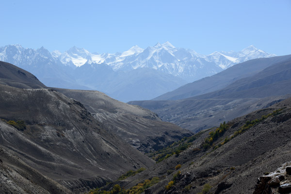 The massive range of the Hindu Kush formed the northern wall of the British Empire |
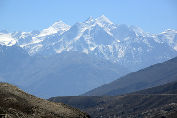 These peaks of the Hindu Kush in Afghanistan's Wakhan Corridor rise to over 20,000 feet and are about 10 km north of Pakistan |
 The Pamir River drops off far below us as we continue south towards the Wakhan |
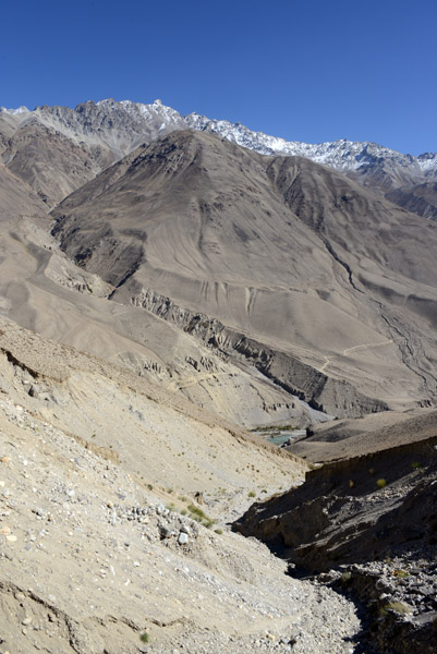
 Here, the Pamir River runs through a canyon over 1000 feet lower than the level of the road. We have a steep descent ahead |
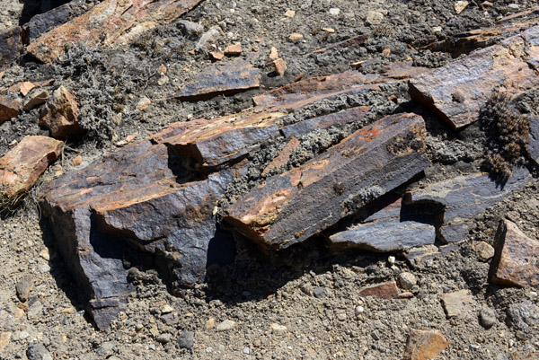 Geology project - rock samples in the Pamir Valley |
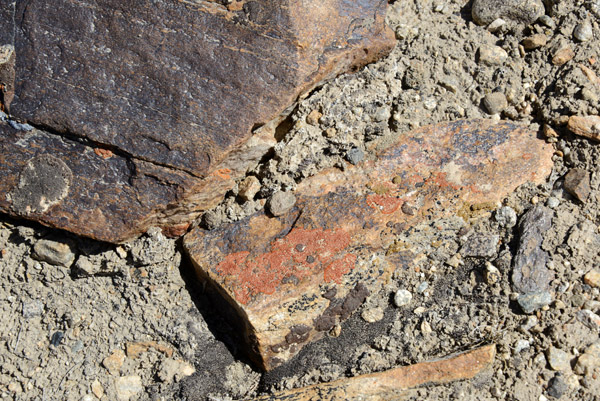 Guessing from previous experience that there is a large iron content in these reddish rocks |
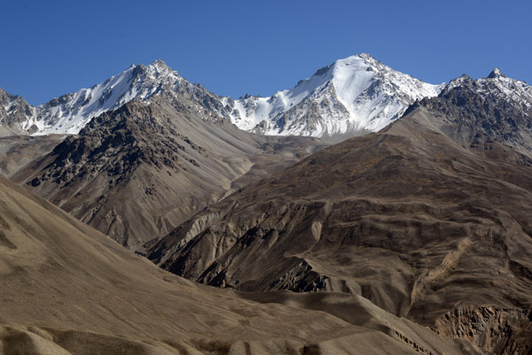
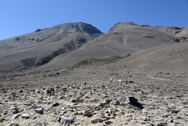 Mountains on the Tajikistan side of the Pamir Valley, here hills compared to the Hindu Kush |
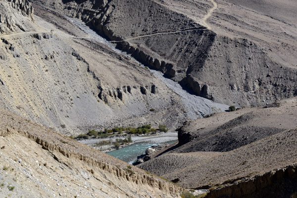
 There river is barely visible in the canyon below and it looks like the Afghan caravan trail is on a similar level as this road |
 I couldn't find too many mountain names on my source, Google Earth, for this area of the Pamirs and Hindu Kush |
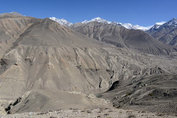
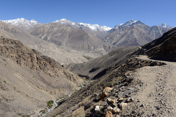
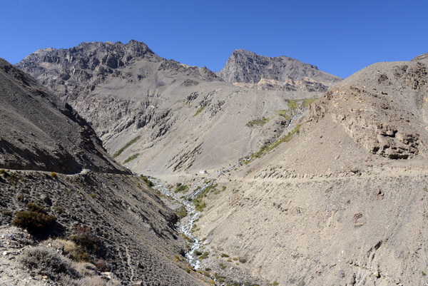
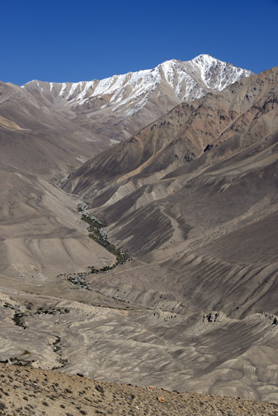
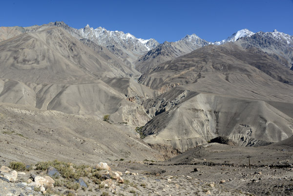
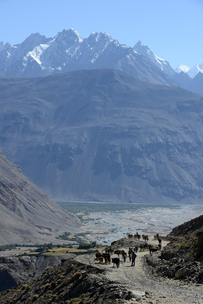
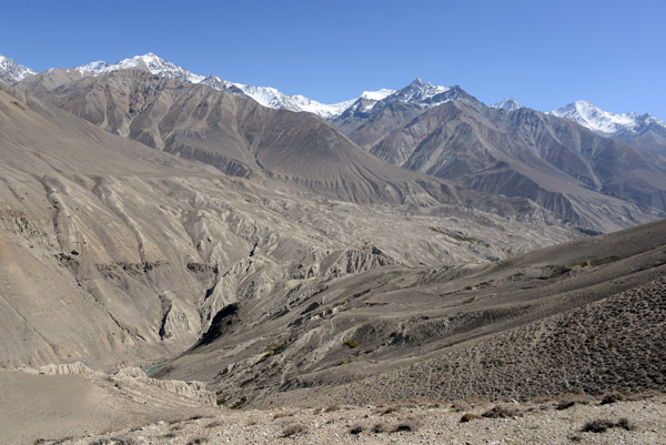 Southern end of the Pamir Valley |
 Tajik road to the Wakhan Valley with the great wall of the Hindu Kush |
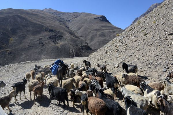 Yet another flock of sheep and goats. The driver is impatient and honks wildly as he forces his way through the herd |
 Start of the big descent |
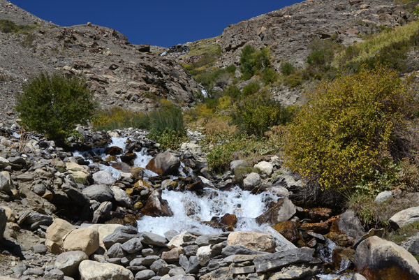 A cascade descends through scrub taking on fall colors |
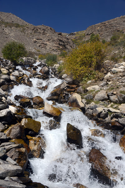 A cascading waterfall, Pamir Valley |
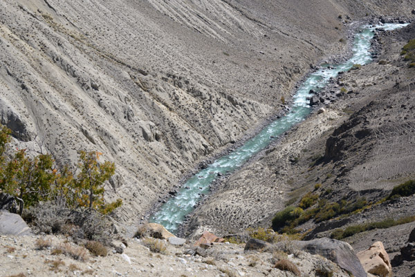
 A small feeder stream of the Pamir River |
 The road crosses this mountain stream at a big bend around 18km north of the confluence of the Pamir and Wakhan Rivers |
 The Pamir River once again drops sharply away from the Tajik road |
 After our descent, we again approach the level of the Pamir River. The track in Afghanistan seems a bit larger now |
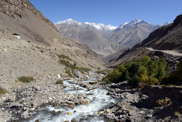
 Pamir River north of the Wakhan Valley |
 Rapids in the Pamir River |
 Big bed in the road as the it crosses a small stream feeding the Pamir River 18 km north of the Wakhan |
 The Big Bend in the road |
 A side valley on the Afghan Wakhan Corridor |
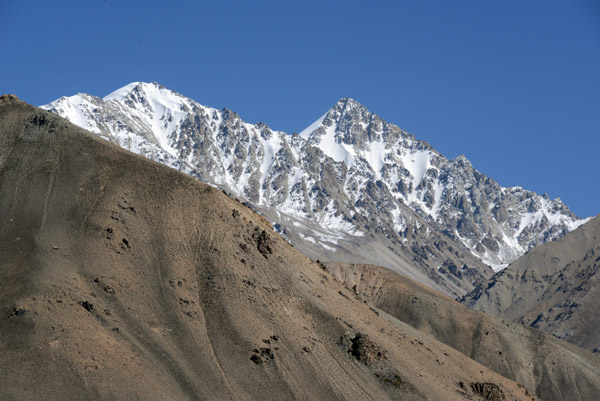
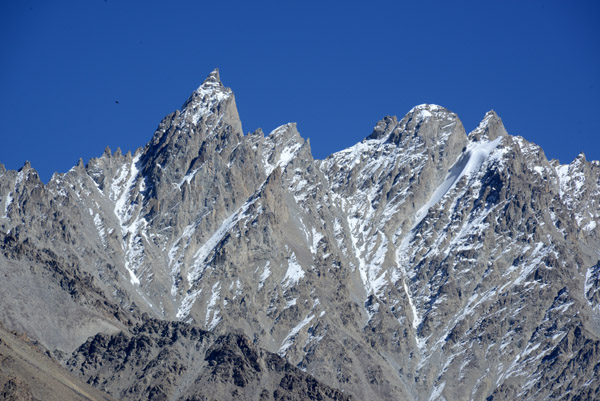
 A nameless 17,800 foot mountain in the Afghan Wakhan Corridor |
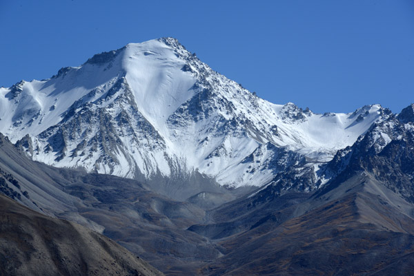 18,000 foot summit in the Wakhan Corridor, Afghanistan |
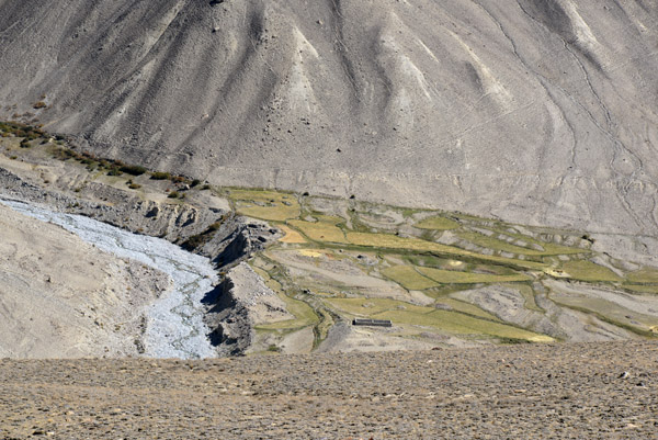 The first signs of serious cultivation that we'll see a lot more in the Wakhan Valley, Pur Sang, Afghanistan |
 Sum Ting Wong? |
 The Wakhan Corridor, that narrow strip of land like a quail's head feather coming out of "mainland" Afghanistan |
 An agreement between the British and Russian Empires in 1873 established the Wakhan Corridor as a buffer between the two empires |
 The mountains above Pur Sang, Afghanistan - Wakhan Corridor |
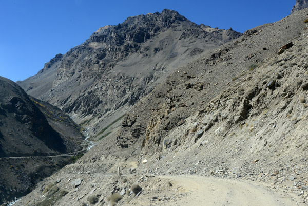
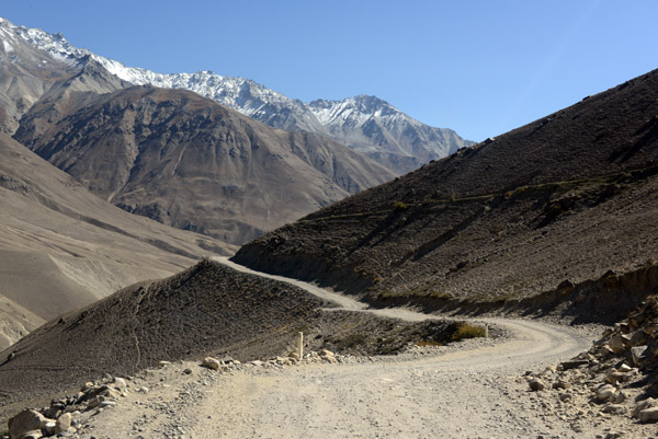
 The scenic Tajik road connecting the Pamir Highway to the Wakhan Valley |
 Please don't run the guy over Mr Driver |
 The caravan trail on the Afghan side that's been parallel to us for the past 70km |
 The first of a series of ancient forts protection the Wakhan Valley |
 Mountains of the Wakhan Corridor east of the Pamir Valley |
 Valley leading east to the high mountains of the Wakhan Corridor 15km north of the confluence |
 Amazingly rugged nameless mountain, Wakhan Corridor, Afghanistan |
 15km to go for the descent to the Wakhan Valley |
 Natural or blasted to let the road pass through |
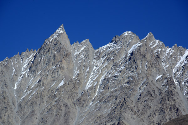 Needle sharp spire |
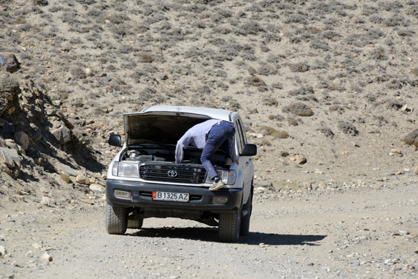
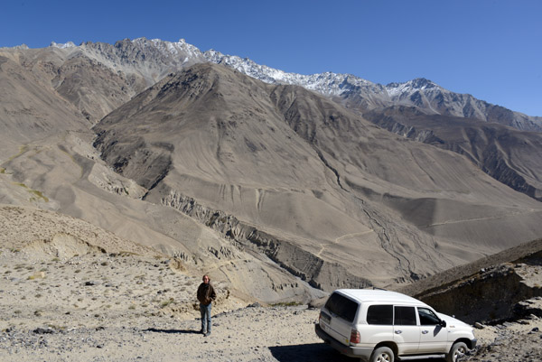 Steven and our Land Cruiser |
 10 km from the Wakhan/Pamir Confluence |
 South end of the Pamir Valley |
 A dry riverbed and the caravan trail on the Afghan side of the Pamir River |
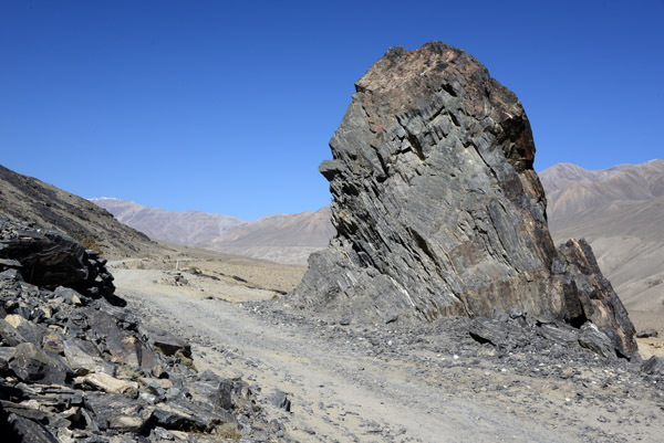
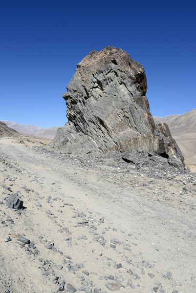
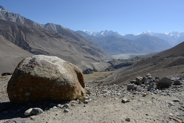 The broad Wakhan Valley comes into sight near a large roadside boulder |
 The confluence of the Pamir and Wakhan Rivers and the Hindu Kush |
 Cattle on the road as the Wakhan Valley opens up ahead of us |
 Descending to the Wakhan Valley |
 Trying to pass more livestock without pushing any of them over the ridge |
 An interesting eroded gulley, Wakhan Valley, Afghanistan |
 The Pamir Valley as it descends to meet the larger Wakhan Valley |
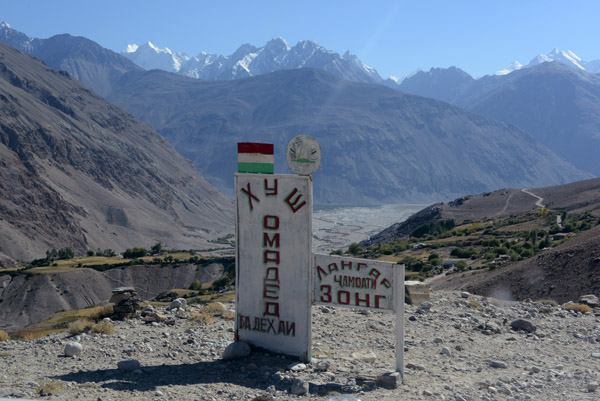 Welcome to the community of Langar |
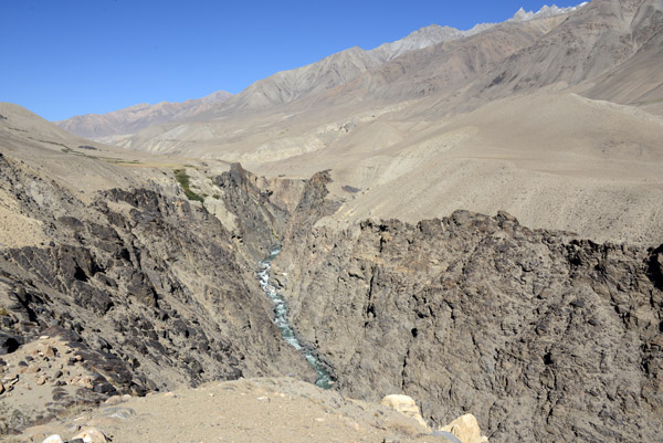 The canyon of the Pamir River just north of the Wakhan Valley |
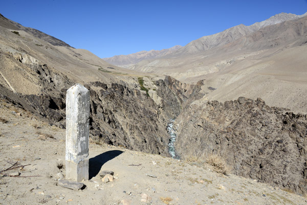 Canyon of the Pamir River with a worn border marker, Tajikistan |
 The final canyon carved by the Pamir River just before it reaches the Wakhan Valley |
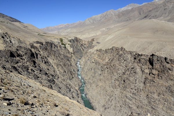
 The Pamir River deep below in the canyon |
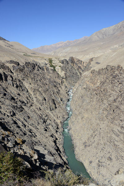 The southernmost canyon of the Pamir River |
 Mountains east of the Pamir canyon, Afghanistan |
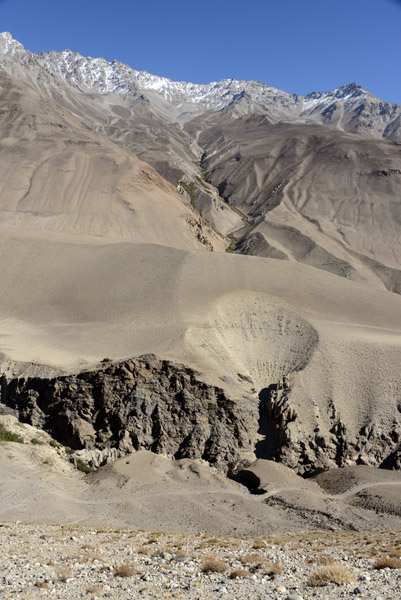
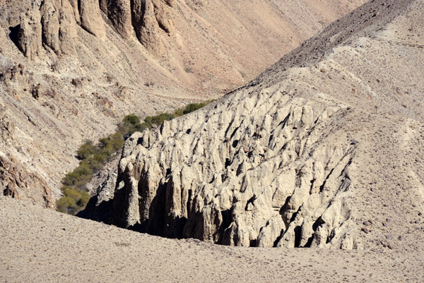 Erosion creating Utah-like formations, Pamir Valley, Afghanistan |
| comment | share |