


|
|
|
|
|
|
| Bill Minter | profile | all galleries >> Galleries >> America's Great Parks Tour 2024 | tree view | thumbnails | slideshow |
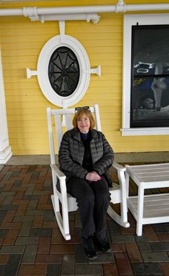
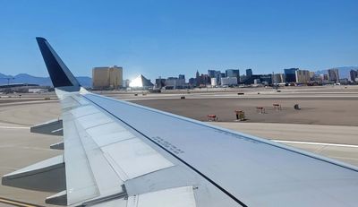 Arriving in Las Vegas |
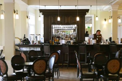
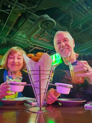 Dinner at Gilley's in Treasure Island Casino |
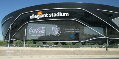 Leaving Las Vegas to tour "America's Great Parks" |
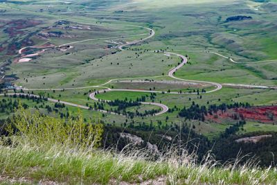
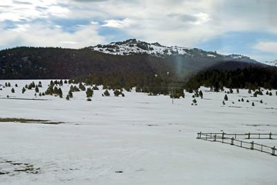
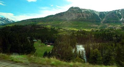
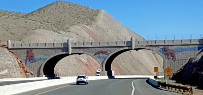 Wildlife Overpass over I-11 in Nevada |
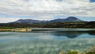
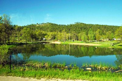
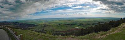
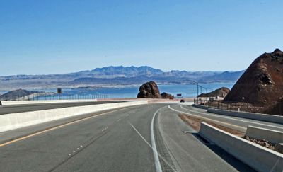 Lake Meade, Nevada, is still very low |
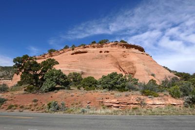
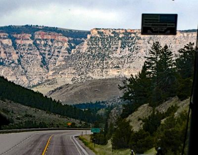
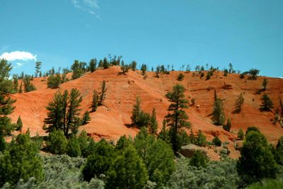
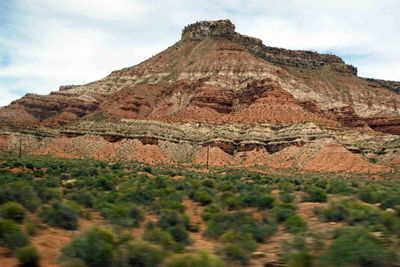
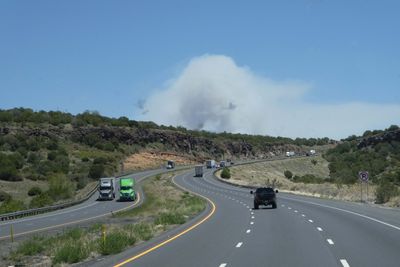 Smoke in the distance was a planned burn near Williams, Arizona |
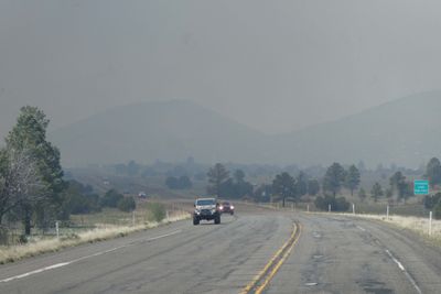 Driving into smoke on Route 66 |
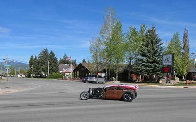
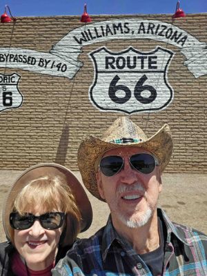 Stop in Williams, AZ on the way to the Grand Canyon |
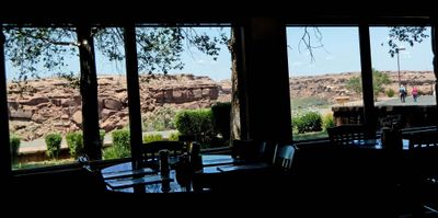
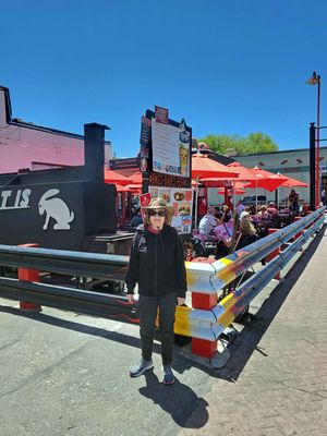 Lunch at Cruiser's Route 66 Cafe in Williams, AZ |
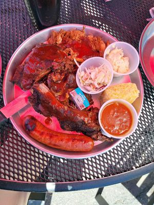 BBQ Plate at Cruiser's Route 66 Cafe in Williams, AZ |
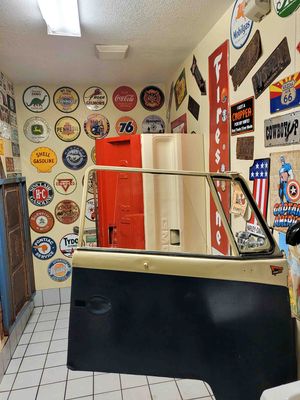 Car Door urinal divider at Route 66 Cafe in Williams, AZ |
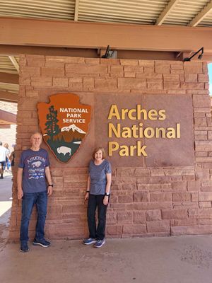
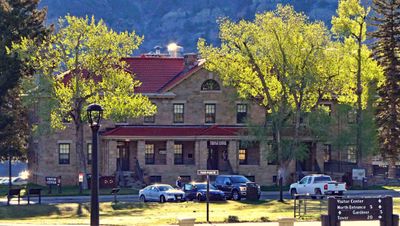
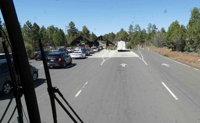 Arriving at the entrance to Grand Canyon National Park |
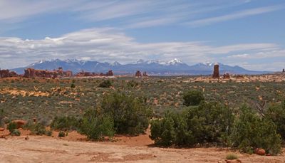
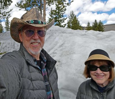
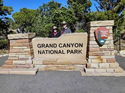 At Grand Canyon National Park |
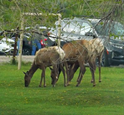
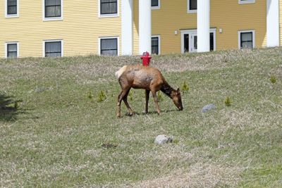
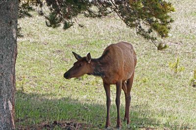
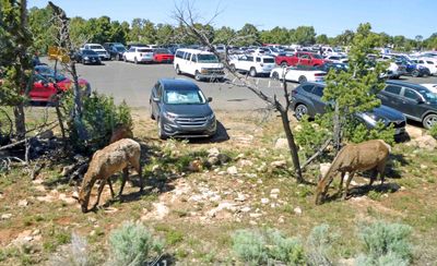 Elk in the parking lot at Grand Canyon |
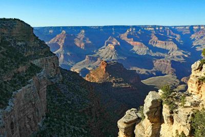
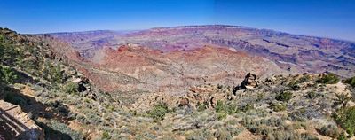
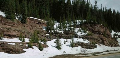
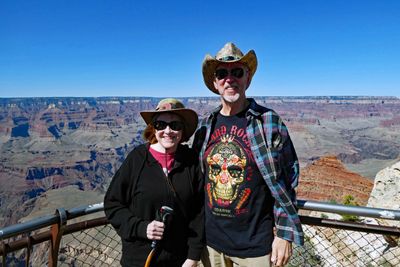 1st stop in Grand Canyon |
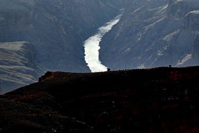
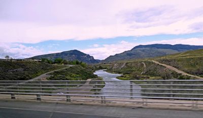
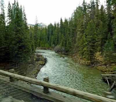
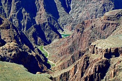 Colorado River running through the Grand Canyon |
 Late afternoon in the Grand Canyon |
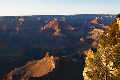 Waiting for sunset on the Grand Canyon |
 Colorado River in the late afternoon |
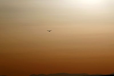 Soaring above the Grand Canyon near sunset |
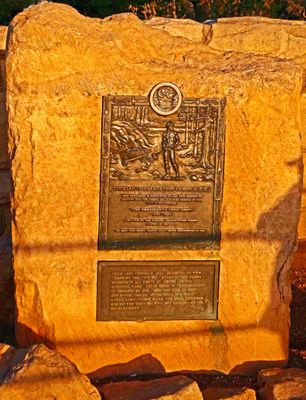 Monument to the Civilian Conservation Corps at Sunset on the Grand Canyon |
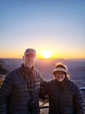 Watching the sun set over the north rim of the Grand Canyon |
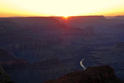 Sunset over the north rim of the Grand Canyon |
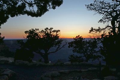 Dusk over the Grand Canyon |
 Morning view of the Grand Canyon |
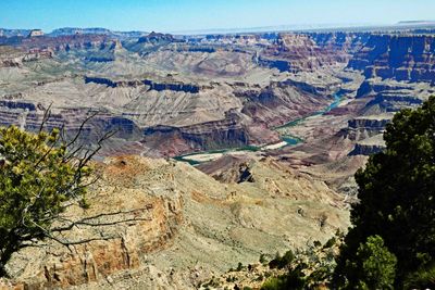 The Colorado River flows for 277 miles through the Grand Canyon |
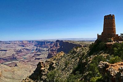 The 70-foot tall Desert View Watchtower was built in 1932 |
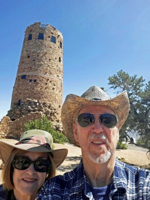 At Desert View Watchtower |
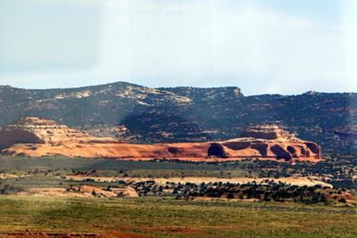
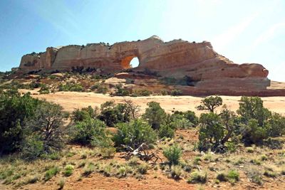
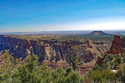 The Grand Canyon joins the Painted Desert with a view of Cedar Mountain |
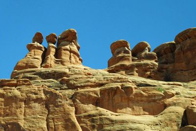
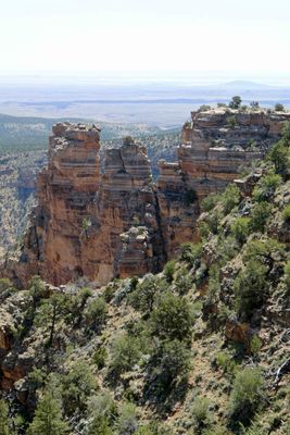 Rock formation at the southeast end of the Grand Canyon |
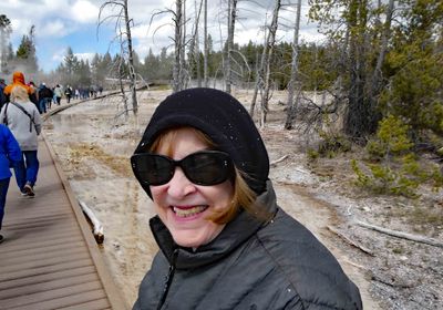
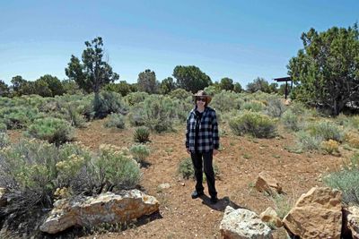 Susan at Desert View on the rim of the Grand Canyon |
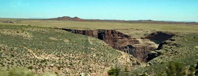
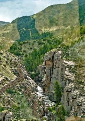
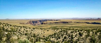 The Little Colorado River Gorge on the Navajo Indian Reservation of Arizona |
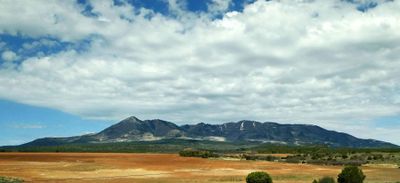
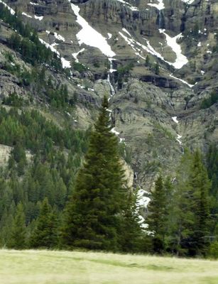
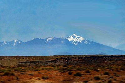 Humphreys Peak is the highest natural point the state of Arizon with an elevation of 12,637 feet |
 At least 10 tribes have ancestral connections to the Little Colorado River |
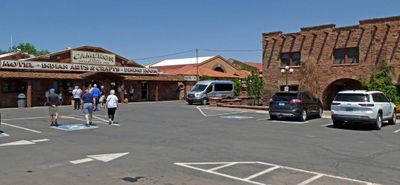 Lunch stop at Cameron Trading Post (Arizona) |
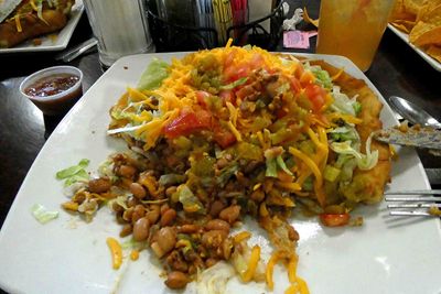 Navajo Taco on Indian Fry Bread for lunch |
 Lunch view of Little Colorado River Gorge from Cameron Trading Post |
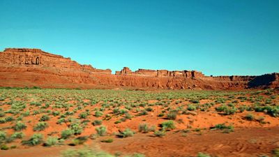
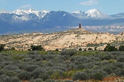
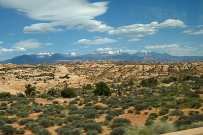
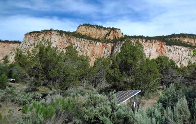
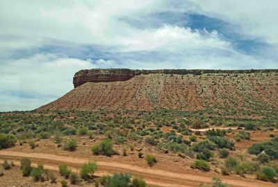
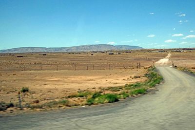 Driving through the Navajo Reservation in Arizona |
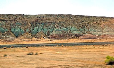
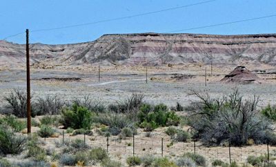 Painted Desert in Arizona |
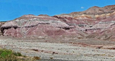 Painted Desert in Arizona |
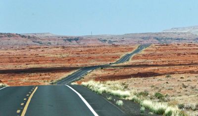 The road ahead in AZ |
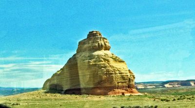
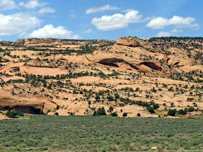 Desert rocks |
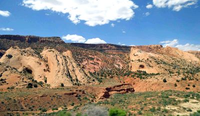 Desert Landscape |
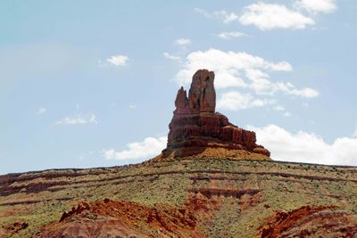 Passing El Capitan in Arizona |
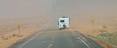 Driving through a sandstorm in Arizona |
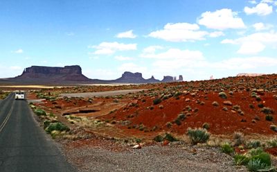
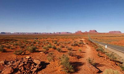
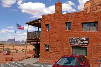 Arriving at Goulding's Trading Post and Lodge in Monument Valley, Utah |
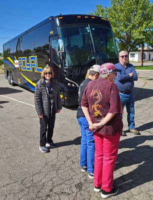
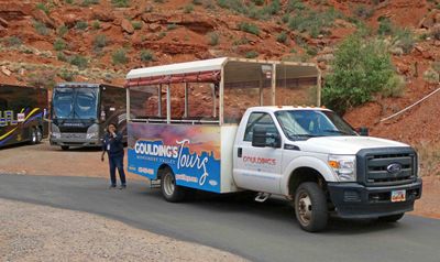 Tour guide and vehicle for Monument Valley excursion |
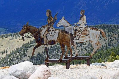
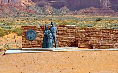 Great Seal of the Navajo Nation and Bronze Navajo Family Statue at the entrance of Monument Valley |
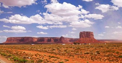 Monument Valley Navajo Tribal Park is a 91,000 acre tribal park |
 Monument Valley straddles the Utah-Arizona border |
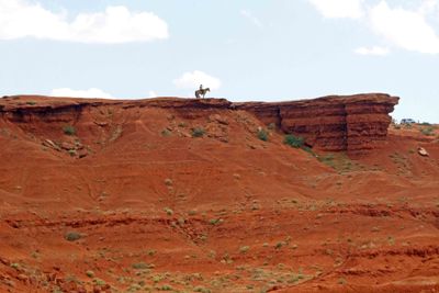
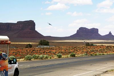 A hawk soars over Monument Valley |
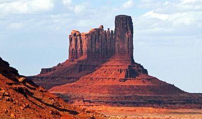 Camel Butte, Monument Valley |
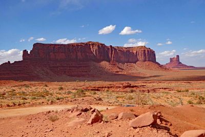
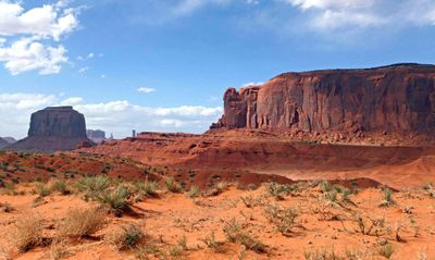
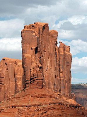
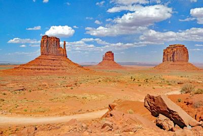 West & East Mittens and Merrick Butte, Monument Valley |
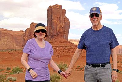
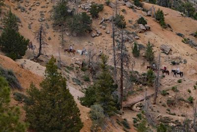
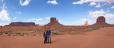 Monument Valley Tour |
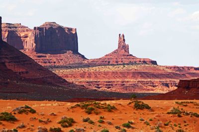 The King and His Throne, Monument Valley |
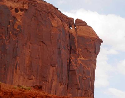 Anyone else see Alfred Hitchcock's profile? |
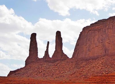 Three Sisters, Monument Valley |
 Monument Valley was the setting for 9 John Ford Movies, including Stagecoach and She Wore a Yellow Ribbon |
 John Ford Point was often the camera location for films directed by John Ford |
 Over 60 films have featured Monument Valley, inlcuding Easy Rider, Forrest Gump, & Back to the Future III |
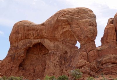
 Elephant Butte, Monument Valley |
 In front of Elephant Bluff at John Ford Point |
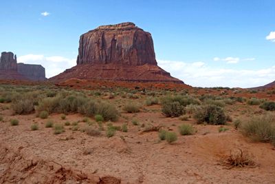 Merrick Butte, Monument Valley |
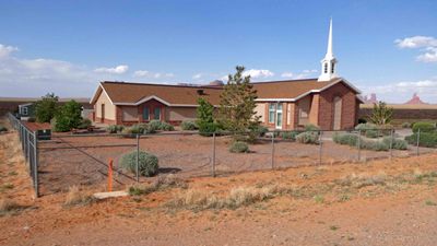 Monument Valley Mormon Church, Utah |
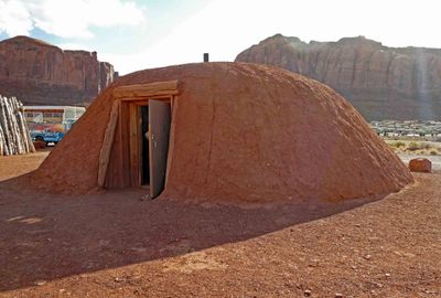 Traditional Navajo Hogan |
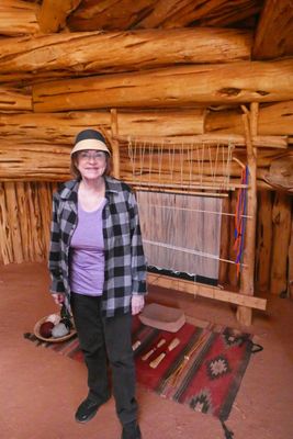 Inside a Navajo Hogan |
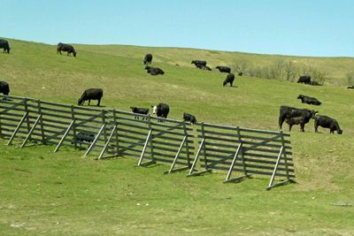
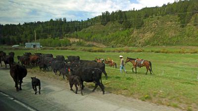
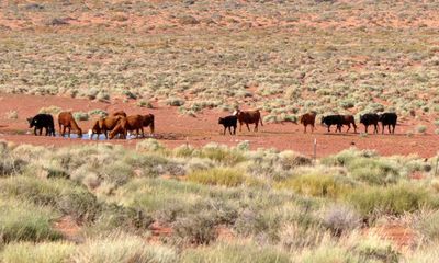 Cattle coming to water on the Navajo Reservation |
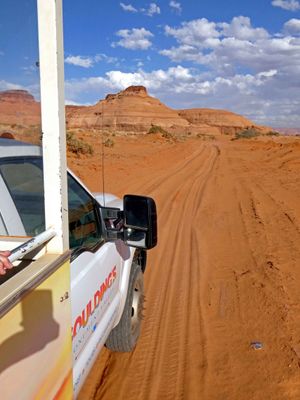 1h5 - Driving through sand to Navajo Backcounty Cookout.jpg |
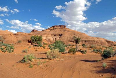 Rock formations on the way to Navajo Backcountry Cookout |
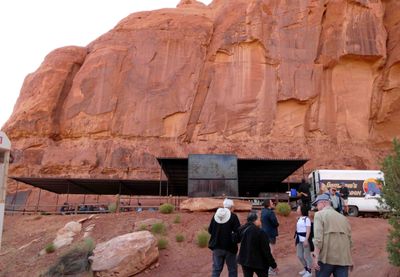 Nice setting for a Navajo Backcountry Cookout |
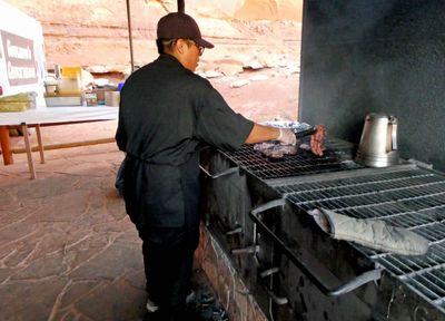 Grilling steaks for Navajo Backcountry Cookout |
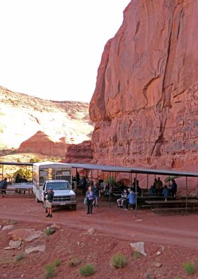 Susan at the Navajo Cookout |
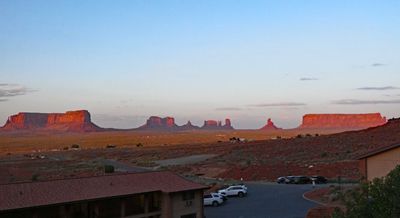 Late afternoon sun on Monument Valley from our balcony |
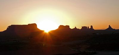 Sunrise over Monument Valley from our balcony |
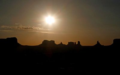 Morning sun behind Monument Valley rock formations |
 Had a chicken-fried steak and eggs breakfast at Goulding's Lodge |
 View of Monument Valley from Forrest Gump Point (where he ended his 15,000 mile run) |
 Pit stop in Blanding, Utah |
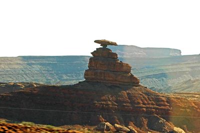 Mexican Hat is a famous landmark along US 163 in Utah |
 Open country in Utah |
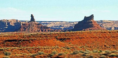 Driving through the Valley of the Gods in Utah |
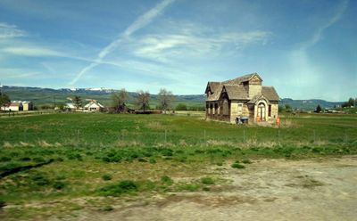
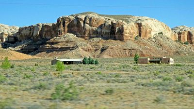 Life in the southeast corner of Utah |
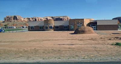 Bluff Utah Elementary School |
 The Bluff Formation in the four corners area of Utah was deposited in the late Jurassic Period |
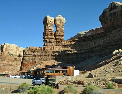 The Navajo Twin Rocks of Bluff, Utah |
 Abajo Mountains,Utah |
 Snow on Abajo Mountains (sometimes called the Blue Mountains) |
 Church Rock near Monticello, Utah |
 Desert Sandstone formation in Utah |
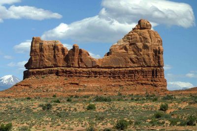
 Wilson's Arch, south of Moab, Utah, is Entrada Sandstone |
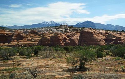 First look at Utah's LaSal Mountains |
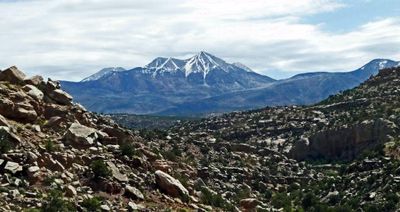 Mt. Peale is the highest peak in the LaSal Mountain Range at 12.726 feet |
 Interesting clouds over sandstone cliffs near Moab, Utah |
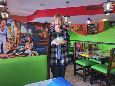 El Tapatio Restaurant in Moab, Utah for lunch |
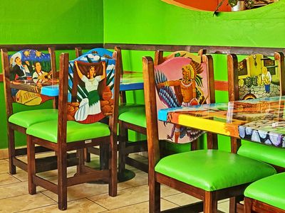 Nicely painted chairs in El Tapatio Restaurant in Moab, Utah |
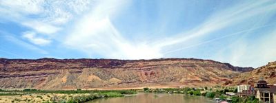 Crossing the Colorado River outside Moab, Utah |
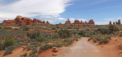
 At Arches National Park Visitors Center |
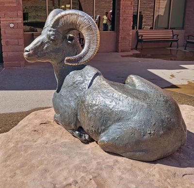 The only Bighorn Sheep we saw was this one at the Visitors Center |
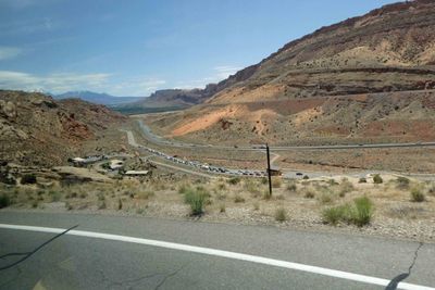 Looking down at cars waiting to enter Arches National Park |
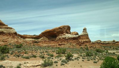
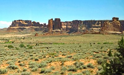
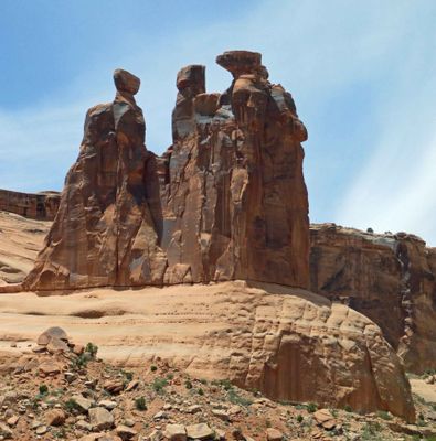 The Three Gossips in Arches National Park |
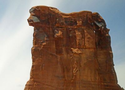 'Sheep Rock' in Arches National Park looks like a Lion to Bill |
 Driving through Arches National Park |
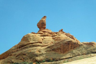
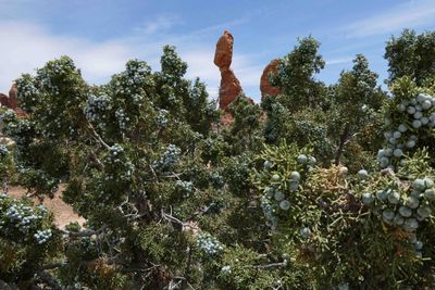 Balanced Rock in Arches National Park viewed through a Juniper plant |
 Balanced Rock in Arches National Park will eventually collapse due to erosion |
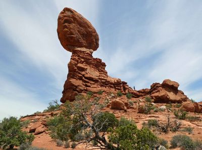 Balanced rock viewed from the side trail |
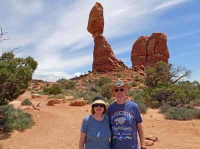
 Bill climbed to the base of Balancing Rock |
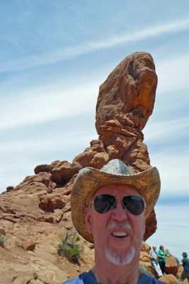
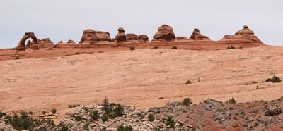 Delicate Arch is the most widely recognized landmark in Arches National Park |
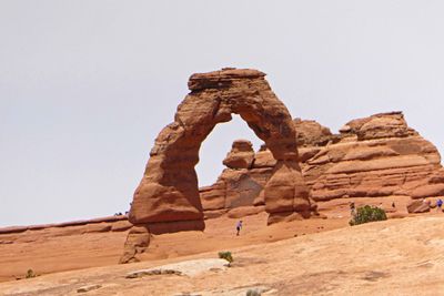 Delicate Arch with a person to show the scale |
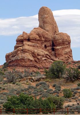
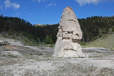
 No name on this rock, so Bill named it the Grinch |
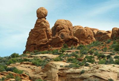 Another interesting formation in Arches National Park |
 On the Windows Trail in Arches National Park |
 Biceps Arch in Arches National Park |
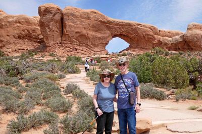
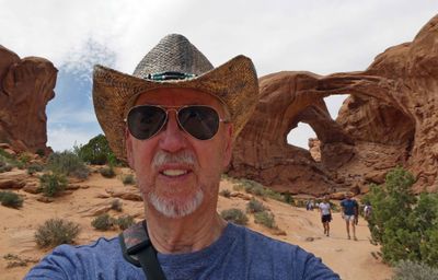
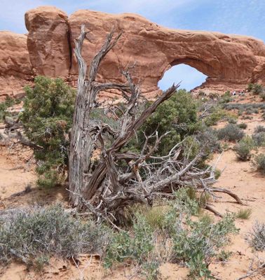 North Window in Arches National Park |
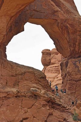
 Looking at hikers on Double Arch Trail |
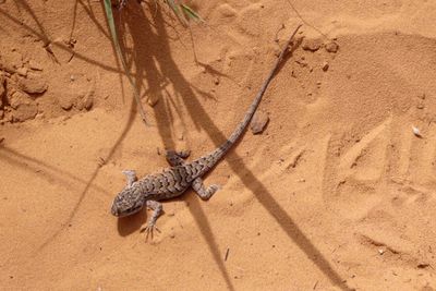 Lizard on Double Arch Trail in Arches National Park |
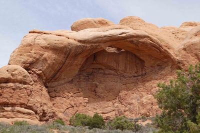
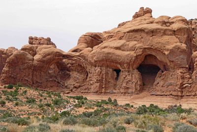
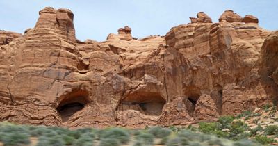 "Cove of Caves" near Double Arch Trail in Arches National Park |
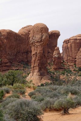
 Elephant Butte on Double Arch Trail in Arches National Park |
 Parade of Elephants viewed from Double Arch Trail in Arches National Park |
 One section of Parade of Elephants viewed from Double Arch Trail |
 As close as Bill got to the Double Arch in Arches National Park |
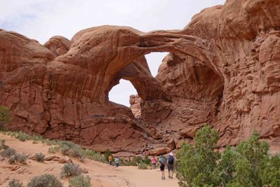 The Double Arch at Arches National Park |
 People climbing into the lower of the Double Arches |
 The view going back up Double Arch Trail in Arches National Park |
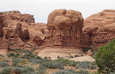
 You can name this formation in Arches National Park for yourself |
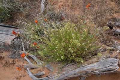 Desert Flowers on Double Arch Trail |
 Turret Arch formation in Arches National Park in front of Lasal Mountains in Utah |
 Lone Pillar in Arches National Park with LaSal Mountains behind |
 Petrified Dunes in Arches National Park |
 Driving through Arches National Park |
 The Three Gargoyles in Arches National Park |
 Leaving Arches National Park |
 Colorful rock formation along US 191 in Utah |
 Champagne Welcome at the Doubletree in Grand Junction, CO |
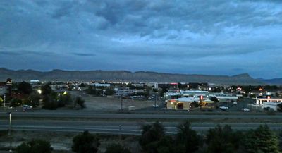 View of Grand Junction, CO from our hotel room |
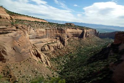
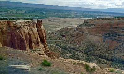
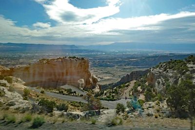 Starting the drive from 4,600 to 7,100 feet elevation in Colorado National Monument |
 Colorado National Monument was created by executive order of President William H. Taft in 1911 |
 A National Monument can be created by the President, but a National Park requires an Act of Congress |
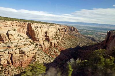
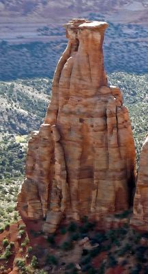
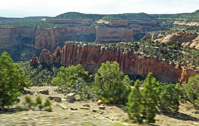 Ute Canyon in Colorado National Monument |
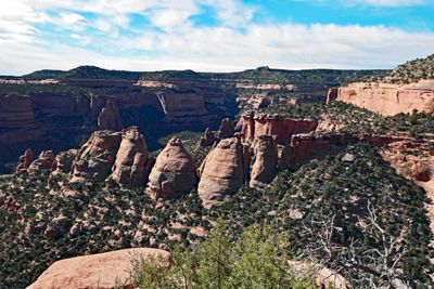 Early settlers named these the "Coke Ovens" because of their resemblance to man-made structures |
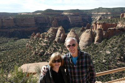 Bill and Susan overlooking the "Coke Ovens" |
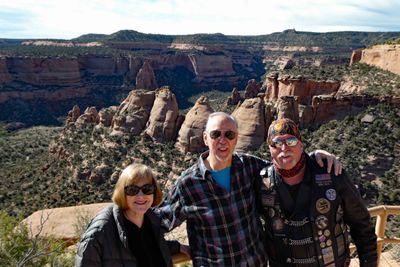 Photo bomb at the "Coke Ovens" in Colorado National Monument |
 Having fun with bikers in Colorado National Monument |
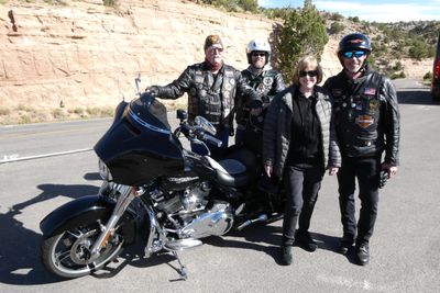 Saying goodbye to our newfound friends in Colorado National Monument |
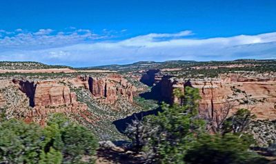
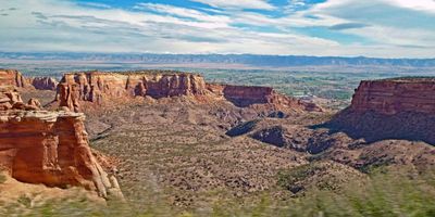 View from the top of the Colorado National Monument |
 Susan on "the Grand View Trail" in Colorado National Monument |
 Formation containing "Kissing Couple" in Colorado National Monument |
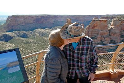 Tribute to the Kissing Couple Rock Formation |
 "Kissing Couple" in Colorado National Monument |
 Sandstone mound outside Colorado National Monument Visitors Center |
 Hiking Canyon Rim Trail in Colorado National Monument |
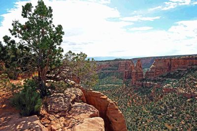 View along Canyon Rim Trail in Colorado National Monument |
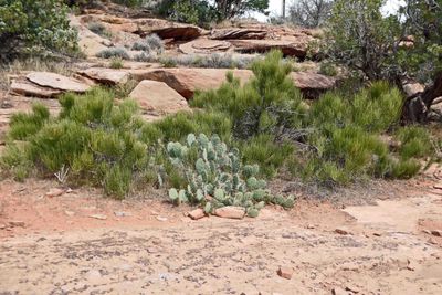 Desert vegetation along Canyon Rim Trail |
 Winding road up Colorado National Monument |
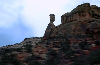 A balanced rock in Colorado National Monument |
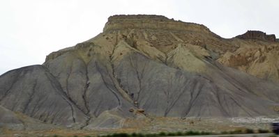 Along the road in Colorado |
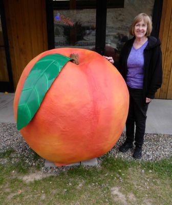 Pit stop at Palisade Peach Shack, Colorado |
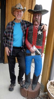 Wooden cowboy at Palisade Peach Shack, Colorado |
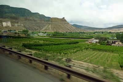 Wineries in Colorado |
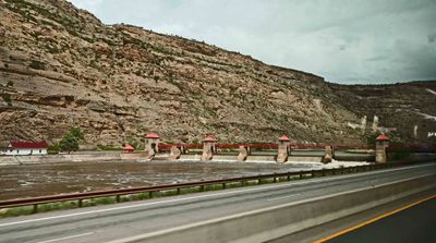 Grand Valley Diversion Dam on the Colorado River |
 Lunch at Doc Holliday's Saloon and Restaurant in Glenwood Springs, CO |
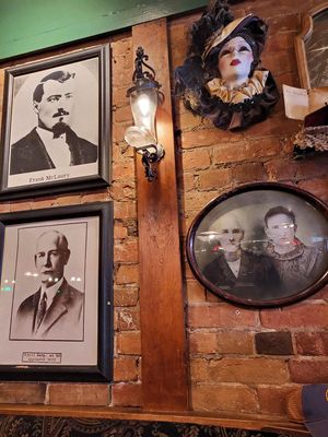 Wall above our booth in Doc Holliday's Saloon and Restaurant in Glenwood Springs, CO |
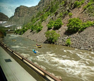 Rafting and Kayaking on the Colorado River |
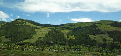 Patchwork of pine trees and aspen trees in White National Forest |
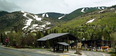 Vail Ski runs and Aspens (trees) in May |
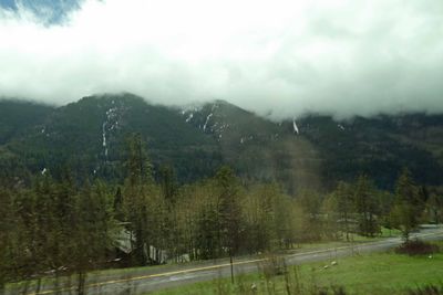 Driving in the clouds in the Rocky Mountains |
 Starting to see more snow as we gain altitude |
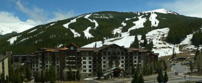 Passing Copper Mountain Ski Resort |
 White National Forest in Colorado contains 10 peaks higher than 14,000 feet |
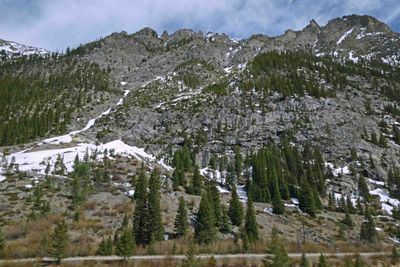 Rugged Mountain high in the Rockies |
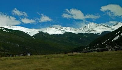
 Driving through snow-covered mountains high in the Rockies |
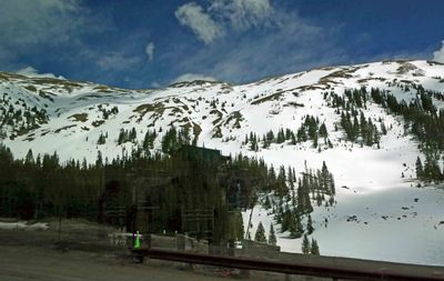
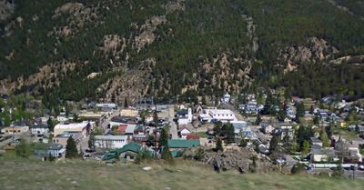 Georgetown, Colorado (established in 1859) sits at an elevation of 8,530 feet |
 Arriving in Denver, Colorado for the night |
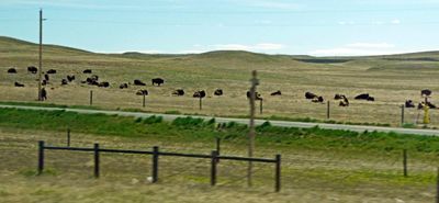 Herd of buffalo in Pawnee National Grassland near the CO/WY border |
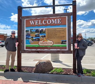 Lunch at Arby's in Torrington, WY |
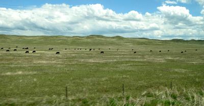 Lots of cattle on the plains of Wyoming |
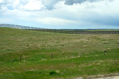 Miles & miles of snow fence on the plains of Wyoming |
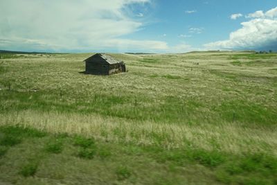 Little house on the Wyoming prairie |
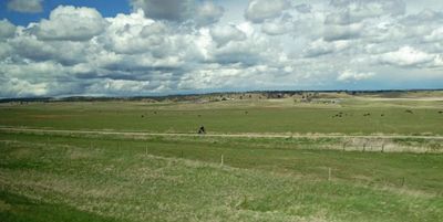 Gotta wonder where this guy on a bicycle came from |
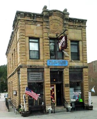 State Bank of Dakota Territory Building (The Territory of Dakota existed from 1861-1889), Custer, SD |
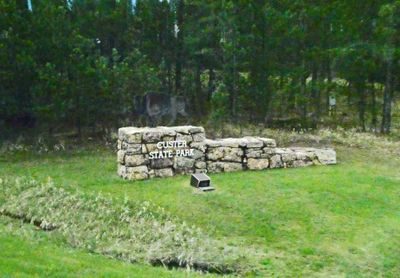 Entering Custer State Park in South Dakota |
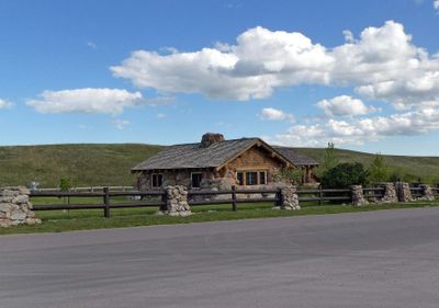
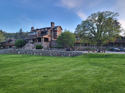 Arriving at Custer State Game Lodge |
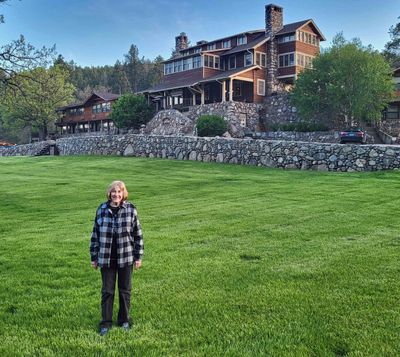 On the lawn at Custer State Game Lodge |
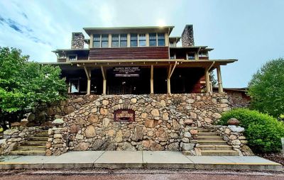 Custer State Game Lodge was built in 1920 |
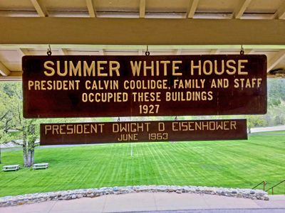 Custer State Game Lodge was occupied by two U.S. Presidents |
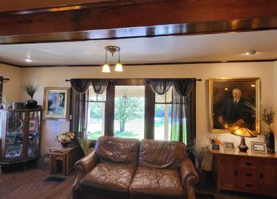 Lobby of Custer State Game Lodge |
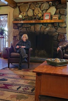 Susan in front of fireplace in Custer State Game Lodge |
 Afternoon walk by Grace Coolidge Creek in Custer State Park |
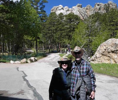
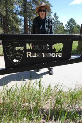 At Mount Rushmore National Memorial |
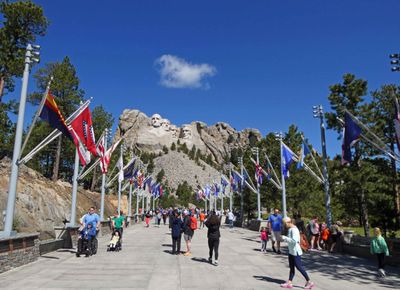 Avenue of Flags at Mount Rushmore includes 50 states, one district, three territories, and two commonwealths |
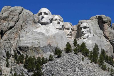 Mount Rushmore took from 1927 to 1941 to complete |
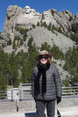 Visiting Mt. Rushmore was on Susan's Bucket List |
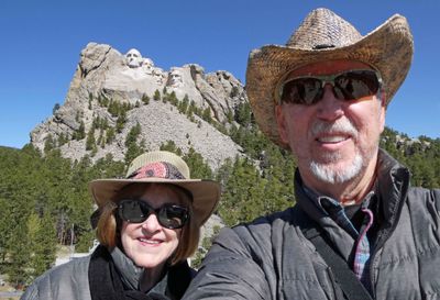 A chilly day at Mount Rushmore |
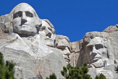 Washington's sculpture is the only one that includes any detail below chin level |
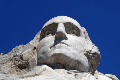 Looking up a George Washington from the Presidential Trail at Mount Rushmore |
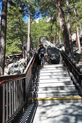 Susan on the last of 422 steps on the Presidential Trail at Mount Rushmore |
 At the bottom of the Presidential Trail at Mount Rushmore |
 "Death Song" sculpture stands in front of the entrance to Crazy Horse Memorial |
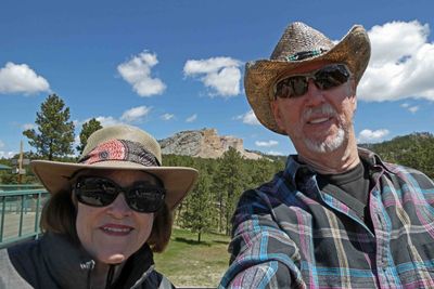 We didn't get very close to Crazy Horse Memorial |
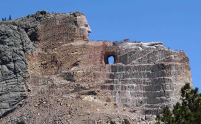 The face of Crazy Horse was completed in 1998 and is 27.5 feet taller than faces on Mount Rushmore |
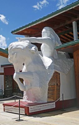
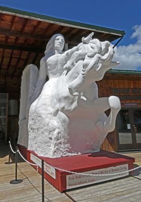 This model shows the planned sculpture when completed |
 The Crazy Horse project has been ongoing since 1948 and is dependent on donations for completion |
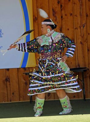 Lakota Indian demonstrates traditional Lakota costume and dance |
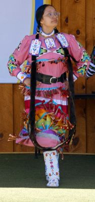 Young Lakota demonstrates a traditional Lakota costume and dance |
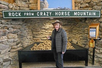 Rocks from Crazy Horse blast site are free for the taking |
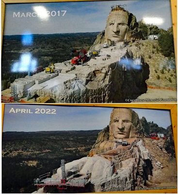 Crazy Horse Monument Progress is slow |
 Craig (tour director) and Susan in the Crazy Horse Memorial Museum |
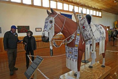
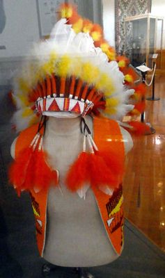 Headdress and Vest inside Crazy Horse Memorial Museum |
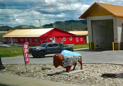 Painted bison statues on display in Custer, SD |
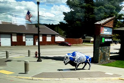 Another painted bison statue in Custer, SC |
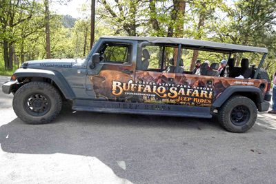 Getting ready for a Buffalo (actually Bison) Safari in Custer State Park |
 One of five lakes and ponds in Custer State Park |
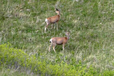
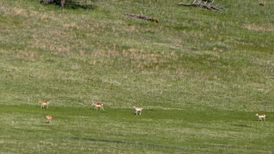 Pronghorn Antelope in Custer State Park |
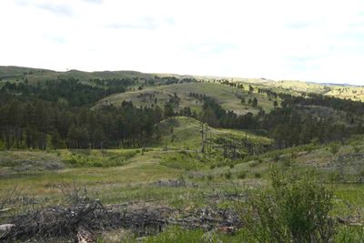 Driving through the Black Hills in Custer State Park |
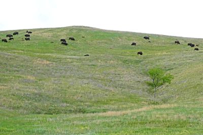
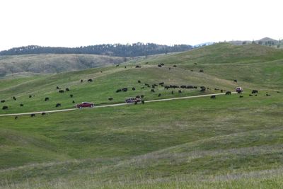 Large Bison herd in Custer State Park |
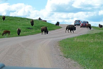 Waiting for Bison to clear the road |
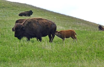
 There were a lot of new calves in the bison herds in Custer State Park |
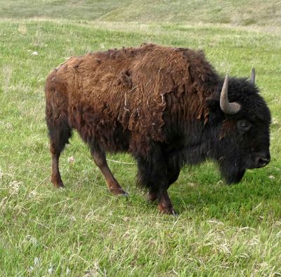 Bison just starting to lose her winter coat |
 Dinnertime in Custer State Park |
 May be a territorial dispute in Custer State Park |
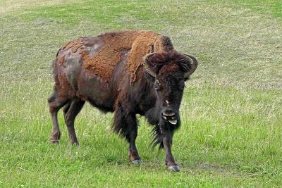 Winter coat is almost gone |
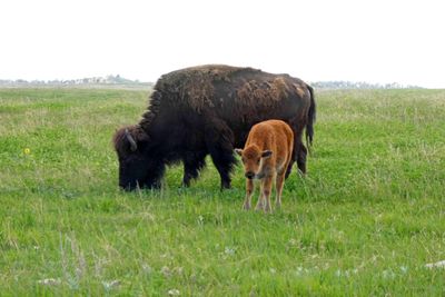
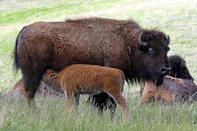 Calf nursing in Custer State Park |
 Whitetail deer in Custer State Park |
 Custer State Park is home to around 1,400 bison |
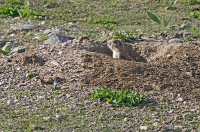
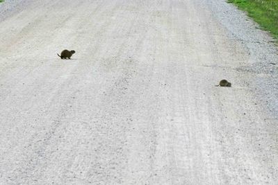 Prairie dogs crossing the road |
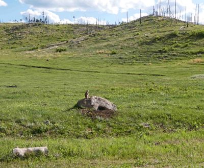 Prairie dog posing on a rock in Custer State Park |
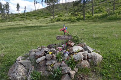 Grave of stillborn baby from 1902 when settlers lived in Custer State Park |
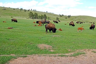 A Bison herd with a large number of calves in Custer State Park |
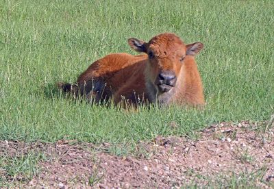 Bison calves are nicknamed 'Red Dog' because of their orange-red color |
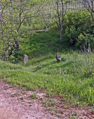 Wild Turkey in Custer State Park |
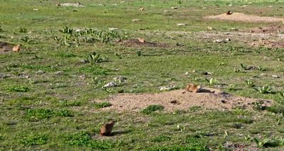 There are a lot of prairie dog towns in Custer State Park |
 Black-tailed prairie dogs are native to South Dakota |
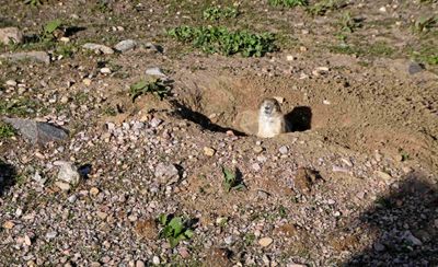 Curious prairie dog in Custer State Park |
 Custer State Park Wildlife Station Visitor Center began as the herdsman’s house in 1987 |
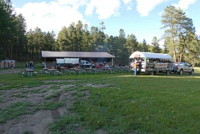 Arriving at a Chuck- wagon dinner in Custer State Park |
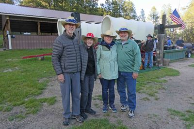 Bill, Susan, Sue, and Jim waiting for Chuck-wagon Dinner |
 Musicians and chow line at Chuck-wagon Dinner |
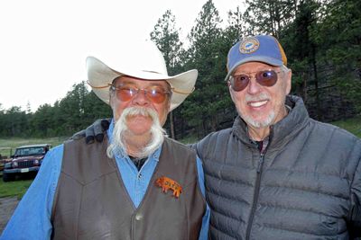 An impressive mustache at Chuck-wagon Dinner |
 Not sure if these are Mule Deer or Whitetail Deer in Custer State Park |
 Silhouette of Cathedral Spires of the Black Hills in Custer State Park |
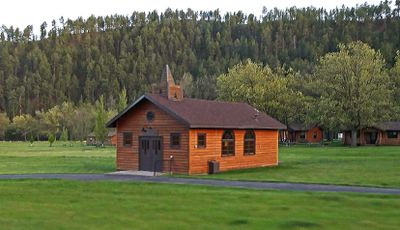 Wedding Chapel in Custer State Park |
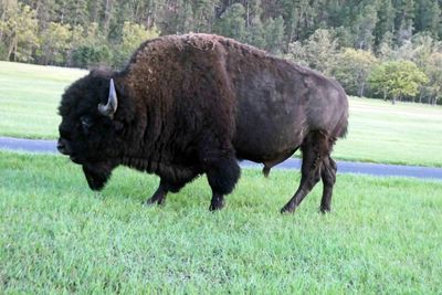 Big Bull Bison just outside Custer State Game Lodge |
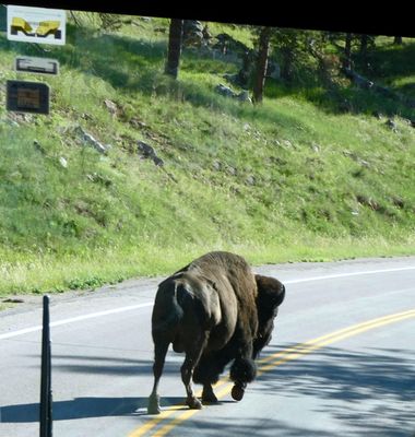 Last Bison delay leaving Custer State Park |
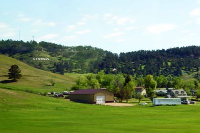 Passing Sturgis, SD |
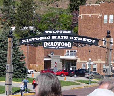 Arriving in Deadwood, SD |
 Deadwood tour guide was Blake Joseph, former television personality and now City Commissioner |
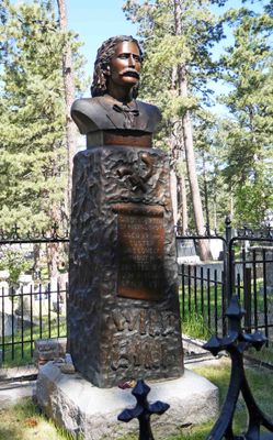
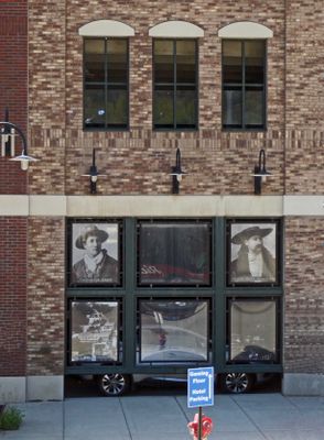 Calamity Jane and Wild Bill Hickok were legends in Deadwood, SD |
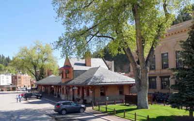 The Deadwood Train Station (1897) is now used as Deadwood History and Information Center |
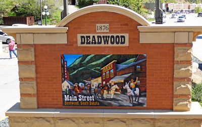 Deadwood Main Street (1876) |
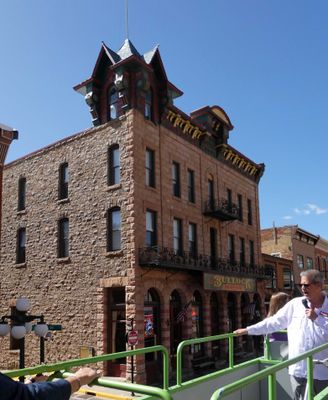
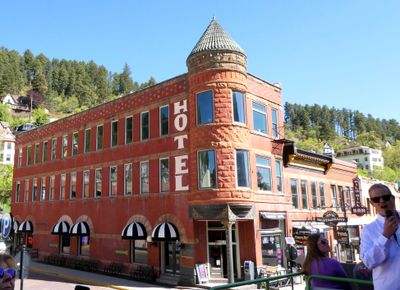 The Fairmont Hotel (1896) in Deadwood, SD |
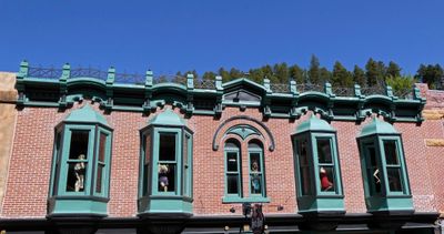
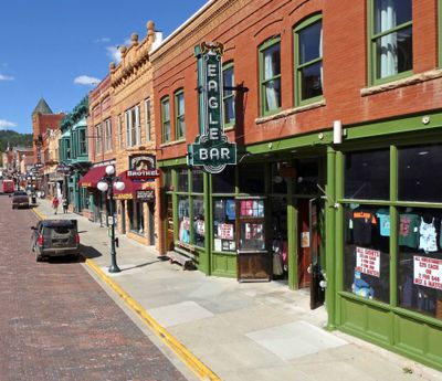 Main Street Deadwood, SD |
 Prostitution was legal in Deadwood, SD, from 1876 until 1980 |
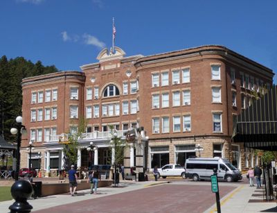
 The Bullock Hotel (opened 1896) Deadwood,SD |
 Franklin Hotel in Deadwood (1903) has hosted Teddy Roosevelt, Babe Ruth, and John Wayne (to name a few) |
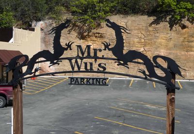 Mr. Wu's parking marks the location of what was the largest Chinatown of any city east of San Francisco in the 1800's |
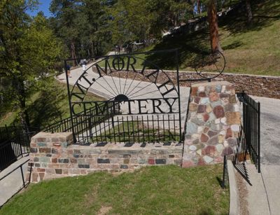 Visiting Mt. Moriah Cemetery in Deadwood, SD (est. 1878) |
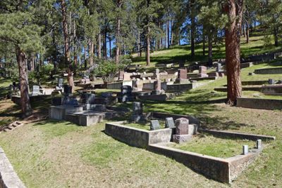 Deadwood's Mt. Moriah Cemetery is also known as Boot Hill |
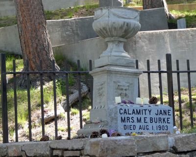 Grave of Calamity Jane in Mt. Moriah Cemetery |
 Wild Bill Hickok's Grave in Mt. Moriah Cemetery |
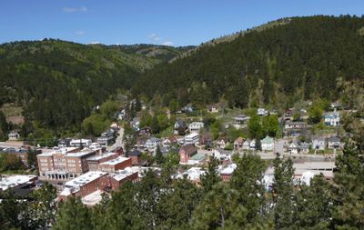 Looking down on Deadwood from Mt. Moriah |
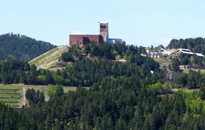 Former Deadwood mine shaft is now the Sanford Underground Research Facility studying dark matter and neutrinos |
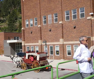
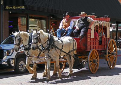 Stagecoach tour in front of Rocksino Casino in Deadwood, SD |
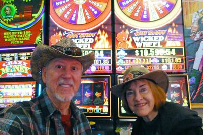 Lunch break in Rocksino Casino in Deadwood, SD |
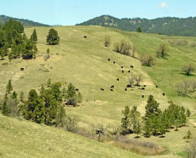 Ranching on the hills of Wyoming |
 Cattle and Snow Fence in Wyoming |
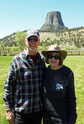
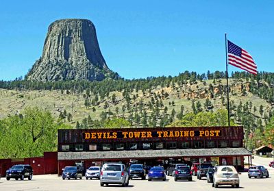 Devils Tower (1,267 feet) in Wyoming was designated as America's first national monument in 1906 by President Theodore Roosevelt |
 Over twenty Native American tribes have cultural or religious affiliation with Devils Tower |
 Devils Tower was featured in Steven Spielberg’s cult classic "Close Encounters of the Third Kind" |
 Bill couldn't resist trying the Devils Tower Lager |
 Best Margarita of the trip was at La Herradura in Sheridan, WY |
 The food at La Herradura in Sheridan, WY, was very good |
 Sheridan, Wyoming Statue called 'Bigger Flies for Tired Eyes' |
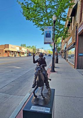 Sheridan, Wyoming Main Street |
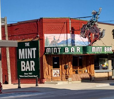 The Mint Bar (1907) in Sheridan, Wyoming |
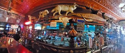 At the Mint Bar in Sheridan, Wyoming |
 Driving through Bighorn National Forest |
 The road we came from |
 Overlook on Bighorn Scenic Byway |
 Starting to see more snow as we go over the Bighorn Mountains |
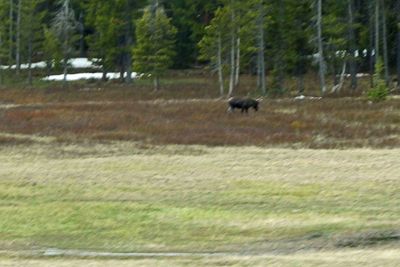 The only moose we saw on this trip |
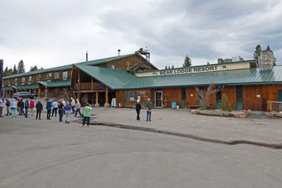 Pit stop at Bear Lodge Resort (8,300 feet elevation) in the Bighorn Mountains |
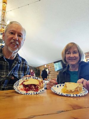 Big Bear Lodge is known for their pie |
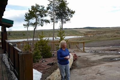 First time Lynn, from Australia, had touched snow |
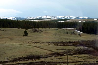 View of the Bighorn Mountain peaks from U.S. Hwy 14 |
 Snow along U.S. 14 (Bighorn Scenic Byway) |
 Coming down from the Bighorn Mountains |
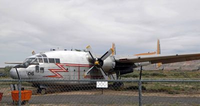 Fairchild C-119 Flying Boxcar is an American Military Transport used in World War II on display adjacent to Greybull Rest |
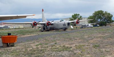 PB4Y-2 Super Privateer is an American World War II and Korean War era patrol bomber of the U.S. Navy |
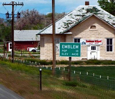 Driving through Emblem, WY, population 10 |
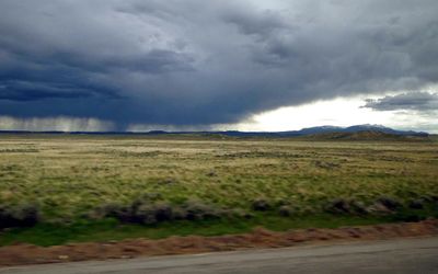 Watching rain across the plains of WY |
 View of the Absaroka Mountain Range from outside Cody, Wyoming |
 "High 'n' Dry" Sculpture in Cody, WY |
 Shoshone River in Wyoming |
 Mountain Wildflowers along the Chief Joseph Scenic Byway in Wyoming |
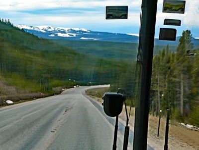
 Driving through the Absaroka Mountains |
 Stop at 'Dead Indian Summit Overlook' (8,048 ft elevation) |
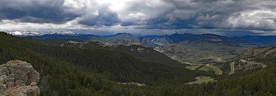 Panorama of Absaroka Range from Dead Indian Pass in Wyoming |
 Sculpture at Dead Indian Summit Overlook, Wyoming |
 Sunlight Gorge, Wyoming |
 Mountain Lake along Beartooth Hwy in Wyoming |
 Clarks Fork River is a tributary of the Yellowstone River |
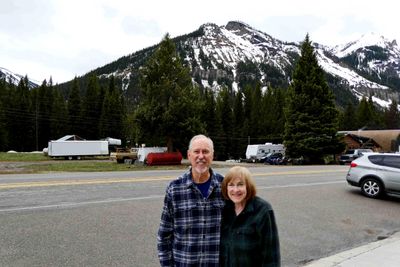 Pit stop in Cooke City, Montana, on the way to Yellowstone National Park |
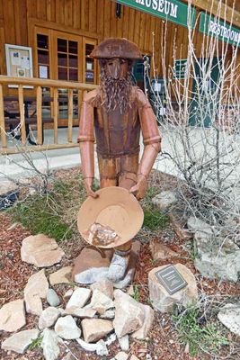 Gold was discovered around Cooke City, MT in 1869-70 |
 Cooke City, Montana, elevation is 7,651 feet |
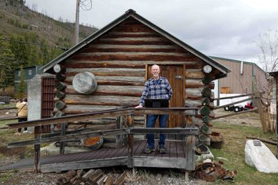
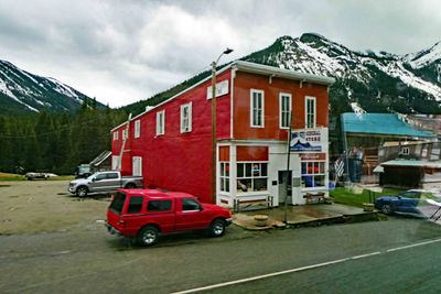 The Cook County Store was built in the late 1880's |
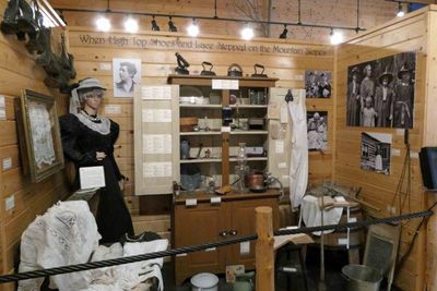 Cooke City, MT, has a small museum inside the visitors center |
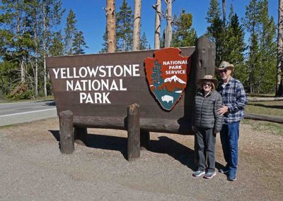
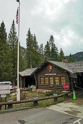 At the Northeast Entrance Station to Yellowstone National Park |
 Spotted a fox in the woods in Yellowstone |
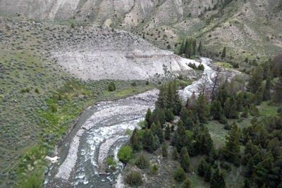
 Crossing the Yellowstone River |
 Small waterfall in Yellowstone National Park |
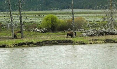
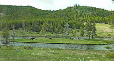
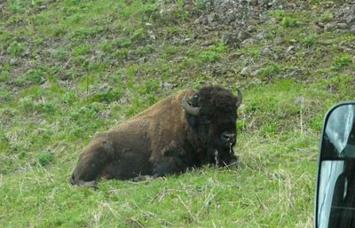 First Bison spotted at Yellowstone National Park |
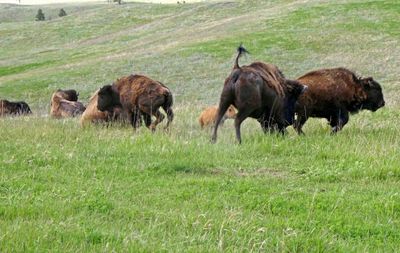
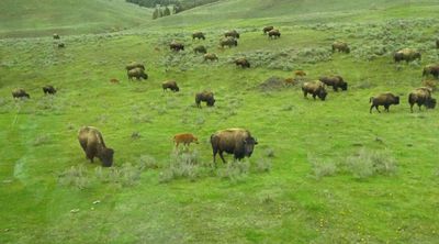
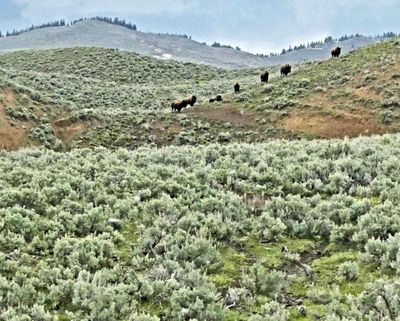
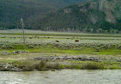 Bison herd in Lamar Valley in Yellowstone National Park |
 Bison scratching an itch beside the Yellowstone River |
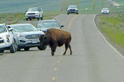 Bison are not worried about traffic in Yellowstone |
 Bison shedding the winter coat |
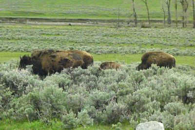
 Another Bison herd with calves in Lamar Valley in Yellowstone |
 Bison climbing a hill in the Lamar Valley of Yellowstone |
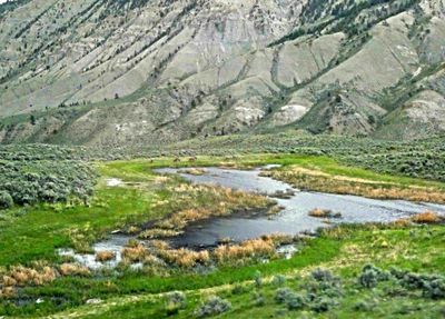
 Driving above the Yellowstone River |
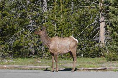
 Elk grazing along the Yellowstone River |
 Elk in Lamar Valley in Yellowstone |
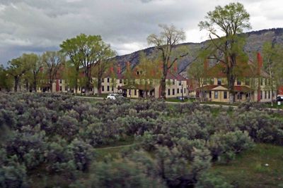 35 buildings from the late 1890's remain from Fort Yellowstone near Mammoth Hot Springs Hotel |
 Buildings from Fort Yellowstone are now used for Park Headquarters and employee housing |
 Elk on the lawn of Mammoth Hot Springs Hotel |
 Mammoth Hot Springs Hotel built in 1883 was the first 'grand hotel' built in Yellowstone National Park |
 Mammoth Grand Hotel rooms have been upgraded many times since 1883 |
 Mammoth Hot Springs Hotel has retained a few historic touches |
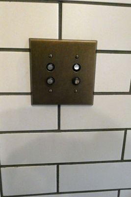 Historic style light switches in Mammoth Hot Springs Hotel |
 Mammoth Hot Springs is at 6,239 feet elevation |
 Mammoth Hot Springs is within walking distance of Mammoth Hot Springs Hotel |
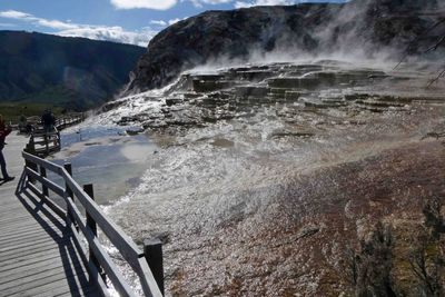
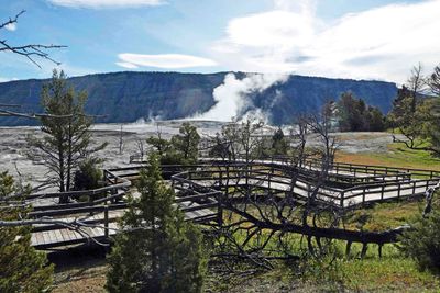 Wooden walkway through Mammoth Hot Springs in Yellowstone |
 Mammoth Hot Springs looks a little like a scene from a science fiction movie |
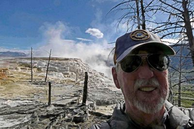 Bill walking around Mammoth Hot Springs in Yellowstone National Park |
 Travertine mounds in Yellowstone at Mammoth Hot Springs |
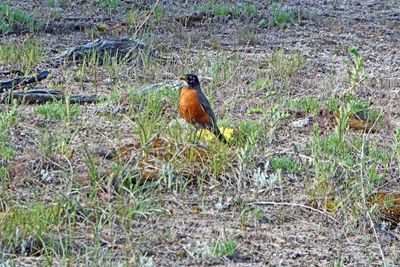 American Robin along the Mammoth Hot Springs Walkway |
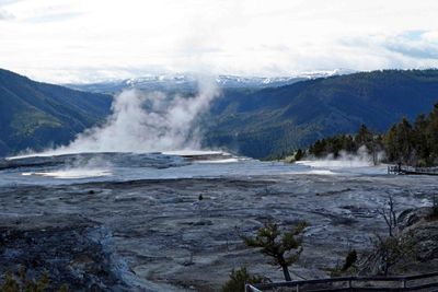 Mammoth Hot Springs Overlook in Yellowstone |
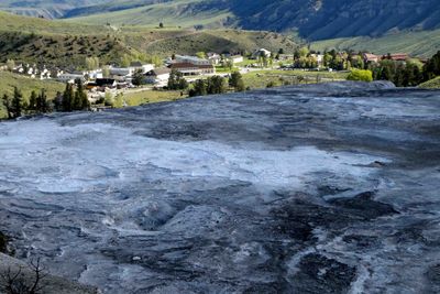 View of Mammoth Hot Springs Hotel property from the top of Mammoth Hot Springs |
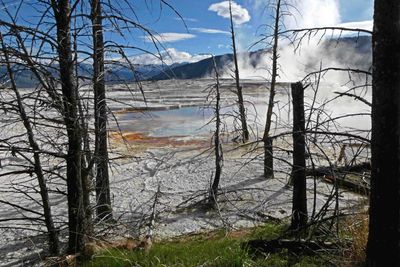
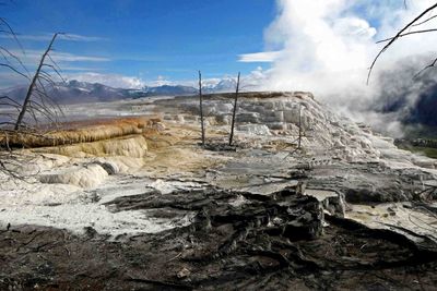
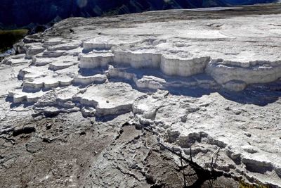 Travertine Terraces in Mammoth Hot Springs in Yellowstone |
 Black Travertine Terrace in Mammoth Hot Springs in Yellowstone |
Wide shot of impressive Travetine Terraces at Mammoth Hot Springs in Yellowstone |
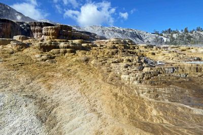 Colored Travertine Terraces in Mammoth Hot Springs in Yellowstone |
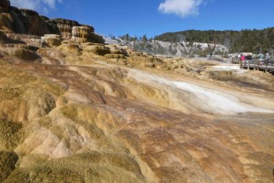 Mound Terrace at Mammoth Hot Springs in Yellowstone |
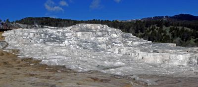 Minerva Terrace at Mammoth Hot Springs in Yellowstone |
 'Liberty Cap' (named is 1871) is a travetine deposit built up by a now dormant hot spring |
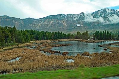
 Mountain lake in Yellowstone National Park |
 Rustic Falls in Yellowstone National Park |
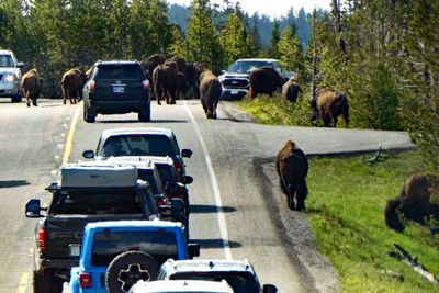 Half-hour Bison Traffic Jam in Yellowstone |
 Crossing the Yellowstone River |
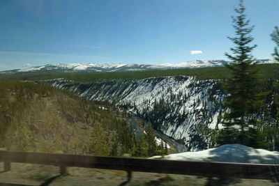
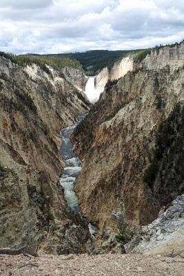 Grand Canyon of Yellowstone |
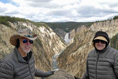 Overlooking the Lower Falls in the Grand Canyon of Yellowstone |
 Lunch stop at Canyon Village in Yellowstone National Park |
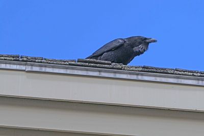 Raven in Canyon Village in Yellowstone National Park |
 Snowdrift taller than Susan at Canyon Village in Yellowstone |
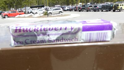 Huckleberries are found in everything you can imagine in Yellowstone store |
 Elk on the lawn of the Lake Yellowstone Hotel |
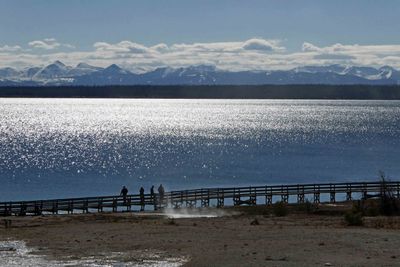
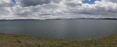 Yellowstone Lake viewed from Yellowstone Lake Hotel |
 Mount Sheridan, elevation 10,313 feet (Red Mountains) across Yellowstone Lake |
 Susan on porch of Yellowstone Lake Hotel (built in 1891) |
 Bar inside the Yellowstone Lake Hotel |
 Saying goodbye to the elk at the Yellowstone Lake Hotel |
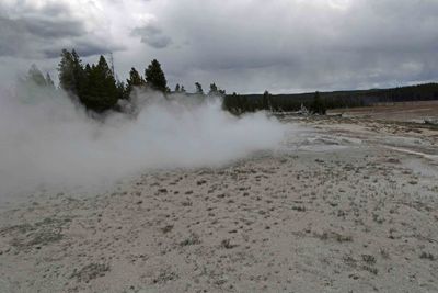
 Fountain Paint Pot Trail goes through one of the most dynamic hydrotherrmal areas in Yellowstone National Park |
 Snow flurries along the Paint Pot Trail in Yellowstone in May |
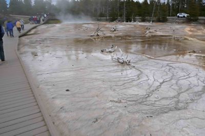
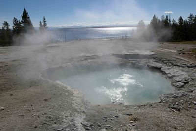
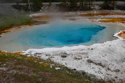 Celestine Pool is a hot spring on the Fountain Paint Pot Trail |
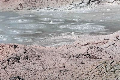 Bubbling Mud Pot on Fountain Pot Trail in Yellowstone |
 Geyser along Fountain Paint Pot Trail in Yellowstone |
 Fumarole on the Fountain Pot Trail in Yellowstone |
 Smaller geyser along the Fountain Paint Pot Trail in Yellowstone |
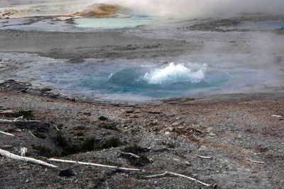 Watching a bubbling pool along the Fountain Paint Pot Trail |
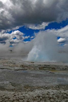
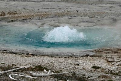 Bubbling pool getting bigger along the Fountain Paint Pot Trail |
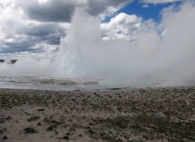
 Bubbling pool turns into small Spouter Geyser along Fountain Paint Pot Trail |
 Bison on an island in Yellowstone River |
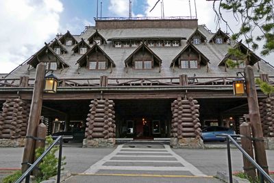 Arriving at Old Faithful Inn (built in 1903-04) in Yellowstone National Park |
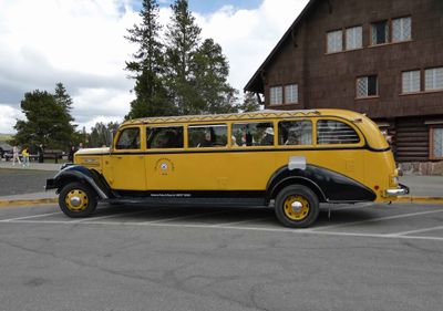 Yellowstone vintage tour bus parked in front of Old Faithful Inn |
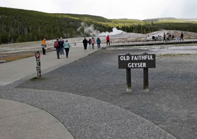 It's a short walk from Old Faithful Inn to Old Faithful Geyser |
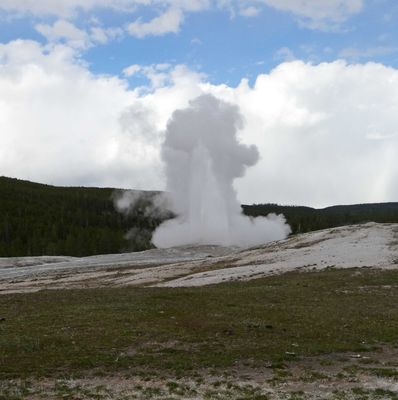 Old Faithful starting to erupt in the afternoon |
 Old Faithful late afternoon eruption in Yellowstone National Park |
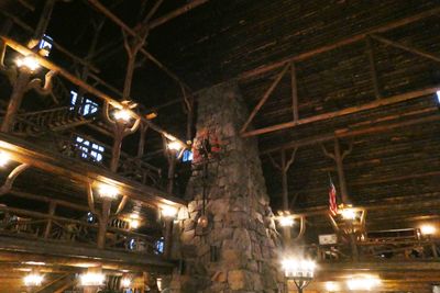 Old Faithful Inn's stone fireplace has 500 lbs of volcanic rhyolite quarried about five miles from the construction site |
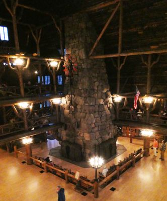 Old Faithful Inn is one of the largest log structures in the world |
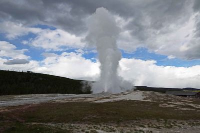
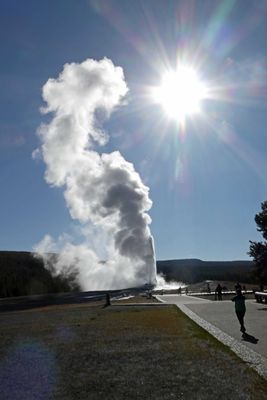 Early morning eruption of Old Faithful |
 Elk in the parking lot of West Thumb Geyser in Yellowstone |
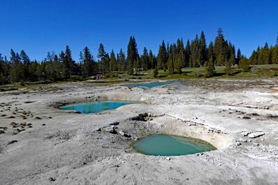 Painted pools in West Thumb Geyser Basin in Yellowstone |
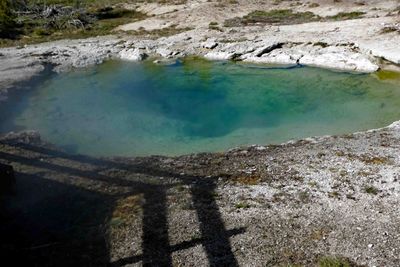 Collapsing Pool in West Thumb Geyser Basin |
 West Thumb Geyser walkway along Yellowstone Lake |
 Ledge Spring in West Thumb Geyser Basin in Yellowstone |
 Snowy banks of the Yellowstone River |
 Leaving Yellowstone National Park |
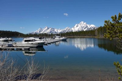 Jackson Lake in Grand Teton National Park is at 6,772 ft elevation |
 The Snake River in Grand Teton National Park |
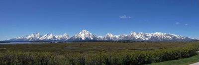 Ten peaks in the Grand Tetons are over 12,000 feet in elevation |
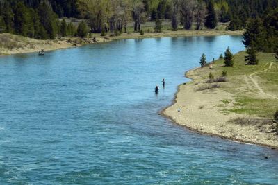 Fly fishing on the Snake River in Grand Teton National Park |
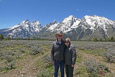 Photo stop at Teton Fault viewpoint |
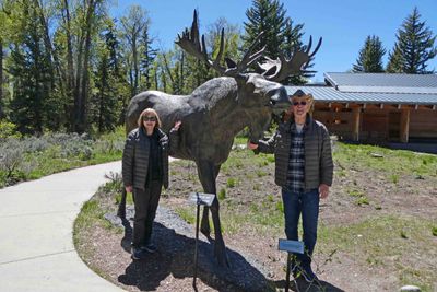 Moose statue at a rest stop in Grand Teton National Park |
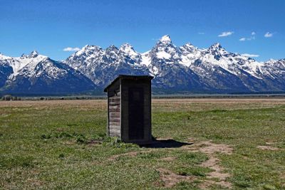
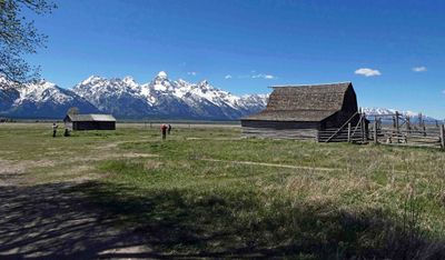 Mormon Row Historic District (settled in the 1890's) grew to a total of 33 homesteads |
 The last homestead in the Mormon Row Historic District was sold after almost 100 years |
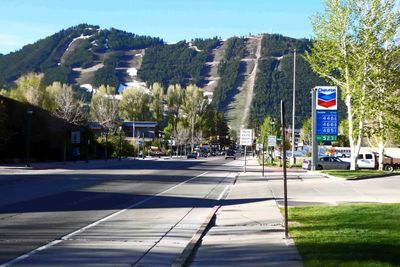 Snow is almost gone on Jackson, Wyoming Ski Runs |
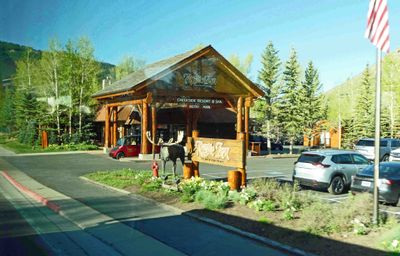 Arriving at the Rustic Inn Creekside Resort and Spa, Jackson, WY |
 Staying overnight at the Rustic Inn at Jackson Hole, Wyoming |
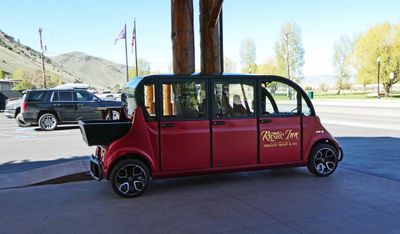 Shuttle to downtown Jackson, WY |
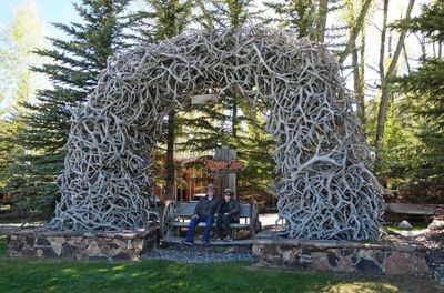 Antler Arch at the Rustic Inn at Jackson Hole, WY |
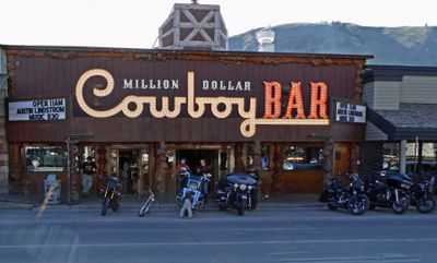 The Million Dollar Cowboy Bar in Jackson, WY, was built in the 1930's |
 The Million Dollar Cowboy Bar has live music and dancing nightly |
 The Million Dollar Cowboy Bar has Saddles for barstools |
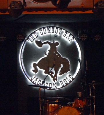
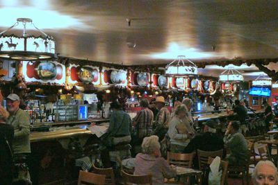
 Having drinks at the Million Dollar Cowboy Bar in Jackson, WY |
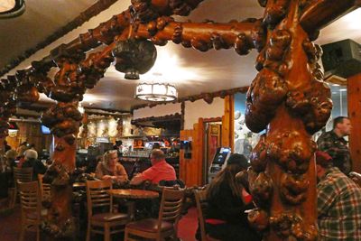 Burled, longpole pine wood in the Million Dollar Cowboy Bar |
 Decorations in Million Dollar Cowboy Bar, Jackson, WY |
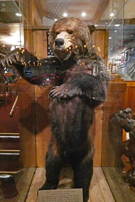 Rocky Mountain Grizzly Bear in Million Dollar Cowboy Bar, Jackson, WY |
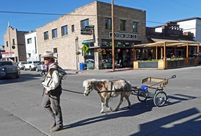 On the street in Jackson, Wyoming |
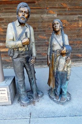 Beaver Dick (trapper), Jenny Leigh (Shoshone wife), and son are historical figures in Wyoming |
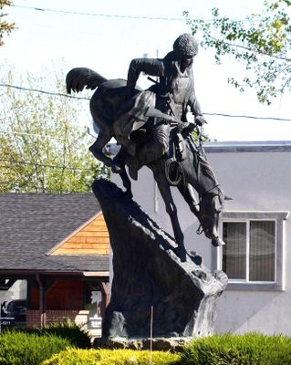
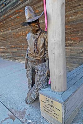 'Slim' is a bronze statue on the street in Jackson, WY |
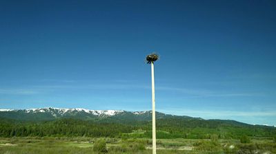 Osprey nest outside Jackson, WY |
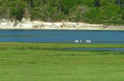 Osprey on Flat Creek, WY |
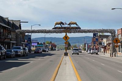 World's largest Elkhorn Arch in Afton, WY, is comprised of 3,011 intertwined elk antlers and weighs 15 tons |
 'Mountain Man' sculpture in Afton, WY |
 On the street in Afton, WY |
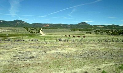
 Waiting for cattle to clear the road before continuing in Wyoming |
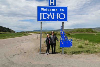 Crossing the border from Wyoming into Idaho |
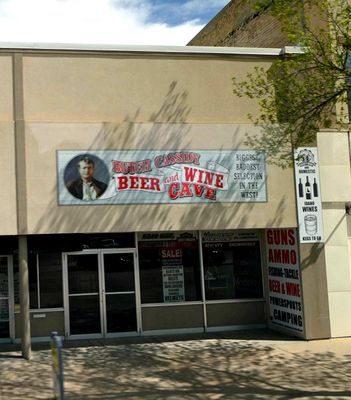 Montpelier, Idaho, is famous for Butch Cassidy living and robbing a bank there |
 Probably a really fine house in it's day in Idaho |
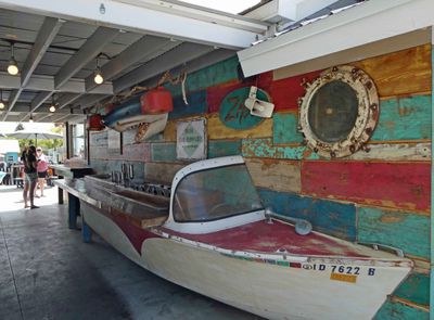
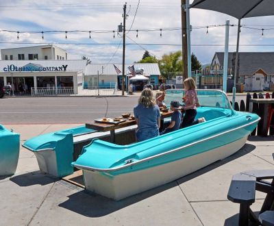 Interesting table at Zipz (outdoor cafe) in Garden City, Utah |
 Interesting condiment bar at Zipz in Garden City, Utah |
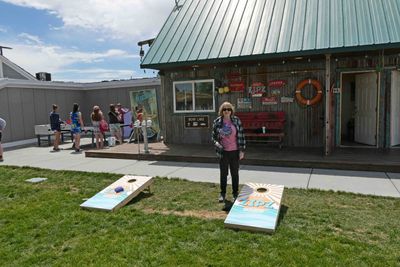 Game of cornhole after lunch at Zipz in Garden City, Utah |
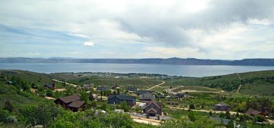 Bear Lake is 20 miles long, 8 miles wide, and straddles the Utah-Idaho border |
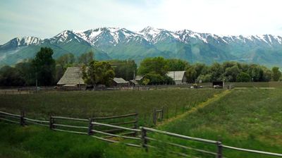
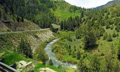 Driving in Logan Canyon, Utah |
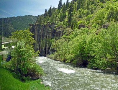 The Logan River is 53.7 miles long and flows through Idaho and Utah |
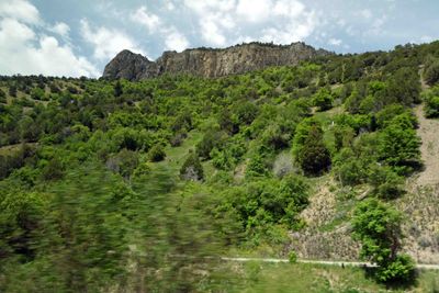 Logan Canyon, Utah |
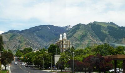 Mormon Temple in Logan, Utah, was built in 1877-84 |
 The Promontory Mountains just south of Logan, Utah |
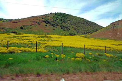 Wildflowers in Utah along U.S. 89 |
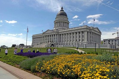 Utah state capital in Salt Lake City |
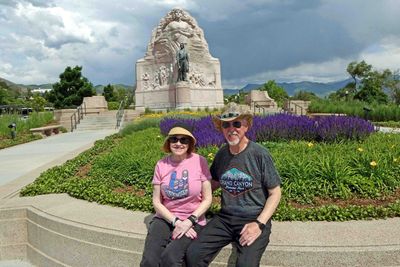 Mormon Battalion Monument dedicated to 500 Mormons who volunteered during the Mexican-American War |
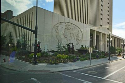 Office Building for The Church of Jesus Christ of Latter-day Saints in Salt Lake City |
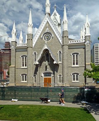 Salt Lake Assembly Hall (Church of Jesus Christ of Latter-day Saints) was completed in 1882 |
 Metal art on the plains of Utah |
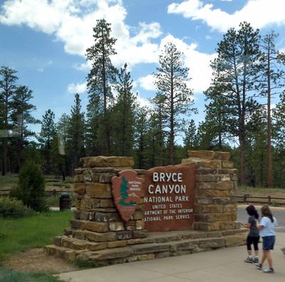 Entering Bryce Canyon National Park in Utah |
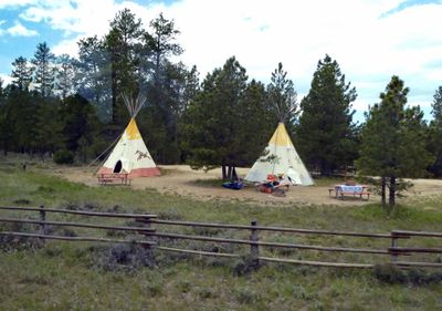 Tipis for rent inside Bryce Canyon National Park |
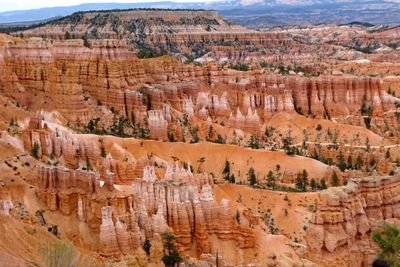
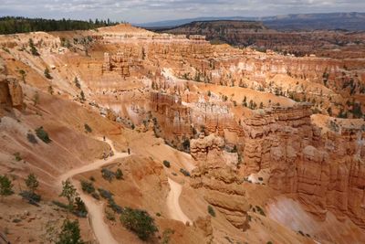
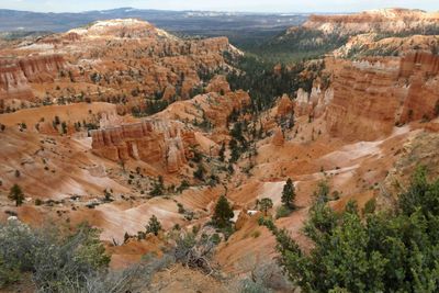
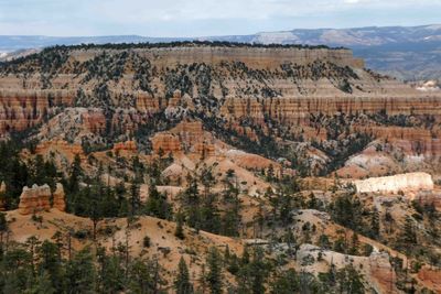
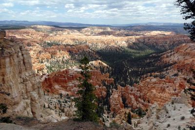 View of Bryce Canyon from elevation of 8,300 feet |
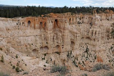
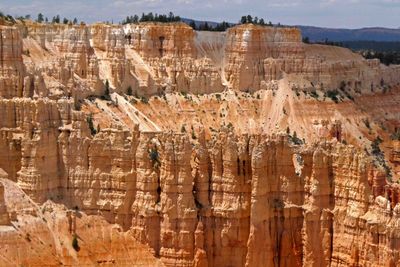
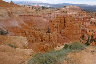
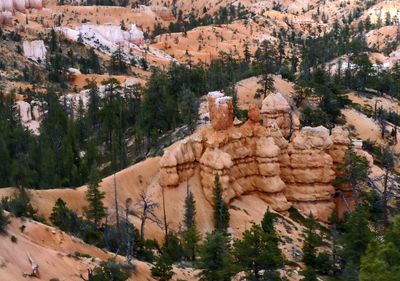
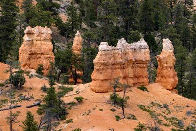
 Colorful 'hoodoos' in Bryce Canyon, Utah |
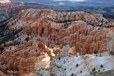
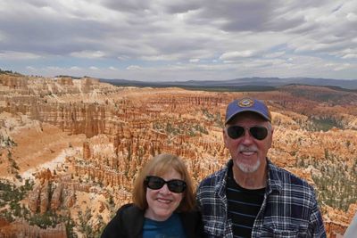 Susan & Bill at Bryce Point in Bryce Canyon National Park |
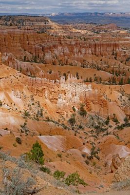
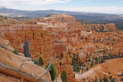
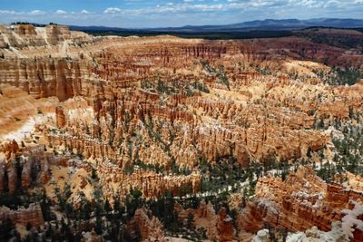 View from Bryce Point |
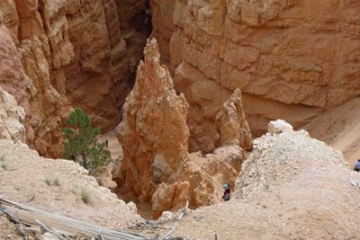
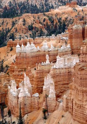
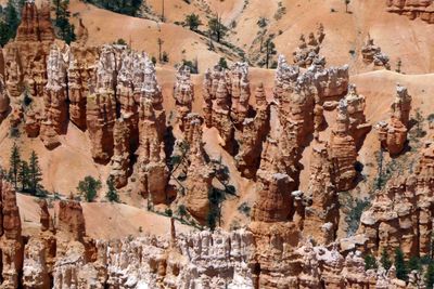 Close-up of hoodoos in Bryce Canyon National Park |
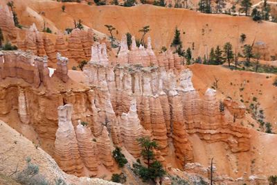
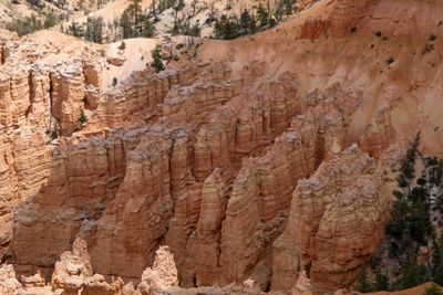 Hoodoos in rows in Bryce Canyon National Park |
 Another view from Bryce Point |
 Final shot from Bryce Point in Bryce Canyon National Park |
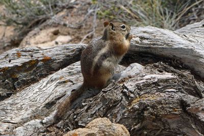 Golden-mantled Ground Squirrel at Bryce Point in Bryce Canyon National Park |
 Sunset Point in Bryce Canyon National Park |
 View from Sunset Point in Bryce Canyon National Park |
 Looking at the trail down into Bryce Canyon |
 Looking down into Bryce Canyon at hikers from the trail rim near Sunset Point |
 Walking along the rim of Bryce Canyon |
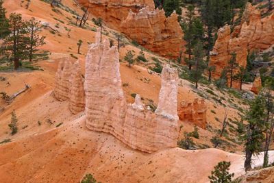
 Hoodoos in Bryce Canyon can reach heights of 150 feet tall |
 On the Bryce Canyon Rim between Sunset Point and Sunrise Point |
 More hoodoos while walking along the Bryce Canyon Rim |
 First look at the 'Queens Garden' in Bryce Canyon National Park |
 Part of the 'Queens Garden' in Bryce Canyon |
 Changing shapes and colors along the rim of Bryce Canyon |
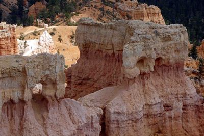 Holes in rocks in Bryce Canyon are known as 'windows' |
 Another different shape in Bryce Canyon National Park |
 These appear to have been set down on sand in Bryce Canyon |
 Horse trail in Bryce Canyon National Park |
 Looking toward the Chinese Wall in Bryce Canyon National Park |
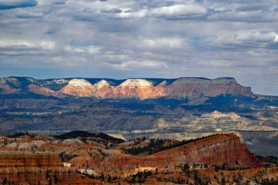 Bryce Canyon High Plateau |
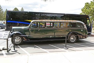 1938 White Motor Company 706 was used as a touring vehicle between Zion, Bryce Canyon, Gand Canyon, and Cedar Breaks |
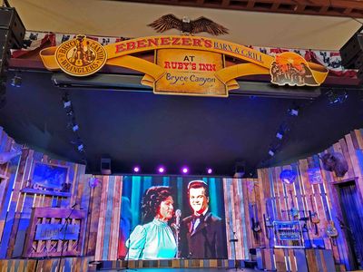 Dinner Show in Bryce Canyon City, Utah |
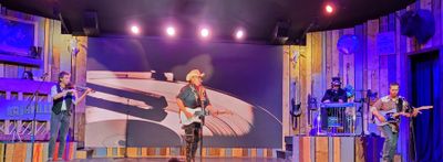 Band at Dinner Show in Bryce Canyon City |
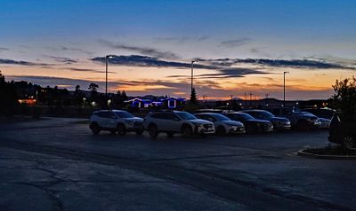 Walking back to our hotel after the Dinner Show in Bryce Canyon City, Utah |
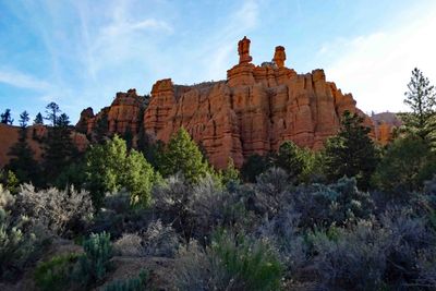 Entering Red Canyon in Utah |
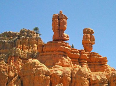 "Salt and Pepper Shakers" in Red Canyon in Utah |
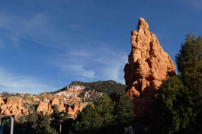 Red Canyon is in the Dixie National Forest in Utah |
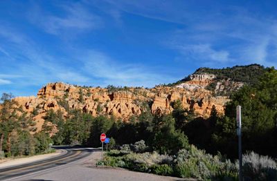 Rock formations in Red Canyon, Utah |
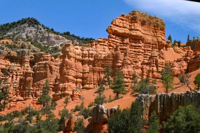 Red Canyon in Utah |
 Leaving Red Canyon in Utah |
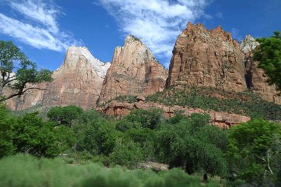
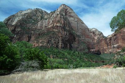
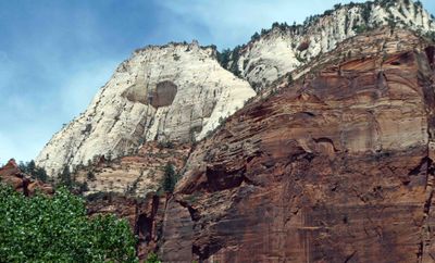
 Temple Cap Formation in Zion National Park |
 Rock formation almost looks like it was painted |
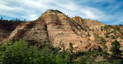
 Heading into Zion National Park in Utah |
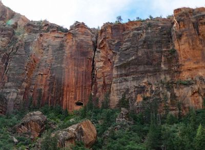
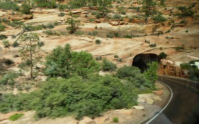 Entering natural rock tunnel in Zion National Park |
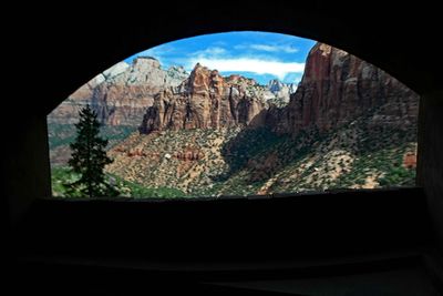 View from window carved in the side of the natural rock tunnel in Zion National Park |
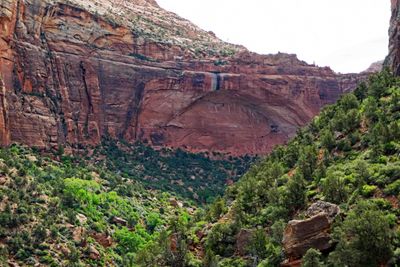
 Hole at the bottom is the window from the previous photo inside the tunnel in Zion National Park |
 The 'Great Arch' in Zion Natural Park |
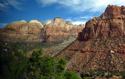
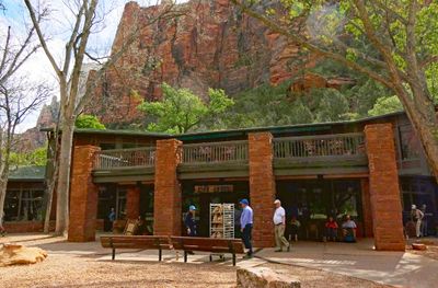
 "The Court of the Patriarchs" in Zion National Park |
 Sack lunches ready for pickup in Zion National Park |
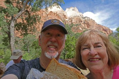 Picnic lunch spot in Zion Canyon, Utah |
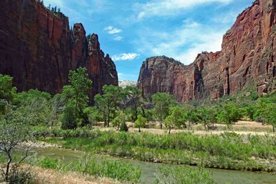
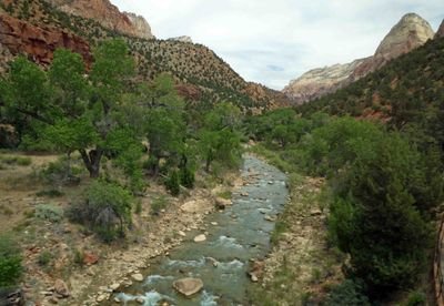
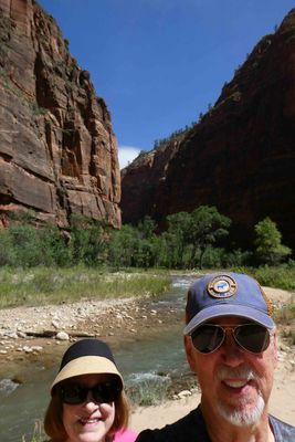 At the bottom of Zion Canyon along the Virgin River |
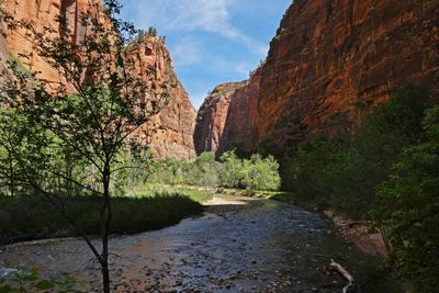 The Virgin River flows through Zion Canyon |
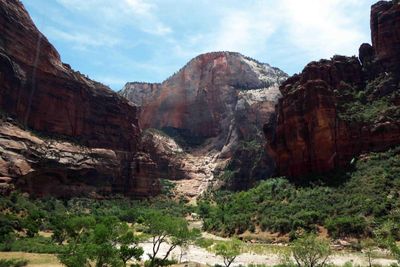
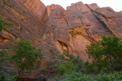 Looking up at the sheer cliffs from the bottom of Zion Canyon |
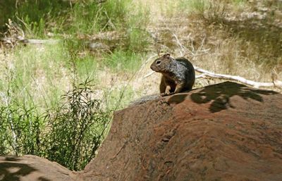 Rock Squirrel on a rock along the Riverside Walk in Zion Canyon |
 "The Pulpit" Rock at Temple of Sinawava in Zion National Park |
 Vegetation in Zion Canyon |
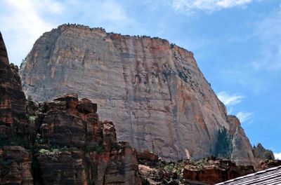 "The Great White Throne" in Zion National Park is 6,747 feet elevation at its highest point |
 Cable Mountain is a 6,940-foot elevation Navajo Sandstone summit in Zion National Park |
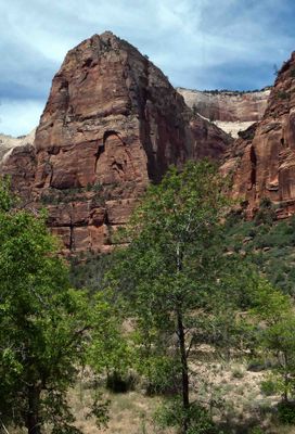 "Angels Landing" in Zion Canyon is a 1,488-foot tall rock formation |
 "Lady Mountain" towers 2700 feet above Zion Lodge and the canyon floor |
 Natural Caves in Zion National Park |
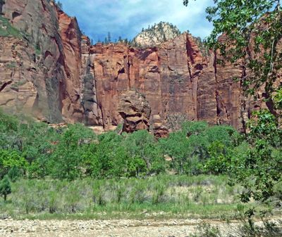
 Last look at the Virgin River in Zion National Park |
 Land for Sale in Utah |
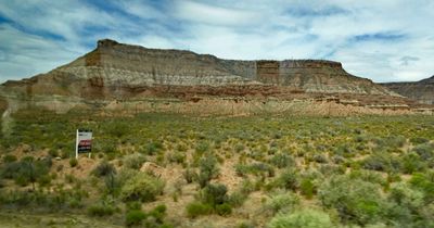
 Part of the Moenkopi formation near Springdale, Utah |
 Mesa in the Utah desert |
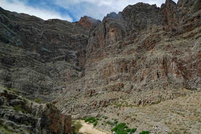 VIrgin River Canyon in Arizona |
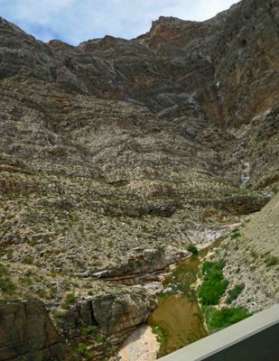 Virgin River Gorge in Arizona |
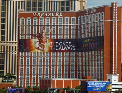 Back at Treasure Island for one night |
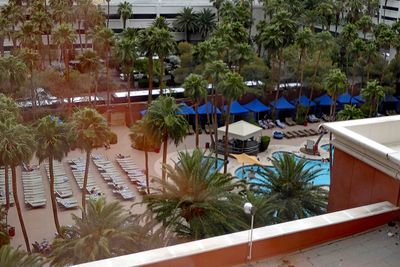 Room overlooking Treasure Island Pool |
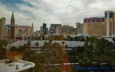 View of Las Vegas Strip from our room in Treasure Island |
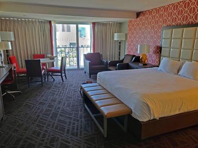 Checked into our hotel room in the Horseshoe (formerly Bally's) Casino in Las Vegas |
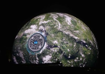
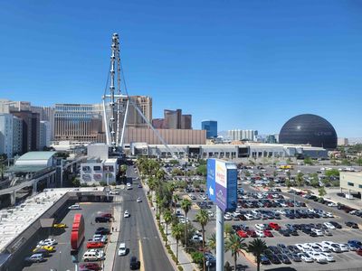 View of High Roller and The Sphere from our room in the Horseshoe Casino |
 Daytime view of The Sphere in Las Vegas |
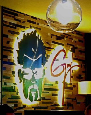 Guy Fieri's new Flavortown Sports Kitchen in the Horseshoe in Las Vegas |
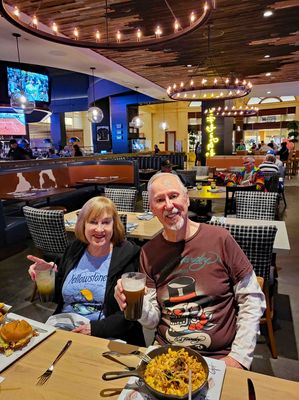 Dinner at Guy Fieri's Flavortown Sports Kitchen in Las Vegas |
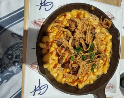 Brisket Mac and Cheese at Guy's Fieri's Flavortown Sports Kitchen |
 Excellent Cheeseburger at Guy Fieri's Flavortown Sports Kitchen in Las Vegas |
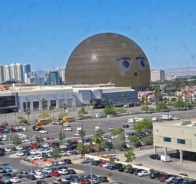
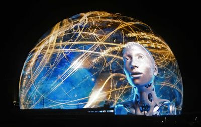
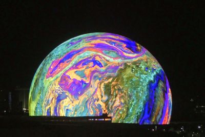 Watching The Sphere's changing colors from our hotel room |
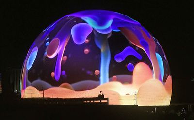 Interesting to watch the changing skin of The Sphere from our hotel room |
 Changing look of The Sphere as seen from our hotel room |
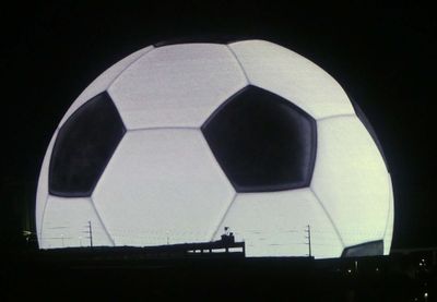 The Sphere changed to look like a giant soccer ball |
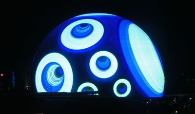
 Very unusual look at the Sphere from our hotel room |
 Watching the changing patterns on The Sphere from our hotel room |
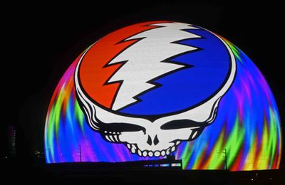 Grateful Dead 'Steal Your Face' logo on the Sphere |
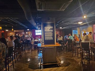 Inside the Speakeasy at the Mob Museum in Las Vegas, Nevada |
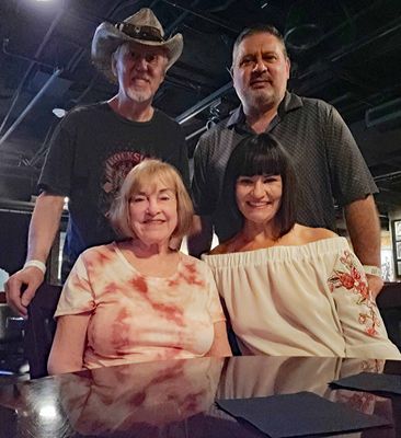 At the Mob Museum with Todd and Meredith |
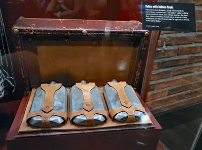 Prohibition-era valise with hidden flasks, made by Abercrombie & Fitch |
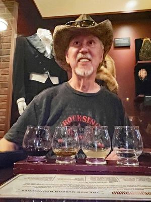 Bill drinking the Mob Museum Moonshine Flight |
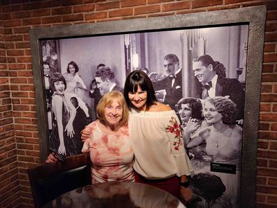 Susan & Meredith blending in with the Prohibition-era Speakeasy patrons |
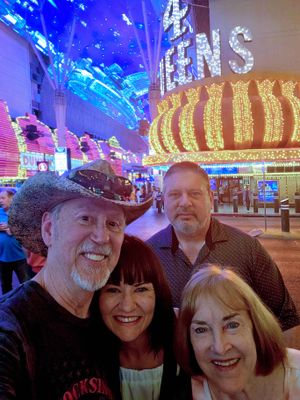 Good time with friends on Fremont Street in Las Vegas |
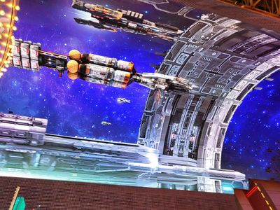 Star Wars on the canopy above Fremont Street |
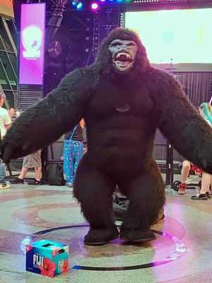 King Kong on Fremont Street in Las Vegas |
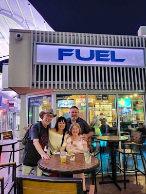 Finishing the day at our favorite Fuel Bar in Las Vegas at 1:30 AM |
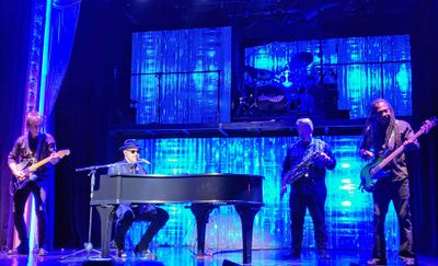 Attending a 'Piano Man' Tribute to Billy Joel and Elton John |
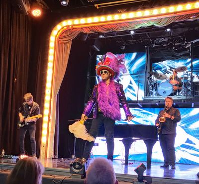 'Piano Man' tribute to Elton John |
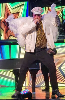 'Piano Man' with his tribute to Elton John |
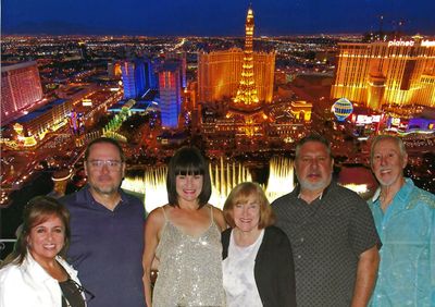 Photo after Piano Man with Penny, Russell, Meredith, Susan, Todd, & Bill |
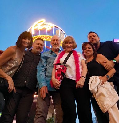 Photo from Bill's Samsung Z-flip phone on the street in Las Vegas |
| comment | share |