


|
|
|
|
|
|
| Dave Lloyd | profile | all galleries >> USA >> California >> Death Valley - Color | tree view | thumbnails | slideshow |
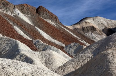
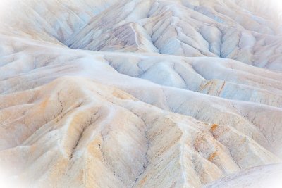 Abstract Badlands, Zabriskie Point (12/9/10) |
 Hikers approaching Zabriskie Point (12/9/10) |
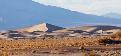
 Ridge, Mesquite Flat Dunes (12/10/10) |
 Sea of sand, Mesquite Flat Dunes (12/10/10) |
 Rock outcrop, Mesquite Flat Dunes (12/10/10) |
 Mosaic Canyon (12/10/10) |
 Mosaic Canyon (12/10/10) |
 Mosaic Canyon (12/10/10) |
 Evening, Mesquite Flat dunes (12/10/10) |
 Mudflats near Devil's Cornfield (12/10/10) |
 Badwater, looking north at dawn (12/11/10) |
 Sunrise, Badwater (12/11/10) |
 Sunrise, Badwater (12/11/10) |
 Devil's Golf Course (12/11/10) |
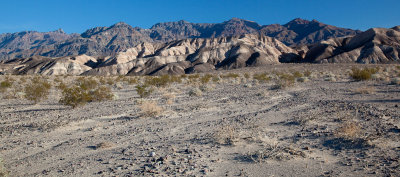
 Eastern Amargosa Mountains (12/11/10) |
 Upper Titanothere Canyon (12/11/10) |
 View south-east from Red Pass (12/11/10) |
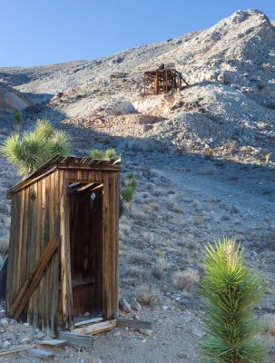
 Mining ruins, Leadfield (12/11/10) |
 Mine entrance, Leadfield (12/11/10) |
 Mine building, Leadfield (12/11/10) |
 Fall Canyon (12/11/10) |
 Lower end of Fall Canyon (12/11/10) |
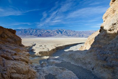
 Wash below Fall Canyon (12/11/10) |
 Morning, Mesquite Flat Dunes (12/12/10) |
 Hills near Beatty Cutoff (12/12/10) |
 Desert near Ubehebe Crater (12/12/10) |
 Farrabee's Wrangler, near Ubehebe Crater (12/12/10) |
 Racetrack Valley (12/12/10) |
 A walking stone, Racetrack Valley (12/12/10) |
 Walking stones, Racetrack Valley (12/12/10) |
 Cactus (12/12/10) |
 Cactus (12/12/10) |
 Racetrack Valley (12/12/10) |
 Joshua Trees, Hidden Valley (12/12/10) |
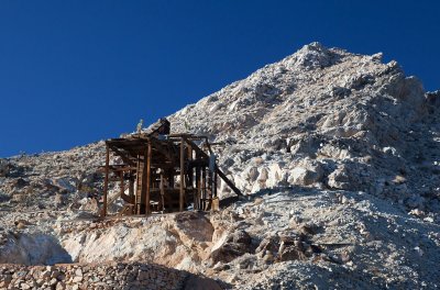
 The facility, Lost Burro Mine (12/12/10) |
 Ore crusher, Lost Burro Mine (12/12/10) |
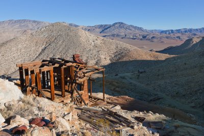 Ore crusher, Lost Burro Mine (12/12/10) |
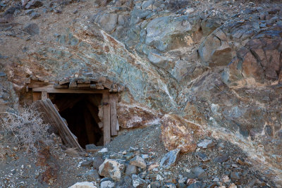 Entrance, Lost Burro Mine (12/12/10) |
 Dusk, Panamint Valley from Hunter Canyon (12/12/10) |
 Erosion in the alluvial fan, below Gower Gulch (12/13/10) |
 Above the first fall, Gower Gulch (12/13/10) |
 Badlands, Gower Gulch (12/13/10) |
 Badlands, Gower Gulch (12/13/10) |
 Entrance, borax mine, Gower Gulch (12/13/10) |
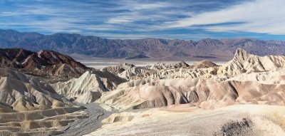 Upper Gower Gulch and badlands from Zabriskie Pont (12/13/10) |
 Badlands below Manly Beacon (12/13/10) |
 Borax mule train wagon (12/13/10) |
 Harmony borax works boiler (12/13/10) |
 The obligatory sunset to close, looking towards Furnace Creek (12/13/10) |
| comment | share |