photo sharing and upload picture albums photo forums search pictures popular photos photography help login
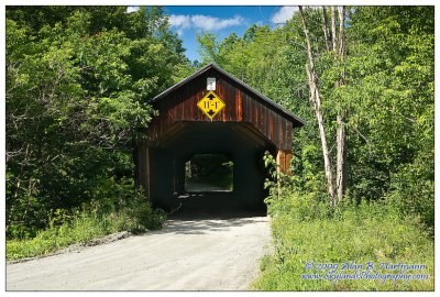
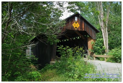
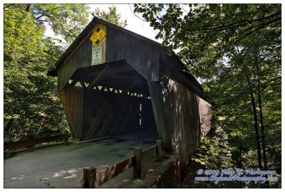
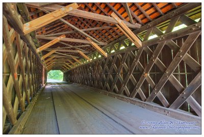
Alan Hartmann | profile | all galleries >> Covered Bridges >> Covered Bridges of Vermont >> 45-14-01 Windsor County, Martins Mill Covered Bridge tree view | thumbnails | slideshow | map

45-14-01 Windsor County, Martins Mill Covered Bridge

On Martinsville Rd., apx 0.5 miles east of Rt 5, just north of the interchange with I91, Hartland Twp. Spans Mulls Brook. The GPS coordinates are within a hundred feet or so of I91, but the bridge is not accessible from the highway -- don't let your GPS plot a course that takes you north of Exit 9 on I91! (I did, and wasted 20 miles backtracking from I89!)

PBase Maps

N43 31.925 W72 23.775
SKY32449.jpg
SKY32449.jpg
SKY32452.jpg
SKY32452.jpg
SKY32459.jpg
SKY32459.jpg
SKY32464.jpg
SKY32464.jpg
SKY32466.jpg
SKY32466.jpg