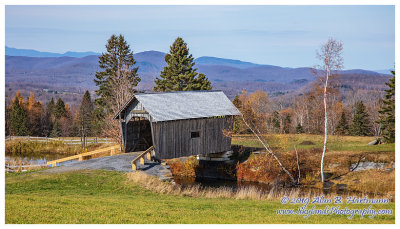
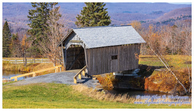
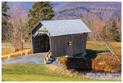
Alan Hartmann |
profile
|
all galleries
>>
Covered Bridges
>>
Covered Bridges of Vermont
>> 45-12-75 Washington County, A.M Foster CB
tree view
| thumbnails |
slideshow
|
map
45-12-75 Washington County, A.M Foster CB
This bridge is on private property. It's visible from Cabot Plains Rd, Cabot VT, apx 1.5 miles east of Rt 215.
Spans a pond.
GPS 44.4237, -72.2673
PBase Maps
SKY25754.jpg
SKY25757.jpg
SKY25762.jpg
SKY25764.jpg
SKY25766.jpg
SKY25769.jpg
SKY25771.jpg
comment
|
share
Type your message and click Add Comment
It is best to
login
or
register
first but you may post as a guest.
Enter an optional name and contact email address.
Name
Name
Email
help
private comment
click on thumbnails for full image