Alan Hartmann |
profile
|
all galleries
>>
Covered Bridges
>>
Covered Bridges of Pennsylvania
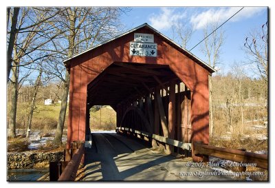
>> 38-19-29 Columbia County, Parr Mill Bridge
tree view
| thumbnails |
slideshow
|
map
38-19-29 Columbia County, Parr Mill Bridge
On Parr's Mill Rd, immediately south of Ashton Hollow Rd at the intersection with Esther Furnace Rd, in Franklin Twp. Many "private property / no trespassing" signs, limited vantage points from public property. Spans Roaring Creek.
N40 54.414 W76 28.349
PBase Maps
Franklin Twp, PA
IA7X3740.jpg
comment
|
share
Type your message and click Add Comment
It is best to
login
or
register
first but you may post as a guest.
Enter an optional name and contact email address.
Name
Name
Email
help
private comment
click on thumbnails for full image