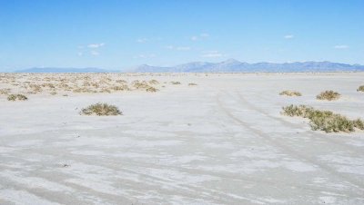
Tire tracks show the two route choices I had. At left was the more direct route closer to the “shore” of Crater Island. It was littered with vegetation mounds and drainage channels. Ahead was the longer route going out to the open playa. Both routes were cursed with ubiquitous patches of wet mud.
When the mud is dry and hard, the longer route on the open playa is by far the more attractive one for handcart hiking because:
1. its surface is fairly even, which uses less effort and involves less jarring
than does the uneven ground created by drainage channels amongst the mounds
2. one can travel pretty much in a series of long straight
lines, (less tiring) than constantly weaving to avoid
obstructions such as mounds or drainage channels
3. being farther out on the playa gives one a greater sense of being in a wild environment.
For these reasons, I used the longer playa route on the return
portion of this first hike and most of the second hike.
I have no idea how old the vehicle tire tracks are. Geo-tagging is approximate.
|