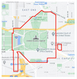
This map of the fences surrounding the US Capitol area was posted on Popville.com on January 29 by a person named Claire, who was quoted as saying:
“I’ve seen lots of posts about the Capitol fence (here and elsewhere), but no one seems to be circulating a map of how far the fence actually extends. So yesterday I circumnavigated it and drew one. For scale, that’s more than three miles of fencing.
“Despite how my somewhat thick line makes it look, the Capitol South metro entrance is on the outside of the fences. And whether or not a specific block is open to traffic, especially on Louisiana Ave, is changing frequently, so consider this a snapshot of a particular point in time when it comes to those finer details. But the overall boundaries are pretty stable at this point.”
Best to view in "Original" because other versions resized by Pbase are decidedly
unsharp.
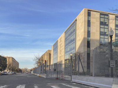
Federal buildings behind fences, too, posted earlier: