


|
|
|
|
|
|
| |
On Tuesday morning, December 27, we left Buenos Aires Ezeiza Airport on Aerolineas Argentinas flight #1892 at 8:35am (left an hour late) and flew to El Calafate, Santa Cruz Province, Argentina arriving around 11:45am. We gathered our luggage, picked up our Avis rental car and began the drive from El Calafate on National Route 40 and Provincial Route 5 to Rio Gallegos to catch National Route 3 northward to Penninsula Valdes in Chubut Province, Argentina. Passing through Guer Aike, Argentina placed us the southern most we have been on planet earth to date, at Latitude 51°38' 60" South. We drove around 12 hours that afternoon and evening, finally checking into Hotel Robert in Caleta Olivia around 1:00am in the morning. After sleeping for about 4 hours we drove the rest of the way on Wednesday, December 28 to Puerto Piramide on Peninsula Valdes arriving around 4pm. We had our first taste of gasoline shortages and lines while filling up in the Trelew area. We had to wait about 45 minutes to fill up the gas tank. It seems some of the YPF refinery workers were striking and causing shortages of gasoline through various areas of Argentina.
Our trip was broken up into three general areas, with the first area being Peninsula Valdes, Punta Loma and Punta Tombo, Argentina on the Atlantic coast.
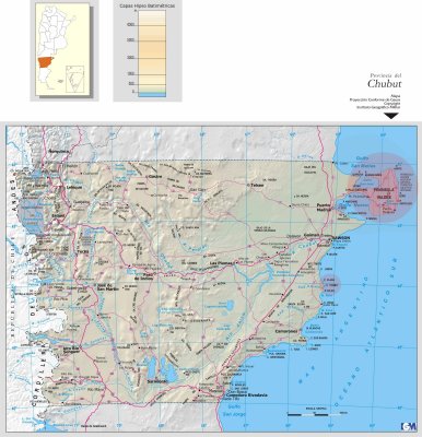
See the map of Chubut Province Argentina - Courtsey of Mapa Proyeccion Conforme de Gauss, Copyright Instituto Geografico Militar. Highlighted in light red are the three areas we visited - Peninsula Valdes, Punta Loma and Punta Tombo.
Copyright by Dan Drost