photo sharing and upload picture albums photo forums search pictures popular photos photography help login
Jean-Marc MICHEL | profile | all galleries >> Galleries >> Kanchanaburi tree view | thumbnails | slideshow

Kanchanaburi

According to most historians, the ancient town of Kanchanaburi was located near Ban Lat Ya, a small village situated approximately 16 kilometers north of the present town. The site was repeatedly recorded in Thai history as an invasion route which the Burmese used to enter Thai Kingdoms.

Kanchanaburi, which has mostly mountainous terrain, covers an area of approximately 19,473 square kilometers and is the third largest province in Thailand after Chiang Mai and Nakhon Ratchasima. Situated approximately 129 kilometres west of Bangkok, Kanchanaburi shares a border with Myanmar to the west, Tak and Uthai Thani Provinces to the north, Suphan Buri and Nakhon Pathom Provinces to the east, and Ratchaburi Province to the south.
In north and west Kanchanaburi, the terrain is comprised mainly of mountains and high plains, with the Thanon Thongchai Range acting as a natural border between Thailand and Myanmar. The range is the source of Kanchanaburis two most important rivers Mae Nam Khwae Noi and Mae Nam Khwae Yai, which form the famous Maenam Mae Klong. As a result, several of Thailand's largest Namtok (waterfalls) and most extensive wildlife sanctuaries are found in this area.
The magnificent landscape and charming beauty of Kanchanaburi have resulted of several well-known waterfalls, caves which were once inhabited by Neolithic man, pristine national parks, tranquil rivers, virgin forests, and reservoir.

The city of Kanchanaburi is located at the point where two tributaries, the Khwae Noi and Khwae Yai meet and form the Maenam Mae Klong. This is the location of the notorious Death Railway and the Bridge on the River Khwae one of the worlds famous World War II sites which have been immortalized in print and film.
In economic terms, Kanchanaburi has been doing well on a national scale, with over 10 per cent growth annually. Important industries include sugar, agricultural products and jewelry.
Residents of Kanchanaburi are engaged in agricultural activities. Most of the locals are of Thai ancestry with notable Mon and Karen minorities. Rural dwellers enjoy living simply and respecting nature. Moreover folk music and dances dating back at least 500 years are still performed today.

Chong Kai War Cemetery: Situated only 2 kilometers south of town on the bank of the Kwai Noi River, the cemetery occupies the site of the Chong Kai which once was the prisoner of war camp. Smaller in size, the cemetery attracts visitors to see its peaceful, well-designed landscape where 1,740 POWs rest in eternal peace.

War Cemetery (Don Rak): This is the place where the remains of 6,982 POWs died during the construction of the Death Railway are buried.

The Thailand-Burma Railway Centre: In an interactive museum, research and information centre dedicated to presenting the story of the Thailand-Burma Railway built during the World War II.The centre is on the western side of the main Kanchanaburi War Cemetery (Don Rak.

The Bridge on the River Khwae (the Death Railway Bridge): Thanks to several films and books, the Bridge on the River Khwae has become notoriously famous and attracted both Thais and foreigners to the site. If an ordinary black iron bridge can tell a story, you can be sure it's a dramatic one.The bridge spans across Maenam Khwae Yai which is a branch of Maenam Mae Klong. During the Japanese occupation of Thailand in World War II, the Japanese Imperial Army brought the iron bridge from Java. It was then resembled by Allied Prisoners of War (POW) under Japanese supervision. The bridge was part of a strategic railway route to Myanmar in which the Japanese aimed to secure supplies with which to conquer other western Asian countries. It was 415 kilometers long (about 303 kilometers in Thailand and about 112 kilometers in Burma) and passed through the Three Pagoda Pass in Sangkhlaburi District, the northern most part of Kanchanaburi province. Construction started on September 16, 1942 at Nong Pladuk, and was completed on 25 December 1943. It is estimated that over 16,000 POWs from England, Australia, Holland and America died while building the bridge which was a target of bombing raids in 1945. In addition to this, approximate 90,000 laborers from Thailand, Myanmar, Malaysia and Indonesia died during its construction.Rebuilt after WWII, the bridge is still in use today with the curved portions of the bridge being that of the original. An attraction of note is the annual light and sound event at the bridge to commemorate the Allied attack in 1945.

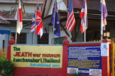
The JEATH War Museum: The name JEATH is derived from countries which engaged in the WWII death railway construction from 1942 to 1945, which included Japan, England, America, Australia, Thailand and Holland. Located in the area of Wat Chai Chumphon, the museum is a reconstruction of the POWs thatched detention hut with cramped, elevated bamboo bunks. On the wall of the huts, photographs and illustrations of the POWs living conditions are on display. POWs who survived from the camp have donated items to enhance the museums atmosphere and authenticity.

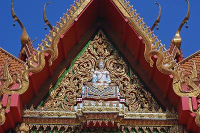
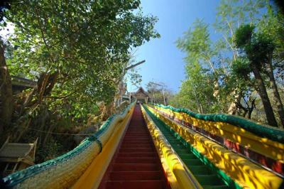
Tham Mangkon Thong Temple (Wat Tham Mangkon Thong): Situated 5 kilometers from town, the splendid temple is located in a cave which is only assessable via steps flanked by dragon carvings on both sides. The temple is well known for the incredible performance of a nun floating on the surface of a deep pool. A small museum displaying a variety of ancient objects found in the area is located nearby.

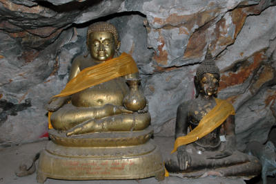
Tham Khao Pun Temple (Wat Tham Khao Pun): Once a major POW camp, the temple where many Buddha images are enshrined is located in the middle cave and is surrounded by stalactites and stalagmites. The temple is 3 kilometers from Chongkai War Cemetery.

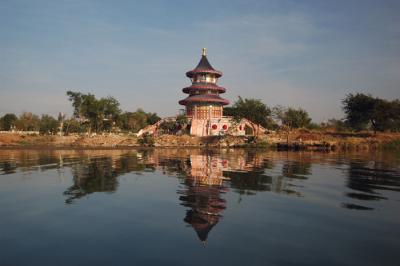
Tham Khao Noi Temple(Wat Tham Khao Noi): Wat Tham Khao Noi is located near Wat Tham Suea. It was constructed on the hill and decorated in Chinese style. Going up the hill is rewarding as you can see panoramic view of the city.

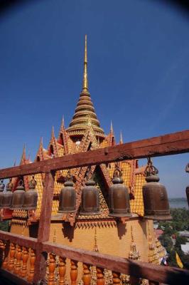
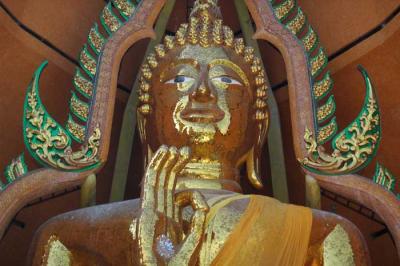
Tham Suea Temple (Wat Tham Suea): Wat Tham Suea is located at tambon Muang Chum, 4 kilometres beyond Wachiralongkorn Dam. The temple is built in a mixed, splendid Thai-Chinese style and enshrines a huge Buddha image.

Copyright Jean-Marc Michel. Use of any image is strictly forbidden without my explicit written permission.

The images on the site are available for sale as fine art prints and also as stock images.
For more information please contact me at jeanmarcmichelmy@yahoo.fr
previous pagepages 1 2 3 4 5 6 ALL next page
DSC_0078
DSC_0078
DSC_0232
DSC_0232
DSC_0051
DSC_0051
DSC_0205
DSC_0205
DSC_0040
DSC_0040
DSC_0089
DSC_0089
DSC_0199
DSC_0199
DSC_0133
DSC_0133
DSC_0185
DSC_0185
previous pagepages 1 2 3 4 5 6 ALL next page