


|
|
|
|
|
|
| |
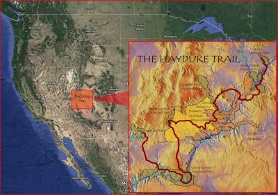
The red line is that of the guidebook Hayduke Trail which we followed approximately. We added many variations though mostly to maximise the great scenery!
The blue line from top right to bottom level is the Colorado River with the Green River joining from the north.
The huge loop at the bottom marks a line into the Grand Canyon and back out to finish in Zion National Park
| comment | |